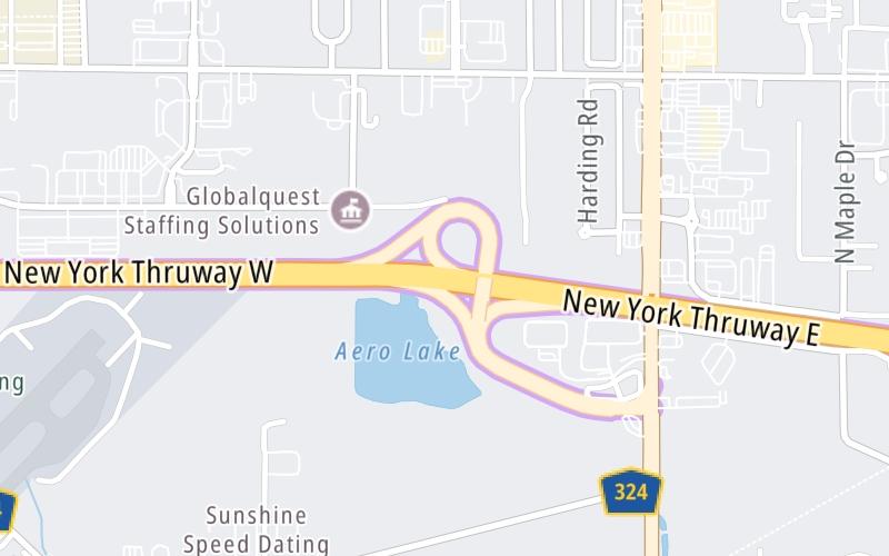
Right Now At NY Route 78 / Transit Road / Depew / Lockoprt and The New York State Thruway
Current Weather And Visibility
6:34 pm Local Time

Sunny
84°F / 28.9°C
Feels Like:
88°F / 31.3°C

Visibility
9 Mi / 14.5 Km
3-Hour Precip:
0 In / 0.0 Cm
West Northwest
Winds (WNW)3.3 MPH / 5.4 KPH
Gusts:
6 MPH / 9.7 KPH
Conditions and forecasts provided in partnership with AccuWeather.

Weather provided in partnership with AccuWeather.
Forecast weather and driving conditions follow the jump. These include an hour-by-hour forecast for the next 12-hours, a three-day forecast and an extended forecast, for extended travel planning.
An area traffic map, with available traffic cameras, shows driving conditions, from current traffic to mother nature's influence on the road. These follow the short-range forecasts below.


 Bayonne Bridge ▹
 Goethals Bridge ▹
 Holland Tunnel ▹
 Garden State Parkway ▹
 George Washington Bridge ▹
 Lincoln Tunnel ▹
 New Jersey Turnpike ▹
 Outerbridge Crossing ▹
 Bronx Whitestone Bridge ▹
 Hugh L Carey Tunnel ▹
 Cross Westchester Expressway ▹
 Robert F Kennedy Bridge ▹
 Queens Midtown Tunnel ▹
 New England Thruway ▹
 New York State Thruway ▹
 Throgs Neck Bridge ▹
 Henry Hudson Bridge ▹
 Atlantic Beach Bridge ▹
 Marine Parkway Bridge ▹
 Connecticut Turnpike ▹
 Bear Mountain Bridge ▹
 Massachusetts Turnpike ▹
 Thousand Islands Bridge ▹
 Niagara Thruway ▹
 Peace Bridge ▹
 Rainbow Bridge ▹

 Pennsylvania Turnpike ▹
 Milford Montague Toll Bridge ▹
 Delaware Water Gap Toll Bridge ▹
 Portland Columbia Toll Bridge ▹
 Easton Phillipsburg Toll Bridge ▹
 I78 Toll Bridge ▹


