New Jersey Turnpike Map

Advertising
Advertising

Exits Map For The New Jersey Turnpike

This map of the New Jersey Turnpike displays markers for exits and tolling points, which you can select to get a close-up map of that point of interest or location.

The points-of-interest shown on this map are also listed below, ordered from south to north.

See below for more comprehensive information about the New Jersey Turnpike

Advertising
Advertising
Static map a segment of the New Jersey Turnpike

A Quick Look At The New Jersey Turnpike

NJ Turnpike and NJTP are other names for this roadway. This state toll road serves several key cities, including Carneys Point, Swedesboro, Camden, Mount Laurel, Bordentown, Edison, New Brunswick, Woodbridge Township, Elizabeth, Newark, Jersey City, North Bergen, Fort Lee, and Bayonne.

The static map seen here shows a segment of The New Jersey Turnpike at I–287 / NJ 440/Outerbridge Crossing. The entirety of The New Jersey Turnpike can be seen in the fully-interactive map above, which includes linked markers. You may resize and reposition the interactive map to orient the road in relation to other landmarks.

There is also a complete list of exits below.

View Map Exit / POI List

Advertising
Advertising

What Does It Cost To Use The New Jersey Turnpike?

Tolls For Cars, SUVs, Pickups, etc.

▹ Toll as of January 1, 2025.

The total toll for using the New Jersey Turnpike is $21.24, if you are using a compatible transponder, RFID sticker or other pass.

NOTE: The rates shown are the maximum toll incurred. Your trip may have a lower rate.

Transponders You Can Use

For drivers paying with a transponder, the following passes will work on the New Jersey Turnpike

  • e-zpass
  • epass xtra
  • i-pass
  • quick pass
  • riverlink
  • sunpass pro
  • uni

Learn about transponders and accounts in New Jersey.

Without a compatible pass or transponder, the toll will be $21.35.

View MapAll Tolls / Calculator ▸

Our new toll and trip calculator is being constructed. For most roads, you can still use the legacy calculator for current, accurate tolls.

Discover New Jersey Attractions

Turnpikes.com has partnered with Tiqets.com to bring you these excusive deals on attractions!

Advertising
Advertising

Travel Alerts

No alerts to display at this time.

Exit/POI List For The New Jersey Turnpike

Selecting an exit or other location opens a separate map with locations of available gas, EV charging, fast-food and other dining options. Current weather and driving conditions will also be shown.

Delaware Memorial Bridge — Carneys Point

Note(s): None.

GPS 39.681068000 X -75.470803610

NJTA New Jersey Turnpike Authority manages this segment.

View Map & Info

Delaware Memorial Bridge toll Plaza — Penn's Grove

Note(s): None.

GPS 39.685232000 X -75.447561000

NJTA New Jersey Turnpike Authority manages this segment.

View Map & Info

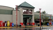
John Fenwick Service Area — Oldmans Township

Available fuels and EV charging:

  • gas

    gas

  • diesel

    diesel

  • ev

    ev

  • tesla

    tesla

  • truck parking

    truck
    parking

View Map & Info

Clara Barton Service Area — Oldmans Township

Available fuels and EV charging:

  • gas

    gas

  • diesel

    diesel

  • ev

    ev

  • tesla

    tesla

  • truck parking

    truck
    parking

View Map & Info

Exit 2Swedesboro — Swedesboro

Note(s): Chester

GPS 39.753710270 X -75.276005000

NJTA New Jersey Turnpike Authority manages this segment.

View Map & Info

Exit 3Woodbury — Woodbury

Note(s): South Camden

GPS 39.859980000 X -75.072659400

NJTA New Jersey Turnpike Authority manages this segment.

View Map & Info

Walt Whitman Service Area — Cherry Hill

Available fuels and EV charging:

    View Map & Info

    Exit 4Mt. Laurel / Camden — Mount Laurel

    Note(s): Philadelphia

    GPS 39.931375000 X -74.952662000

    NJTA New Jersey Turnpike Authority manages this segment.

    View Map & Info

    James Fenimore Cooper Service Area — Mount Laurel

    Available fuels and EV charging:

      View Map & Info

      Exit 5Burlington — Burlington

      Note(s): Pictures here. Mount Holly

      GPS 40.024910500 X -74.823079720

      NJTA New Jersey Turnpike Authority manages this segment.

      View Map & Info

      Delaware River Bridge — Burlington

      Note(s): Pictures here. to Pennsylvania Turnpike

      GPS 40.115500000 X -74.825200000

      NJTA New Jersey Turnpike Authority manages this segment.

      View Map & Info

      US 130 — Burlington

      Note(s): Pictures here. Florence

      GPS 40.101363800 X -74.789516380

      NJTA New Jersey Turnpike Authority manages this segment.

      View Map & Info

      Exit 6NJTP Extension to Pennsylvania Turnpike — Bordentown

      Note(s): Pictures here.

      GPS 40.096121000 X -74.730725000

      NJTA New Jersey Turnpike Authority manages this segment.

      View Map & Info

      Exit 7Bordentown — Bordentown

      Note(s): Trenton

      GPS 40.124737500 X -74.699775000

      NJTA New Jersey Turnpike Authority manages this segment.

      View Map & Info

      Richard Stockton Service Area — Hamilton Township

      Available fuels and EV charging:

      • gas

        gas

      • diesel

        diesel

      • ev

        ev

      • tesla

        tesla

      • truck parking

        truck
        parking

      View Map & Info

      Woodrow Wilson Service Area — Hamilton Township

      Available fuels and EV charging:

      • gas

        gas

      • diesel

        diesel

      • ev

        ev

      • tesla

        tesla

      • truck parking

        truck
        parking

      View Map & Info

      Exit 7AI–195 — Allentown

      Note(s): Begin/End I–95 NJ

      GPS 40.192487000 X -74.602505270

      NJTA New Jersey Turnpike Authority manages this segment.

      View Map & Info

      Exit 8Hightstown — Hightstown

      Note(s): Trenton

      GPS 40.264678050 X -74.510916380

      NJTA New Jersey Turnpike Authority manages this segment.

      View Map & Info

      Molly Pitcher Service Area — Monroe Township

      Available fuels and EV charging:

      • gas

        gas

      • diesel

        diesel

      • ev

        ev

      • tesla

        tesla

      • truck parking

        truck
        parking

      View Map & Info

      Exit 8AJamesburg — Jamesburg

      Note(s): Cranbury

      GPS 40.348400000 X -74.473934720

      NJTA New Jersey Turnpike Authority manages this segment.

      View Map & Info

      Joyce Kilmer Service Area — East Brunswick

      Available fuels and EV charging:

        View Map & Info

        Exit 9New Brunswick — New Brunswick

        Note(s): None.

        GPS 40.476660830 X -74.406059720

        NJTA New Jersey Turnpike Authority manages this segment.

        View Map & Info

        Exit 10I–287 / NJ 440/Outerbridge Crossing — Edison

        Note(s): to Staten Island

        GPS 40.525618050 X -74.342281000

        NJTA New Jersey Turnpike Authority manages this segment.

        View Map & Info

        Exit 11Garden State Pkwy. — Woodbridge

        Note(s): Woodbridge

        GPS 40.542024000 X -74.301225830

        NJTA New Jersey Turnpike Authority manages this segment.

        View Map & Info

        Thomas Edison Service Area — Woodbridge Township

        Available fuels and EV charging:

        • gas

          gas

        • diesel

          diesel

        • truck parking

          truck
          parking

        View Map & Info

        Grover Cleveland Service Area — Woodbridge Township

        Available fuels and EV charging:

        • gas

          gas

        • diesel

          diesel

        • truck parking

          truck
          parking

        View Map & Info

        Exit 12Carteret — Carteret

        Note(s): None.

        GPS 40.594468300 X -74.234565000

        NJTA New Jersey Turnpike Authority manages this segment.

        View Map & Info

        Exit 13I–278 — Elizabeth

        Note(s): to Goethals Bridge / Staten Island

        GPS 40.641500500 X -74.205749720

        NJTA New Jersey Turnpike Authority manages this segment.

        View Map & Info

        Exit 13ANewark Liberty Int'l/EWR / Elizabeth Seaport — Newark

        Note(s): None.

        GPS 40.665403050 X -74.181835000

        NJTA New Jersey Turnpike Authority manages this segment.

        View Map & Info

        Exit 14Newark Liberty Int'l/EWR / I-78 — Newark

        Note(s): None.

        GPS 40.704468300 X -74.152898050

        NJTA New Jersey Turnpike Authority manages this segment.

        View Map & Info

        Exit 14ANJ 440 / Bayonne — Bayonne

        Note(s): None.

        GPS 40.686099000 X -74.096544000

        NJTA New Jersey Turnpike Authority manages this segment.

        View Map & Info

        Exit 14BBayview Avenue / Jersey City — Jersey City

        Note(s): Liberty State Park

        GPS 40.700959000 X -74.068720000

        NJTA New Jersey Turnpike Authority manages this segment.

        View Map & Info

        Liberty Science Center — Jersey City

        Note(s): Park and Ride

        GPS 40.707372000 X -74.059958000

        NJTA New Jersey Turnpike Authority manages this segment.

        View Map & Info

        Christopher Columbus Drive — Jersey City

        Note(s): Exits to Montgomery St.

        GPS 40.720945000 X -74.055176000

        NJTA New Jersey Turnpike Authority manages this segment.

        View Map & Info

        Exit 15ENewark / Jersey City — Jersey City

        Note(s): None.

        GPS 40.728716940 X -74.128660830

        NJTA New Jersey Turnpike Authority manages this segment.

        View Map & Info

        Exit 14CHolland Tunnel — Jersey City

        Note(s): None.

        GPS 40.729732000 X -74.036005000

        NJTA New Jersey Turnpike Authority manages this segment.

        View Map & Info

        Exit 15WNewark / The Oranges — East Orange

        Note(s): None.

        GPS 40.755105000 X -74.117802700

        NJTA New Jersey Turnpike Authority manages this segment.

        View Map & Info

        Exit 15XSecaucus Transfer Station — Jersey City

        Note(s): None.

        GPS 40.761598000 X -74.077028050

        NJTA New Jersey Turnpike Authority manages this segment.

        View Map & Info

        Alexander Hamilton Service Area — Secaucus

        Available fuels and EV charging:

        • gas

          gas

        • diesel

          diesel

        • truck parking

          truck
          parking

        View Map & Info

        Exit 16ENJ 3 / NJ 495 / Lincoln Tunnel - SB On/NB Off — Jersey City

        Note(s): None.

        GPS 40.776613050 X -74.058400830

        NJTA New Jersey Turnpike Authority manages this segment.

        View Map & Info

        Exit 16WNJ 3 / Sportsplex — Newark

        Note(s): E. Rutherford

        GPS 40.800735000 X -74.074609000

        NJTA New Jersey Turnpike Authority manages this segment.

        View Map & Info

        Exit 17NJ 3 / NJ 495 / Lincoln Tunnel - SB Off/NB On — Union City

        Note(s): None.

        GPS 40.789747000 X -74.047827000

        NJTA New Jersey Turnpike Authority manages this segment.

        View Map & Info

        Vince Lombardi Service Area — Ridgefield Borough

        Available fuels and EV charging:

        • gas

          gas

        • diesel

          diesel

        • ev

          ev

        • truck parking

          truck
          parking

        View Map & Info

        Exit 18WI–80 / George Washington Bridge — Fort Lee

        Note(s): None.

        GPS 40.861661940 X -74.011871600

        NJTA New Jersey Turnpike Authority manages this segment.

        View Map & Info

        Advertising
        Advertising

        EXPLORE NEW JERSEY

        Journey to key destinations around and adjacent to New Jersey!

        Map Of This Region ▹

        Communities in this metro area include Camden, Burlington, Palmyra, Pennsauken, Cherry Hill, Gloucester City, Trenton, Wilmington, Delaware, Philadelphia, Pennsylvania, Tacony, Pennsylvania, and Bristol, Pennsylvania.

        Individual toll maps for this region are listed below.

        Map Of This Region ▹

        Communities in this metro area include Atlantic City, Ocean City, Cape May, Wildwood, Egg Harbor Township, and Somers Point.

        Individual toll maps for this region are listed below.

        Map Of This Region ▹

        Communities in this metro area include Knowlton Township, Trenton, Phillipsburg, Easton, Pennsylvania, Lambertville, Ewing, Morrisville, Pennsylvania, and Stroudsburg, Pennsylvania.

        Individual toll maps for this region are listed below.

        Map Of This Region ▹

        Communities in this metro area include Wilmington, Middletown, Newark, and Carneys Point, New Jersey.

        Individual toll maps for this region are listed below.

        Map Of This Region ▹

        Communities in this metro area include Philadelphia, King Of Prussia, Valley Forge, West Chester, Bristol, Burlington, New Jersey, Morrisville, Trenton, New Jersey, Palmyra, New Jersey, Wilmington, Delaware, and Camden, New Jersey.

        Individual toll maps for this region are listed below.

        Map Of This Region ▹

        Communities in this metro area include Scranton, Wilkes Barre, Stroudsburg, Clarks Summit, and Knowlton Township, New Jersey.

        Individual toll maps for this region are listed below.

        Advertising
        Advertising
        Turnpikes.com is proud to partner with the following: