A Quick Look At The Kingston Rhinecliff Bridge

This bridge serves Kingston, Lake Katrine, and Red Hook.
This road is in the Catskills - Hudson Valley area.
A complete list of exits can be found below.
How To Pay On the Kingston Rhinecliff Bridge
Accepted types of payment taken while on the road
Payment Type
Tag
Plate
Cash
Card
App
Available when checked
Tag
Plate
No cash
No card
App
The Kingston Rhinecliff Bridge offers license-plate tolling for those without a compatible transponder.
Transponders You Can Use
For drivers with a transponder, the following passes can be used on the Kingston Rhinecliff Bridge

- e-zpass
- epass xtra
- i-pass
- quick pass
- riverlink
- sunpass pro
- uni


Learn about transponders and accounts in New York.
View MapToll CalculatorAll New York Tolls
Our new toll and trip calculator is complete, but many roads' data are still being entered into our database. The legacy calculator remains active for current, accurate tolls.
Advertising
 New York State Bridge Authority
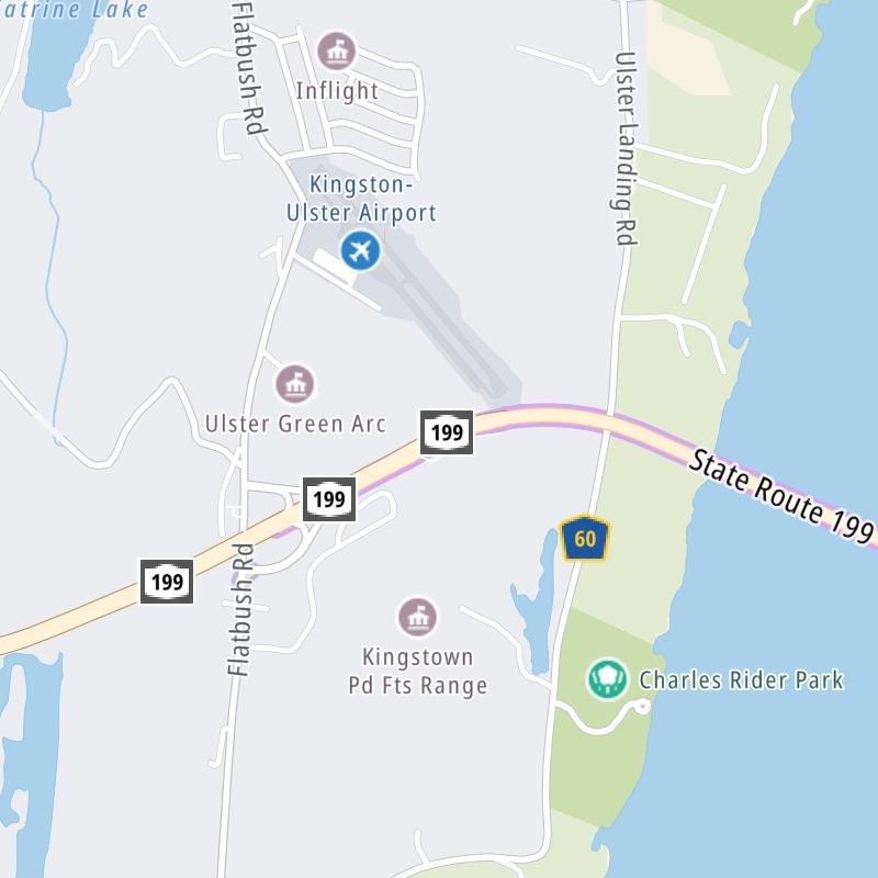

 Bayonne Bridge ▹
 Goethals Bridge ▹
 Holland Tunnel ▹
 Garden State Parkway ▹
 George Washington Bridge ▹
 Lincoln Tunnel ▹
 New Jersey Turnpike ▹
 Outerbridge Crossing ▹
 Bronx Whitestone Bridge ▹
 Hugh L Carey Tunnel ▹
 Cross Westchester Expressway ▹
 Robert F Kennedy Bridge ▹
 Queens Midtown Tunnel ▹
 New England Thruway ▹
 New York State Thruway ▹
 Throgs Neck Bridge ▹
 Henry Hudson Bridge ▹
 Atlantic Beach Bridge ▹
 Marine Parkway Bridge ▹
 Connecticut Turnpike ▹
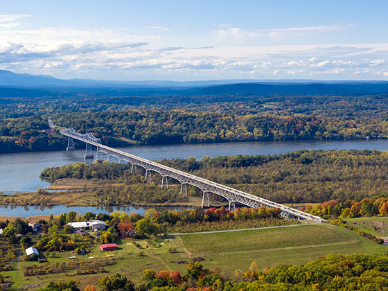
 Bear Mountain Bridge ▹
 Massachusetts Turnpike ▹
 Thousand Islands Bridge ▹
 Niagara Thruway ▹
 Peace Bridge ▹
 Rainbow Bridge ▹

 Pennsylvania Turnpike ▹
 Milford Montague Toll Bridge ▹
 Delaware Water Gap Toll Bridge ▹
 Portland Columbia Toll Bridge ▹
 Easton Phillipsburg Toll Bridge ▹
 I78 Toll Bridge ▹


