New York State Thruway Map

Advertising
Advertising

Exits Map For The New York State Thruway

This map of the New York State Thruway displays markers for exits and tolling points, which you can select to get a close-up map of that point of interest or location.

The points-of-interest shown on this map are also listed below, ordered from west to east.

See below for more comprehensive information about the New York State Thruway

Advertising
Advertising
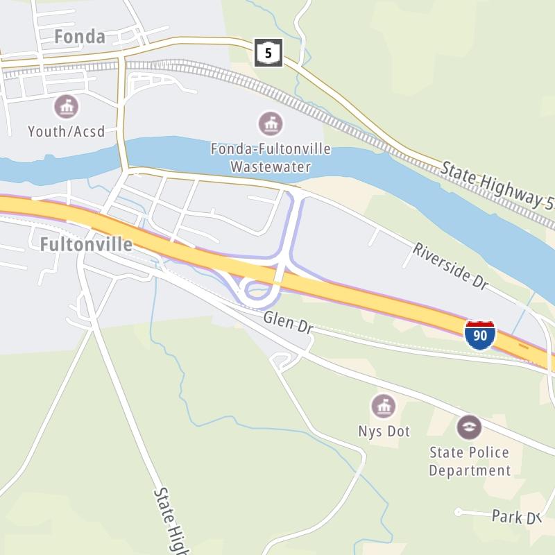
Static map a segment of the New York State Thruway

A Quick Look At The New York State Thruway

This state toll road serves several key cities, including New York City, White Plains, Yonkers, Poughkeepsie, Albany, Rochester, Schenectady, Amsterdam, Utica, Buffalo, Cheektowaga, and Seneca.

The static map seen here shows a segment of The New York State Thruway at NY Route 28 / Herkimer / Mohawk. The entirety of The New York State Thruway can be seen in the fully-interactive map above, which includes linked markers. You may resize and reposition the interactive map to orient the road in relation to other landmarks.

There is also a complete list of exits below.

View Map Exit / POI List

Latest Travel Alert

CONSTRUCTION - New York State Thruway

Monday May 5, 2025 — Monday September 1, 2025

Between mile markers 350.9 and 378.6: Ongoing pavement improvement in Monroe and Genesee Counties. Work will primarily happen overnight. Full and partial dept… Full details below

Impacted area(s):

See all travel alerts

Advertising
Advertising

What Does It Cost To Use The New York State Thruway?

Tolls For Cars, SUVs, Pickups, etc.

▹ Toll as of January 1, 2024.

The total toll for using the New York State Thruway is $39.65, if you are using a compatible transponder, RFID sticker or other pass. Using a New York-issued transponder, the rate is $22.66.

NOTE: The rates shown are the maximum toll incurred. Your trip may have a lower rate.

Transponders You Can Use

For drivers paying with a transponder, the following passes will work on the New York State Thruway

  • e-zpass
  • epass xtra
  • i-pass
  • quick pass
  • riverlink
  • sunpass pro
  • uni

Learn about transponders and accounts in New York.

Without a compatible pass or transponder, the toll will be $39.65.

View MapAll Tolls / Calculator ▸

Our new toll and trip calculator is being constructed. For most roads, you can still use the legacy calculator for current, accurate tolls.

Discover New York Attractions

Turnpikes.com has partnered with Tiqets.com to bring you these excusive deals on attractions!

Advertising
Advertising

New York State Thruway Travel Alerts

CONSTRUCTION - New York State Thruway

Monday May 5, 2025 — Monday September 1, 2025

Between mile markers 350.9 and 378.6: Ongoing pavement improvement in Monroe and Genesee Counties. Work will primarily happen overnight. Full and partial depth repairs and new asphalt. Resurfacing of ramps at Exit 46, the MM 353.1 parking area, and the Ontario and Scottsville Service areas.

Impacted area(s):


CONSTRUCTION - New York State Thruway

Wednesday April 23, 2025 — Wednesday December 31, 2025

Between mile markers 467.7 and 485.0: Ongoing pavement improvement and safety enhancement in Chautauqua County. Traffic reduced to one lane in each direction in work zone. Full and partial depth repairs and new asphalt.

Impacted area(s):


CLOSURE - New York State Thruway

Tuesday April 15, 2025 — Saturday November 1, 2025

Between mile markers 276.5 and 278.9: Interchange 34A bridge rehabilitation project in Onondaga County. Eastbound ramp to Exit 34A closed until start of summer. Traffic detoured to Exit 35. Expect traffic shifts starting this summer. Bridge redecking and repairs to substructure.

Impacted area(s):


CONSTRUCTION - New York State Thruway

Friday April 4, 2025 — Sunday November 1, 2026

At and around mile marker 219.9: Thruway bridge replacement over Mohawk Street in Herkimer County. One side of bridge closed at a time. All traffic on WB span through fall 2025. All traffic shifted to EB span for 2026.

Impacted area(s):


CONSTRUCTION - New York State Thruway

Wednesday April 2, 2025 — Sunday November 1, 2026

Between mile markers 347.13 and 351.4: Pavement improvement in Ontario and Monroe Counties. Expect periodict lane closures and traffic shifts. Crack and seat concrete, overlay surface with asphalt. Mill and replace ashpalt pavement on ramps at Exits 44 and 45. Multiple bridges repaired; bridge culverts serviced or repaired.

Impacted area(s):


CONSTRUCTION - New York State Thruway - More Project Detail

Friday March 28, 2025 — Saturday November 1, 2025

Between mile markers 278.9 and 281.3: Townline Road bridge replacement over NYS Thruway, at MM 280.3, just west of Thompson Road. Townline bridge closed and traffic detoured.

Impacted area(s):


CONSTRUCTION - New York State Thruway

Monday March 24, 2025 — Sunday November 1, 2026

Between mile markers 27.6 and 31.4: Bridge deck replacement and rehabilitation on NYS Thruway in Suffern. Expect lane shifts; three lanes each direction to remain open during project. Bridge over Mahwah River (MM 29.4) and at U.S. Hwy 202 (MM 29.5) affected.

Impacted area(s):


Exit/POI List For The New York State Thruway

Selecting an exit or other location opens a separate map with locations of available gas, EV charging, fast-food and other dining options. Current weather and driving conditions will also be shown.

Major Deegan Expressway (I-87) / Jerome Ave. / New York City Line — Bronx

Note(s): NYSTA Interchange ID: m00x

GPS 40.90564 X -73.87817

The Thruway Authority New York State Thruway Authority manages this segment.
View Map & Info

Exit 1Hall Place / McLean Avenue — Mount Vernon

Note(s): NYSTA Interchange ID: m01x

GPS 40.9121 X -73.87535

The Thruway Authority New York State Thruway Authority manages this segment.

View Map & Info

Exit 2Yonkers Avenue / Raceway No SB Exit — Yonkers

Note(s): NYSTA Interchange ID: m02x

GPS 40.92149 X -73.86309

The Thruway Authority New York State Thruway Authority manages this segment.

View Map & Info

Exit 3Mile Square Road — Yonkers

Note(s): No SB Exit / NYSTA Interchange ID: m03x

GPS 40.9251 X -73.8585

The Thruway Authority New York State Thruway Authority manages this segment.

View Map & Info

Exit 4Cross County Pkwy / Mile Square Rd — Yonkers

Note(s): NYSTA Interchange ID: m04x

GPS 40.93086 X -73.85683

The Thruway Authority New York State Thruway Authority manages this segment.

View Map & Info

Exit 5Central Park Ave / NY Route 100 / White Plains — Yonkers

Note(s): No SB Exit / NYSTA Interchange ID: m05x

GPS 40.93833 X -73.85564

The Thruway Authority New York State Thruway Authority manages this segment.

View Map & Info

Exit 6/6E/6WTuckahoe Road / Yonkers / Bronxville — Bronxville

Note(s): Exit 6 SB / Exits 6E & 6W NB / NYSTA Interchange ID: m06x

GPS 40.95496 X -73.86093

The Thruway Authority New York State Thruway Authority manages this segment.

View Map & Info

Exit 6AStew Leonard Drive — Bronxville

Note(s): NYSTA Interchange ID: m06a

GPS 40.9667 X -73.8608

The Thruway Authority New York State Thruway Authority manages this segment.

View Map & Info

Yonkers Highway Gantry — Yonkers

Note(s): None.

GPS 40.97954 X -73.85553

The Thruway Authority New York State Thruway Authority manages this segment.

View Map & Info

Ardsley Travel Plaza — Yonkers

Available fuels and EV charging:

  • gas

    gas

  • diesel

    diesel

  • ev

    ev

  • tesla

    tesla

View Map & Info

Exit 7NY Route 9A / Ardsley — White Plains

Note(s): No SB Exit / NYSTA Interchange ID: m07x

GPS 41.00872 X -73.85099

The Thruway Authority New York State Thruway Authority manages this segment.

View Map & Info

Exit 7ASaw Mill River Parkway / Taconic State Parkway — White Plains

Note(s): NYSTA Interchange ID: m07a

GPS 41.04259 X -73.83608

The Thruway Authority New York State Thruway Authority manages this segment.

View Map & Info

Exit 8Cross Westchester Expressway / I-287 — White Plains

Note(s): NYSTA Interchange ID: m08x

GPS 41.05656 X -73.83533

The Thruway Authority New York State Thruway Authority manages this segment.

View Map & Info

Exit 8ANY Route 119 / Saw Mill River Pkwy N / Elmsford — East Irvington

Note(s): No NB Exit / NYSTA Interchange ID: m08a

GPS 41.05769 X -73.83732

The Thruway Authority New York State Thruway Authority manages this segment.

View Map & Info

Exit 9US Hwy 9 / Sleepy Hollow / Tarrytown — Tarrytown

Note(s): NYSTA Interchange ID: m09x

GPS 41.06267 X -73.86195

The Thruway Authority New York State Thruway Authority manages this segment.

View Map & Info

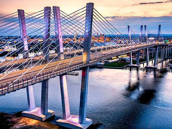
Governor Mario M. Cuomo Bridge Gantry — Tarrytown

Note(s): Formerly Tappan Zee Bridge / Toll charged Southbound Only

GPS 41.08128 X -73.92286

The Thruway Authority New York State Thruway Authority manages this segment.

View Map & Info

Exit 10Nyack / S Nyack / US Route 9W — Nyack

Note(s): No SB Exit / NYSTA Interchange ID: m10x

GPS 41.08199 X -73.92317

The Thruway Authority New York State Thruway Authority manages this segment.

View Map & Info

Exit 11Nyack / S Nyack / US Route 9W — Nyack

Note(s): NYSTA Interchange ID: m11x

GPS 41.09071 X -73.92879

The Thruway Authority New York State Thruway Authority manages this segment.

View Map & Info

Exit 12W Nyack / NY Route 303 / Palisades Center Drive — Nyack

Note(s): NYSTA Interchange ID: m12x

GPS 41.09957 X -73.95094

The Thruway Authority New York State Thruway Authority manages this segment.

View Map & Info

Exit 13Palisades Interstate Pkwy / Bear Mountain State Park — West Nyack

Note(s): to New Jersey / NYSTA Interchange ID: m13x

GPS 41.10179 X -73.99245

The Thruway Authority New York State Thruway Authority manages this segment.

View Map & Info

Exit 14NY Route 59 / Spring Valley / Nanuet — Nanuet

Note(s): NYSTA Interchange ID: m14x

GPS 41.10272 X -74.02769

The Thruway Authority New York State Thruway Authority manages this segment.

View Map & Info

Exit 14AGarden State Parkway / New Jersey — Nanuet

Note(s): NYSTA Interchange ID: m14a

GPS 41.09768 X -74.03997

The Thruway Authority New York State Thruway Authority manages this segment.

View Map & Info

Spring Valley Highway Gantry — Spring Valley

Note(s): Toll charged Northbound Only, No Toll Passenger vehicles

GPS 41.09837 X -74.05456

The Thruway Authority New York State Thruway Authority manages this segment.

View Map & Info

Red Schoolhouse Road — Chestnut Ridge

Note(s): None.

GPS 41.07341 X -74.05202

The Thruway Authority New York State Thruway Authority manages this segment.

View Map & Info

Exit 14BAirmont Road / Airmont / Montebello — Suffern

Note(s): NYSTA Interchange ID: m14b

GPS 41.11629 X -74.11232

The Thruway Authority New York State Thruway Authority manages this segment.

View Map & Info

Exit 15I-287 NJ / NJ Route 17 — Suffern

Note(s): to New Jersey / NYSTA Interchange ID: m15x

GPS 41.12133 X -74.16283

The Thruway Authority New York State Thruway Authority manages this segment.

View Map & Info

Exit 15ANY Route 17 N / NY Route 59 / Sloatsburg / Suffern — Suffern

Note(s): NYSTA Interchange ID: m15x

GPS 41.13408 X -74.16819

The Thruway Authority New York State Thruway Authority manages this segment.

View Map & Info

Sloatsburg Travel Plaza — Sloatsburg

Available fuels and EV charging:

  • gas

    gas

  • diesel

    diesel

View Map & Info

Ramapo Travel Plaza — Ramapo

Available fuels and EV charging:

  • gas

    gas

  • diesel

    diesel

  • ev

    ev

  • tesla

    tesla

  • truck parking

    truck
    parking

View Map & Info

Harriman Ramp Gantry / US Hwy 6 / NY Route 17 — Woodbury

Note(s): NYSTA Interchange ID: m16x

GPS 41.312333 X -74.124722

The Thruway Authority New York State Thruway Authority manages this segment.

View Map & Info

Exit 16US Hwy 6 / NY Route 17 — Woodbury

Note(s): None.

GPS 41.31065 X -74.12265

The Thruway Authority New York State Thruway Authority manages this segment.

View Map & Info

Woodbury Highway Gantry / Start/End of Segment 5 — Harriman

Note(s): Segment 5: 15 Woodbury to 23 Albany and B3 Canaan / MA Border

GPS 41.3114 X -74.12159

The Thruway Authority New York State Thruway Authority manages this segment.

View Map & Info

Exit 17Airport/SWF / I-84 / NY Routes 17K & 300 — Newburgh

Note(s): Stewart International Airport / NYSTA Interchange ID: m17x

GPS 41.50947 X -74.07446

The Thruway Authority New York State Thruway Authority manages this segment.

View Map & Info

Plattekill Travel Plaza — Modena

Available fuels and EV charging:

  • gas

    gas

  • diesel

    diesel

  • ev

    ev

  • tesla

    tesla

  • truck parking

    truck
    parking

View Map & Info

Modena Travel Plaza — Modena

Available fuels and EV charging:

  • gas

    gas

  • diesel

    diesel

  • ev

    ev

  • truck parking

    truck
    parking

View Map & Info

Exit 18NY Route 299 / Poughkeepsie — Poughkeepsie

Note(s): NYSTA Interchange ID: m18x

GPS 41.73551 X -74.0657

The Thruway Authority New York State Thruway Authority manages this segment.

View Map & Info

Exit 19NY Route 28 / Kingston — Kingston

Note(s): to Kingston-Rhinecliff Bridge / NYSTA Interchange ID: m19x

GPS 41.94764 X -74.02749

The Thruway Authority New York State Thruway Authority manages this segment.

View Map & Info

Ulster Travel Plaza — Saugerties

Available fuels and EV charging:

  • gas

    gas

  • diesel

    diesel

View Map & Info

NY Route 32 / Woodstock — Saugerties

Note(s): NYSTA Interchange ID: m20x

GPS 42.08306 X -73.97328

The Thruway Authority New York State Thruway Authority manages this segment.

View Map & Info

Malden Travel Plaza — Catskill

Available fuels and EV charging:

  • gas

    gas

  • diesel

    diesel

View Map & Info

Exit 21NY Route 23 / Catskill / Cairo — Catskill

Note(s): NYSTA Interchange ID: m21x

GPS 42.25013 X -73.88444

The Thruway Authority New York State Thruway Authority manages this segment.

View Map & Info

Exit 21BUS Hwy 9W / NY Route 81 / Ravenna / Cocksackie — Coxsackie

Note(s): NYSTA Interchange ID: m21b

GPS 42.39365 X -73.82495

The Thruway Authority New York State Thruway Authority manages this segment.

View Map & Info

New Baltimore Travel Plaza — Coxsackie

Available fuels and EV charging:

  • gas

    gas

  • diesel

    diesel

  • ev

    ev

  • tesla

    tesla

  • truck parking

    truck
    parking

View Map & Info

Exit 21AI-90 East / Berkshire Connector — East Chatham

Note(s): to Mass Pike / Boston / NYSTA Interchange ID: m21a

GPS 42.51557 X -73.78949

The Thruway Authority New York State Thruway Authority manages this segment.

View Map & Info

Exit 22NY Route 144 / NY Route 396 / Selkirk — Selkirk

Note(s): NYSTA Interchange ID: m22x

GPS 42.53415 X -73.78411

The Thruway Authority New York State Thruway Authority manages this segment.

View Map & Info

Highway Gantry / Start/End of Segment 5 — Albany

Note(s): Segment 5: 15 Woodbury to 23 Albany and B3 Canaan MA Border

GPS 42.60381 X -73.78429

The Thruway Authority New York State Thruway Authority manages this segment.

View Map & Info

Exit B1I-90 / US Route 9 / Albany / Hudson / Rensselaer — Albany

Note(s): NYSTA Interchange ID: b1x

GPS 42.4821 X -73.67022

The Thruway Authority New York State Thruway Authority manages this segment.

View Map & Info

Exit 23I-787 / US Hwy 9W / Downtown Albany — Albany

Note(s): NYSTA Interchange ID: m23x

GPS 42.63289 X -73.78142

The Thruway Authority New York State Thruway Authority manages this segment.

View Map & Info

Highway Gantry — Albany

Note(s): Fixed Toll Segment between Exits 23 and 24

GPS 42.66819 X -73.83581

The Thruway Authority New York State Thruway Authority manages this segment.

View Map & Info

Exit 24I-90 East / I-87 North / Albany — Albany

Note(s): to Montreal, Canada / NYSTA Interchange ID: m24x

GPS 42.69778 X -73.84546

The Thruway Authority New York State Thruway Authority manages this segment.

View Map & Info

Exit B2NY Route 295 / Taconic State Parkway — East Chatham

Note(s): NYSTA Interchange ID: b2x

GPS 42.42027 X -73.54834

The Thruway Authority New York State Thruway Authority manages this segment.

View Map & Info

Highway Gantry — Albany

Note(s): Fixed Toll Segment between Exits 24 and 25

GPS 42.71499 X -73.87003

The Thruway Authority New York State Thruway Authority manages this segment.

View Map & Info

Canaan Highway Gantry / Start/End of Segment 5 — East Chatham

Note(s): Berkshire Connector

GPS 42.39488 X -73.50122

The Thruway Authority New York State Thruway Authority manages this segment.

View Map & Info

Guilderland Travel Plaza — Albany

Available fuels and EV charging:

  • gas

    gas

  • diesel

    diesel

  • ev

    ev

  • tesla

    tesla

  • truck parking

    truck
    parking

View Map & Info

Exit 25I-890 / NY Routes 7 & 146 / Schenectady — Schenectady

Note(s): NYSTA Interchange ID: m25x

GPS 42.754 X -73.93361

The Thruway Authority New York State Thruway Authority manages this segment.

View Map & Info

Exit B3NY Route 22 / Austerlitz / New Lebanon — Austerlitz

Note(s): NYSTA Interchange ID: b3x

GPS 42.35767 X -73.42707

The Thruway Authority New York State Thruway Authority manages this segment.

View Map & Info

Highway Gantry — Schenectady

Note(s): Fixed Toll Segment between Exits 25 and 25A

GPS 42.77924 X -74.00183

The Thruway Authority New York State Thruway Authority manages this segment.

View Map & Info

Massachusetts State Line / Massachusetts Turnpike — Austerlitz

Note(s): NYSTA Interchange ID: bxx

GPS 42.34758 X -73.41155

The Thruway Authority New York State Thruway Authority manages this segment.

View Map & Info

Exit 25AI-88 / NY Route 7 / Schenectady / Binghamton — Schenectady

Note(s): NYSTA Interchange ID: m25a

GPS 42.79035 X -74.01592

The Thruway Authority New York State Thruway Authority manages this segment.

View Map & Info

Highway Gantry — Schenectady

Note(s): Start/End of Segment 4: 25A Schenectady to 34A Syracuse

GPS 42.82137 X -74.01618

The Thruway Authority New York State Thruway Authority manages this segment.

View Map & Info

Exit 26I-890 / NY Routes 5 & 5S / Schenectady — Schenectady

Note(s): NYSTA Interchange ID: m26x

GPS 42.83812 X -74.0126

The Thruway Authority New York State Thruway Authority manages this segment.

View Map & Info

Pattersonville Travel Plaza — Amsterdam

Available fuels and EV charging:

  • gas

    gas

  • diesel

    diesel

View Map & Info

Mohawk Travel Plaza — Amsterdam

Available fuels and EV charging:

  • gas

    gas

  • diesel

    diesel

View Map & Info

Exit 27NY Route 30 / Amsterdam — Amsterdam

Note(s): NYSTA Interchange ID: m27x

GPS 42.92295 X -74.19648

The Thruway Authority New York State Thruway Authority manages this segment.

View Map & Info

Exit 28NY Route 30A / Fultonville / Fonda — Fonda

Note(s): NYSTA Interchange ID: m28x

GPS 42.94476 X -74.35976

The Thruway Authority New York State Thruway Authority manages this segment.

View Map & Info

Exit 29NY Route 10 / Canajoharie / Sharon springs — Canajoharie

Note(s): NYSTA Interchange ID: m29x

GPS 42.90697 X -74.56224

The Thruway Authority New York State Thruway Authority manages this segment.

View Map & Info

Iroquois Travel Plaza — Canajoharie

Available fuels and EV charging:

  • gas

    gas

  • diesel

    diesel

  • ev

    ev

  • tesla

    tesla

  • truck parking

    truck
    parking

View Map & Info

Indian Castle Travel Plaza — Canajoharie

Available fuels and EV charging:

  • gas

    gas

  • diesel

    diesel

  • ev

    ev

  • tesla

    tesla

  • truck parking

    truck
    parking

View Map & Info

Exit 29ANY Route 169 / Little Falls / Dolgeville — Little Falls

Note(s): NYSTA Interchange ID: m29a

GPS 43.01657 X -74.81745

The Thruway Authority New York State Thruway Authority manages this segment.

View Map & Info

Exit 30NY Route 28 / Herkimer / Mohawk — Herkimer

Note(s): NYSTA Interchange ID: m30x

GPS 43.01778 X -74.98931

The Thruway Authority New York State Thruway Authority manages this segment.

View Map & Info

Schuyler Travel Plaza — Frankfort

Available fuels and EV charging:

  • gas

    gas

  • diesel

    diesel

View Map & Info

Exit 31I-790 / NY Route 8 & 12 / Utica — Utica

Note(s): NYSTA Interchange ID: m31x

GPS 43.11198 X -75.20499

The Thruway Authority New York State Thruway Authority manages this segment.

View Map & Info

Exit 32NY Route 233 / Westmoreland / Rome — Rome

Note(s): NYSTA Interchange ID: m32x

GPS 43.12388 X -75.40102

The Thruway Authority New York State Thruway Authority manages this segment.

View Map & Info

Oneida Travel Plaza — Rome

Available fuels and EV charging:

  • gas

    gas

  • diesel

    diesel

View Map & Info

Exit 33NY Route 365 / Verona / Rome / Oneida — Rome

Note(s): NYSTA Interchange ID: m33x

GPS 43.12375 X -75.5823

The Thruway Authority New York State Thruway Authority manages this segment.

View Map & Info

Exit 34NY Route 13 / Canastota / Oneida — Canstota

Note(s): International Boxing Hall of Fame / NYSTA Interchange ID: m34x

GPS 43.0926 X -75.7472

The Thruway Authority New York State Thruway Authority manages this segment.

View Map & Info

Chittenango Travel Plaza — Canosta

Available fuels and EV charging:

  • gas

    gas

  • diesel

    diesel

  • ev

    ev

  • tesla

    tesla

  • truck parking

    truck
    parking

View Map & Info

Highway Gantry — Syracuse

Note(s): Start/End of Segment 4: 34A Syracuse to 25A Schenectady

GPS 43.09506 X -76.03387

The Thruway Authority New York State Thruway Authority manages this segment.

View Map & Info

Exit 34AI-481 / Syracuse / Chittenango — Syracuse

Note(s): NYSTA Interchange ID: m34a

GPS 43.09475 X -76.04353

The Thruway Authority New York State Thruway Authority manages this segment.

View Map & Info

Highway Gantry — Syracuse

Note(s): Fixed Toll Segment between Exits 34A and 35

GPS 43.09439 X -76.06163

The Thruway Authority New York State Thruway Authority manages this segment.

View Map & Info

Exit 35NY Route 298 / Syracuse / East Syracuse — Syracuse

Note(s): NYSTA Interchange ID: m35x

GPS 43.09278 X -76.08985

The Thruway Authority New York State Thruway Authority manages this segment.

View Map & Info

DeWitt Travel Plaza — Syracuse

Available fuels and EV charging:

  • gas

    gas

  • diesel

    diesel

  • ev

    ev

  • tesla

    tesla

View Map & Info

Highway Gantry — Syracuse

Note(s): Fixed Toll Segment between Exits 35 and 36

GPS 43.09287 X -76.13654

The Thruway Authority New York State Thruway Authority manages this segment.

View Map & Info

Exit 36I-81 / Airport/SYR / Watertown — Syracuse

Note(s): Syracuse-Hancock International Airport / NYSTA Interchange ID: m36x

GPS 43.09458 X -76.16788

The Thruway Authority New York State Thruway Authority manages this segment.

View Map & Info

Highway Gantry — Syracuse

Note(s): Start/End of Segment 3: 36 Syracuse I-81 to 39 Syracuse I-690

GPS 43.09792 X -76.17456

The Thruway Authority New York State Thruway Authority manages this segment.

View Map & Info

Exit 37Electronics Parkway / Syracuse / Liverpool — Syracuse

Note(s): NYSTA Interchange ID: m37x

GPS 43.10206 X -76.18139

The Thruway Authority New York State Thruway Authority manages this segment.

View Map & Info

Exit 38Oswego Road / County Road 57 / Syracuse / Liverpool — Syracuse

Note(s): NYSTA Interchange ID: m38x

GPS 43.11717 X -76.21867

The Thruway Authority New York State Thruway Authority manages this segment.

View Map & Info

Highway Gantry — Syracuse

Note(s): Start/End of Segment 3: 39 Syracuse I-690 to 36 Syracuse I-81

GPS 43.1102 X -76.27225

The Thruway Authority New York State Thruway Authority manages this segment.

View Map & Info

Exit 39I-690 / NY Route 690 / Syracuse / Fulton — Syracuse

Note(s): NYSTA Interchange ID: m39x

GPS 43.1073 X -76.2872

The Thruway Authority New York State Thruway Authority manages this segment.

View Map & Info

Warners Travel Plaza — Syracuse

Available fuels and EV charging:

  • gas

    gas

  • diesel

    diesel

  • ev

    ev

  • truck parking

    truck
    parking

View Map & Info

Highway Gantry — Syracuse

Note(s): Start/End of Segment 2: 39 Syracuse to 44 Canandaigua

GPS 43.0896 X -76.37885

The Thruway Authority New York State Thruway Authority manages this segment.

View Map & Info

Exit 40NY Route 34 / Weedsport / Auburn — Weedsport

Note(s): NYSTA Interchange ID: m40x

GPS 43.06112 X -76.56474

The Thruway Authority New York State Thruway Authority manages this segment.

View Map & Info

Port Byron Travel Plaza — Waterloo

Available fuels and EV charging:

  • gas

    gas

  • diesel

    diesel

  • truck parking

    truck
    parking

View Map & Info

Exit 41NY Route 414 / Waterloo / Clyde — Waterloo

Note(s): NYSTA Interchange ID: m41x

GPS 42.96744 X -76.85294

The Thruway Authority New York State Thruway Authority manages this segment.

View Map & Info

Junius Ponds Travel Plaza — Geneva

Available fuels and EV charging:

  • gas

    gas

  • diesel

    diesel

  • ev

    ev

  • tesla

    tesla

  • truck parking

    truck
    parking

View Map & Info

Exit 42NY Route 14 / Geneva / Lyons — Geneva

Note(s): NYSTA Interchange ID: m42x

GPS 42.95489 X -76.98206

The Thruway Authority New York State Thruway Authority manages this segment.

View Map & Info

Clifton Springs Travel Plaza — Canandaigua

Available fuels and EV charging:

  • gas

    gas

  • diesel

    diesel

  • ev

    ev

  • tesla

    tesla

  • truck parking

    truck
    parking

View Map & Info

Exit 43NY Route 21 / Manchester / Palmyra — Manchester

Note(s): NYSTA Interchange ID: m43x

GPS 42.97874 X -77.23343

The Thruway Authority New York State Thruway Authority manages this segment.

View Map & Info

Highway Gantry — Canandaigua

Note(s): Start/End of Segment 2: 44 Canandaigua to 39 Syracuse

GPS 42.97912 X -77.24413

The Thruway Authority New York State Thruway Authority manages this segment.

View Map & Info

Exit 44NY Route 332 / Canandaigua / Victor — Canandaigua

Note(s): NYSTA Interchange ID: m44x

GPS 42.9957 X -77.3684

The Thruway Authority New York State Thruway Authority manages this segment.

View Map & Info

Highway Gantry — Canandaigua

Note(s): Fixed Toll Segment between Exits 44 and 45

GPS 42.99655 X -77.38434

The Thruway Authority New York State Thruway Authority manages this segment.

View Map & Info

Seneca Travel Plaza — Canandaigua

Available fuels and EV charging:

  • gas

    gas

  • diesel

    diesel

  • ev

    ev

  • tesla

    tesla

  • truck parking

    truck
    parking

View Map & Info

Exit 45I-490 / Rochester / Victor — Rochester

Note(s): NYSTA Interchange ID: m45x

GPS 43.00922 X -77.43991

The Thruway Authority New York State Thruway Authority manages this segment.

View Map & Info

Highway Gantry — Rochester

Note(s): Fixed Toll Segment between Exits 45 and 46

GPS 43.04607 X -77.56711

The Thruway Authority New York State Thruway Authority manages this segment.

View Map & Info

Exit 46I-390 / Airport/ROC / Rochester / Corning — Rochester

Note(s): Rochester International Airport / NYSTA Interchange ID: m46x

GPS 43.04775 X -77.65387

The Thruway Authority New York State Thruway Authority manages this segment.

View Map & Info

Scottsville Travel Plaza — Rochester

Available fuels and EV charging:

  • gas

    gas

  • diesel

    diesel

  • ev

    ev

  • tesla

    tesla

  • truck parking

    truck
    parking

View Map & Info

Highway Gantry — Rochester

Note(s): Fixed Toll Segment between Exits 46 and 47

GPS 43.04437 X -77.77636

The Thruway Authority New York State Thruway Authority manages this segment.

View Map & Info

Ontario Travel Plaza — Rochester

Available fuels and EV charging:

  • gas

    gas

  • diesel

    diesel

View Map & Info

Exit 47I-490 / NY Route 19 / Rochester / LeRoy — Rochester

Note(s): NYSTA Interchange ID: m47x

GPS 43.02896 X -77.96674

The Thruway Authority New York State Thruway Authority manages this segment.

View Map & Info

Highway Gantry — Rochester

Note(s): Start/End of Segment 1: 47 Rochester to 50 Williamsville

GPS 43.02916 X -77.97595

The Thruway Authority New York State Thruway Authority manages this segment.

View Map & Info

Exit 48NY Route 98 / Batavia — Batavia

Note(s): NYSTA Interchange ID: m48x

GPS 43.01859 X -78.18819

The Thruway Authority New York State Thruway Authority manages this segment.

View Map & Info

Pembroke Travel Plaza — Batavia

Available fuels and EV charging:

  • gas

    gas

  • diesel

    diesel

  • truck parking

    truck
    parking

View Map & Info

Exit 48ANY Route 77 / Medina / Pembroke — Pembroke

Note(s): NYSTA Interchange ID: m48a

GPS 43.00281 X -78.41385

The Thruway Authority New York State Thruway Authority manages this segment.

View Map & Info

Clarence Travel Plaza — Depew

Available fuels and EV charging:

  • gas

    gas

  • diesel

    diesel

  • ev

    ev

  • tesla

    tesla

  • truck parking

    truck
    parking

View Map & Info

NY Route 78 / Transit Road / Depew / Lockoprt — Depew

Note(s): NYSTA Interchange ID: m49x

GPS 42.95065 X -78.70493

The Thruway Authority New York State Thruway Authority manages this segment.

View Map & Info

Highway Gantry — Depew

Note(s): Start/End of Segment 1: 50 Williamsville to 47 Rochester

GPS 42.95077 X -78.72092

The Thruway Authority New York State Thruway Authority manages this segment.

View Map & Info

Old Williamsville Barrier — Williamsville

Note(s): (Toll plaza removed)

GPS 42.95203 X -78.75245

The Thruway Authority New York State Thruway Authority manages this segment.

View Map & Info

Exit 50I-290 / Niagara Falls — Cleveland Hill

Note(s): to Niagara Falls / NYSTA Interchange ID: m50x

GPS 42.94892 X -78.76393

The Thruway Authority New York State Thruway Authority manages this segment.

View Map & Info

Exit 50ACleveland Drive — Cleveland Hill

Note(s): No WB Exit / NYSTA Interchange ID: m50a

GPS 42.94412 X -78.76637

The Thruway Authority New York State Thruway Authority manages this segment.

View Map & Info

Exit 51Kensington Expy / NY 33 / Airport/BUF / Buffalo — Cheektowaga

Note(s): Exits 51E & 51W / Buffalo-Niagara International Airport / NYSTA Interchange ID: m51x

GPS 42.93153 X -78.76629

The Thruway Authority New York State Thruway Authority manages this segment.

View Map & Info

Exit 52Walden Avenue / Buffalo / Cheektowaga — Cheektowaga

Note(s): Exits 52E & 52W / NYSTA Interchange ID: m52x

GPS 42.9081 X -78.76672

The Thruway Authority New York State Thruway Authority manages this segment.

View Map & Info

Exit 52AWilliam Street / Buffalo — Buffalo

Note(s): NYSTA Interchange ID: m52a

GPS 42.88318 X -78.76863

The Thruway Authority New York State Thruway Authority manages this segment.

View Map & Info

Exit 53I-190 / Niagara Thruway — Buffalo

Note(s): to Niagara Falls / International Bridges / Downtown Buffalo / NYSTA Interchange ID: m53x

GPS 42.87422 X -78.78891

The Thruway Authority New York State Thruway Authority manages this segment.

View Map & Info

Exit 54Aurora Expressway / NY Routes 400 & 16 / West Seneca / East Aurora — West Seneca

Note(s): NYSTA Interchange ID: m54x

GPS 42.8491 X -78.79061

The Thruway Authority New York State Thruway Authority manages this segment.

View Map & Info

Exit 55US Hwy 219 / Ridge Road / Springville / Orchard Park — West Seneca

Note(s): NYSTA Interchange ID: m55x

GPS 42.82744 X -78.79094

The Thruway Authority New York State Thruway Authority manages this segment.

View Map & Info

Old Lackawanna Barrier — Lackawanna

Note(s): (Toll plaza removed)

GPS 42.81319 X -78.79485

The Thruway Authority New York State Thruway Authority manages this segment.

View Map & Info

Highway Gantry — Lackawanna

Note(s): Start/End of Segment 6: 55 Lackawanna to 61 Ripley

GPS 42.80782 X -78.80662

The Thruway Authority New York State Thruway Authority manages this segment.

View Map & Info

Exit 56Mile Strip Road / NY Route 179 / Blasdell / Orchard Park — Blasdell

Note(s): NYSTA Interchange ID: m56x

GPS 42.79274 X -78.81661

The Thruway Authority New York State Thruway Authority manages this segment.

View Map & Info

Exit 57NY Route 75 / Hamburg / East Aurora — Hamburg

Note(s): NYSTA Interchange ID: m57x

GPS 42.74377 X -78.84037

The Thruway Authority New York State Thruway Authority manages this segment.

View Map & Info

Exit 57AEden / Angola — Eden

Note(s): NYSTA Interchange ID: m57a

GPS 42.65908 X -78.9609

The Thruway Authority New York State Thruway Authority manages this segment.

View Map & Info

Angola Travel Plaza — Angola

Available fuels and EV charging:

  • gas

    gas

  • diesel

    diesel

  • ev

    ev

View Map & Info

Exit 58NY Routes 5, 20 & 438 / Silver Creek / Irving — Silver Creek

Note(s): NYSTA Interchange ID: m58x

GPS 42.55092 X -79.10812

The Thruway Authority New York State Thruway Authority manages this segment.

View Map & Info

Exit 59NY Route 60 / Dunkirk / Fredonia — Dunkirk

Note(s): NYSTA Interchange ID: m59x

GPS 42.4621 X -79.3058

The Thruway Authority New York State Thruway Authority manages this segment.

View Map & Info

Exit 60NY Route 394 / Westfield / Mayville — Mayville

Note(s): NYSTA Interchange ID: m60x

GPS 42.33869 X -79.58345

The Thruway Authority New York State Thruway Authority manages this segment.

View Map & Info

Highway Gantry

Note(s): Start/End of Segment 6: 61 Ripley to 55 Lackawanna

GPS 42.30828 X -79.63594

The Thruway Authority New York State Thruway Authority manages this segment.

View Map & Info

Old Ripley Barrier — Ripley

Note(s): (Toll plaza removed)

GPS 42.2658 X -79.73815

The Thruway Authority New York State Thruway Authority manages this segment.

View Map & Info

Exit 61Shortman Road / Ripley — Ripley

Note(s): NYSTA Interchange ID: m61x

GPS 42.26208 X -79.74435

The Thruway Authority New York State Thruway Authority manages this segment.

View Map & Info

Pennsylvania State Line / Interstate 90

Note(s): NYSTA Interchange ID: mpax

GPS 42.25263 X -79.76175

The Thruway Authority New York State Thruway Authority manages this segment.

View Map & Info

Advertising
Advertising

EXPLORE NEW YORK

Journey to key destinations around and adjacent to New York!

Map Of This Region ▹

Communities in this metro area include Poughkeepsie, Newburgh, Middletown, Kingston, Hudson, and Catskill.

Individual toll maps for this region are listed below.

Map Of This Region ▹

Communities in this metro area include Albany, Schenectady, Rotterdam, Amsterdam, and West Stockbridge, Massachusetts.

Individual toll maps for this region are listed below.

Map Of This Region ▹

Communities in this metro area include Syracuse, East Syracuse, Oneida, Utica, Rome, Frankfort, and Watertown.

Individual toll maps for this region are listed below.

Map Of This Region ▹

Communities in this metro area include Buffalo, Batavia, Rochester, Amherst, Niagara Falls, and Niagara Falls, Ontario.

Individual toll maps for this region are listed below.

Map Of This Region ▹

Communities in this metro area include New Haven, Bridgeport, Darien, Greenwich, Stamford, and Port Chester, New York.

Individual toll maps for this region are listed below.

Map Of This Region ▹

Communities in this metro area include Scranton, Wilkes Barre, Stroudsburg, Clarks Summit, and Knowlton Township, New Jersey.

Individual toll maps for this region are listed below.

Map Of This Region ▹

Communities in this metro area include Toronto, Niagara Falls, Hamilton, and Mississauga.

Individual toll maps for this region are listed below.

Advertising
Advertising
Turnpikes.com is proud to partner with the following: