Service Plazas On The Pennsylvania Turnpike
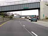
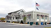
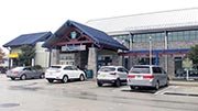
Oakmont Plum Service Plaza
Verona
Fuel & EV charging

gas

diesel

e85

ev

truck
parking
New Stanton Service Plaza
Hunker
Fuel & EV charging
gas
diesel
ev
truck
parking
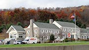
North Somerset Service Plaza
Somerset
Fuel & EV charging
gas
diesel

tesla
truck
parking
South Somerset Service Plaza
Somerset
Fuel & EV charging
gas
diesel
tesla
truck
parking
North Midway Service Plaza
Bedford
Fuel & EV charging
gas
diesel
truck
parking
South Midway Service Plaza
Bedford
Fuel & EV charging
gas
diesel
truck
parking
Sideling Hill Service Plaza
Bedford
Fuel & EV charging
gas
diesel
truck
parking
Blue Mountain Service Plaza
Newburg
Fuel & EV charging
gas
diesel
truck
parking
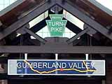
Cumberland Valley Service Plaza
Carlisle
Fuel & EV charging
gas
diesel
truck
parking
Highspire Service Plaza
Middletown
Fuel & EV charging
gas
diesel
truck
parking
Lawn Service Plaza
Lawn
Fuel & EV charging
gas
diesel
truck
parking
Bowmansville Service Plaza
Bowmansville
Fuel & EV charging
gas
diesel
ev
tesla
truck
parking
Peter J. Camiel Service Plaza
Elverson
Fuel & EV charging
gas
diesel
ev
tesla
truck
parking
Valley Forge Service Plaza
Wayne
Fuel & EV charging
gas
diesel
truck
parking
King Of Prussia Service Plaza
King Of Prussia
Fuel & EV charging
gas
diesel
ev
truck
parking
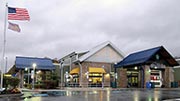
Allentown Service Plaza
Allentown
Fuel & EV charging
gas
diesel
truck
parking
Hickory Run Service Plaza
Jim Thorpe
Fuel & EV charging
gas
diesel
tesla
truck
parking


 Pennsylvania Turnpike Commission
 PA Turnpike 66 ▹
 Beaver Valley Expressway ▹
 Mon Fayette Expressway ▹
 Pennsylvania Turnpike ▹
 Ohio Turnpike ▹
 PA Turnpike 576 ▹

 Delaware Memorial Bridge ▹
 Delaware Turnpike ▹
 Atlantic City Expressway ▹
 New Jersey Turnpike ▹
 Benjamin Franklin Bridge ▹
 Walt Whitman Bridge ▹
 Commodore Barry Bridge ▹
 Betsy Ross Bridge ▹
 Scudder Falls Toll Bridge ▹
 Trenton Morrisville Toll Bridge ▹
 Tacony Palmyra Bridge ▹
 Burlington Bristol Bridge ▹
 Milford Montague Toll Bridge ▹
 Delaware Water Gap Toll Bridge ▹
 Portland Columbia Toll Bridge ▹
 Easton Phillipsburg Toll Bridge ▹
 I78 Toll Bridge ▹
 Garden State Parkway ▹
 New Hope Lambertville Toll Bridge ▹


