Syracuse - Utica - Rome Toll Maps

 Weather Alert [BETA]

Winter Storm Watch

Area: Onondaga

View Alert

Regional photo of Syracuse - Utica - Rome

Using The Interactive Regional Map

The Syracuse - Utica - Rome metro area map shows exits and toll points for region-wide toll roads or other toll roads that cross the region.

View Map ▾Road List ▾

The following (2) toll roads are in this area, cross through this area or connect with this region:

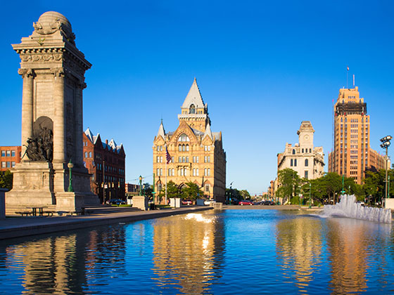
The Syracuse - Utica - Rome area includes the following cities: Syracuse, East Syracuse, Oneida, Utica, Rome, Frankfort, and Watertown.

Markers on the interactive map can be selected to get close-up views of exit points, toll gantries and other locations and points-of-interest. Each POI map shows all nearby dining, gas, EV charging, hotels and other services.

View Map ▾Road List ▾

A complete list of exits and other points-of-interest in the Syracuse - Utica - Rome area follows the map. Exit lists are sorted by toll road.

Advertising
Advertising

Regional Map For Syracuse - Utica - Rome

Pan and zoom as desired. Tap map markers for information and to view that specific location.

A complete list of exits and other points-of-interest is below this map, and other regions are shown further down the page.

Regional photo of Syracuse - Utica - Rome

Visiting In The Syracuse - Utica - Rome Area?

We have partnered with Hotels.com to help you get the best deal on hotels.

Find Hotels

Things to do around Syracuse - Utica - Rome

Things To Do While You're Here

We have partnered with Tiqets to bring you deals on dining and attractions.

Travel Suggestions

Advertising
Advertising

Regional Exits, Listed By Toll Road

A list of all exits and other points-of-interest in this region, sorted by toll road.

Indian Castle Travel Plaza

Indian Castle Travel Plaza — Canajoharie

View Map & Info

▾ AVAILABLE GAS AND EV ▾

  • gas

    gas

  • diesel

    diesel

  • ev

    ev

  • tesla

    tesla

  • truck parking

    truck
    parking

NY Route 169 / Little Falls / Dolgeville

Exit 29ANY Route 169 / Little Falls / Dolgeville — Little Falls

View Map & Info

▸ GPS 43.016570000 X -74.817450000
NOTES: NYSTA Interchange ID: m29a

The Thruway Authority New York State Thruway Authority manages this segment.

NY Route 28 / Herkimer / Mohawk

Exit 30NY Route 28 / Herkimer / Mohawk — Herkimer

View Map & Info

▸ GPS 43.017780000 X -74.989310000
NOTES: NYSTA Interchange ID: m30x

The Thruway Authority New York State Thruway Authority manages this segment.

Schuyler Travel Plaza

Schuyler Travel Plaza — Frankfort

View Map & Info

▾ AVAILABLE GAS AND EV ▾

  • gas

    gas

  • diesel

    diesel

I-790 / NY Route 8 & 12 / Utica

Exit 31I-790 / NY Route 8 & 12 / Utica — Utica

View Map & Info

▸ GPS 43.111980000 X -75.204990000
NOTES: NYSTA Interchange ID: m31x

The Thruway Authority New York State Thruway Authority manages this segment.

NY Route 233 / Westmoreland / Rome

Exit 32NY Route 233 / Westmoreland / Rome — Rome

View Map & Info

▸ GPS 43.123880000 X -75.401020000
NOTES: NYSTA Interchange ID: m32x

The Thruway Authority New York State Thruway Authority manages this segment.

Oneida Travel Plaza

Oneida Travel Plaza — Rome

View Map & Info

▾ AVAILABLE GAS AND EV ▾

  • gas

    gas

  • diesel

    diesel

NY Route 365 / Verona / Rome / Oneida

Exit 33NY Route 365 / Verona / Rome / Oneida — Rome

View Map & Info

▸ GPS 43.123750000 X -75.582300000
NOTES: NYSTA Interchange ID: m33x

The Thruway Authority New York State Thruway Authority manages this segment.

NY Route 13 / Canastota / Oneida

Exit 34NY Route 13 / Canastota / Oneida — Canstota

View Map & Info

▸ GPS 43.092600000 X -75.747200000
NOTES: International Boxing Hall of Fame / NYSTA Interchange ID: m34x

The Thruway Authority New York State Thruway Authority manages this segment.

Chittenango Travel Plaza

Chittenango Travel Plaza — Canosta

View Map & Info

▾ AVAILABLE GAS AND EV ▾

  • gas

    gas

  • diesel

    diesel

  • ev

    ev

  • tesla

    tesla

  • truck parking

    truck
    parking

Highway Gantry

Highway Gantry — Syracuse

View Map & Info

▸ GPS 43.095060000 X -76.033870000
NOTES: Start/End of Segment 4: 34A Syracuse to 25A Schenectady

The Thruway Authority New York State Thruway Authority manages this segment.

I-481 / Syracuse / Chittenango

Exit 34AI-481 / Syracuse / Chittenango — Syracuse

View Map & Info

▸ GPS 43.094750000 X -76.043530000
NOTES: NYSTA Interchange ID: m34a

The Thruway Authority New York State Thruway Authority manages this segment.

Highway Gantry

Highway Gantry — Syracuse

View Map & Info

▸ GPS 43.094390000 X -76.061630000
NOTES: Fixed Toll Segment between Exits 34A and 35

The Thruway Authority New York State Thruway Authority manages this segment.

NY Route 298 / Syracuse / East Syracuse

Exit 35NY Route 298 / Syracuse / East Syracuse — Syracuse

View Map & Info

▸ GPS 43.092780000 X -76.089850000
NOTES: NYSTA Interchange ID: m35x

The Thruway Authority New York State Thruway Authority manages this segment.

DeWitt Travel Plaza

DeWitt Travel Plaza — Syracuse

View Map & Info

▾ AVAILABLE GAS AND EV ▾

  • gas

    gas

  • diesel

    diesel

  • ev

    ev

  • tesla

    tesla

Highway Gantry

Highway Gantry — Syracuse

View Map & Info

▸ GPS 43.092870000 X -76.136540000
NOTES: Fixed Toll Segment between Exits 35 and 36

The Thruway Authority New York State Thruway Authority manages this segment.

I-81 / Airport/SYR / Watertown

Exit 36I-81 / Airport/SYR / Watertown — Syracuse

View Map & Info

▸ GPS 43.094580000 X -76.167880000
NOTES: Syracuse-Hancock International Airport / NYSTA Interchange ID: m36x

The Thruway Authority New York State Thruway Authority manages this segment.

Highway Gantry

Highway Gantry — Syracuse

View Map & Info

▸ GPS 43.097920000 X -76.174560000
NOTES: Start/End of Segment 3: 36 Syracuse I-81 to 39 Syracuse I-690

The Thruway Authority New York State Thruway Authority manages this segment.

Electronics Parkway / Syracuse / Liverpool

Exit 37Electronics Parkway / Syracuse / Liverpool — Syracuse

View Map & Info

▸ GPS 43.102060000 X -76.181390000
NOTES: NYSTA Interchange ID: m37x

The Thruway Authority New York State Thruway Authority manages this segment.

Oswego Road / County Road 57 / Syracuse / Liverpool

Exit 38Oswego Road / County Road 57 / Syracuse / Liverpool — Syracuse

View Map & Info

▸ GPS 43.117170000 X -76.218670000
NOTES: NYSTA Interchange ID: m38x

The Thruway Authority New York State Thruway Authority manages this segment.

Highway Gantry

Highway Gantry — Syracuse

View Map & Info

▸ GPS 43.110200000 X -76.272250000
NOTES: Start/End of Segment 3: 39 Syracuse I-690 to 36 Syracuse I-81

The Thruway Authority New York State Thruway Authority manages this segment.

I-690 / NY Route 690 / Syracuse / Fulton

Exit 39I-690 / NY Route 690 / Syracuse / Fulton — Syracuse

View Map & Info

▸ GPS 43.107300000 X -76.287200000
NOTES: NYSTA Interchange ID: m39x

The Thruway Authority New York State Thruway Authority manages this segment.

Warners Travel Plaza

Warners Travel Plaza — Syracuse

View Map & Info

▾ AVAILABLE GAS AND EV ▾

  • gas

    gas

  • diesel

    diesel

  • ev

    ev

  • truck parking

    truck
    parking

Highway Gantry

Highway Gantry — Syracuse

View Map & Info

▸ GPS 43.089600000 X -76.378850000
NOTES: Start/End of Segment 2: 39 Syracuse to 44 Canandaigua

The Thruway Authority New York State Thruway Authority manages this segment.

NY Route 34 / Weedsport / Auburn

Exit 40NY Route 34 / Weedsport / Auburn — Weedsport

View Map & Info

▸ GPS 43.061120000 X -76.564740000
NOTES: NYSTA Interchange ID: m40x

The Thruway Authority New York State Thruway Authority manages this segment.

Port Byron Travel Plaza

Port Byron Travel Plaza — Waterloo

View Map & Info

▾ AVAILABLE GAS AND EV ▾

  • gas

    gas

  • diesel

    diesel

  • truck parking

    truck
    parking

NY Route 414 / Waterloo / Clyde

Exit 41NY Route 414 / Waterloo / Clyde — Waterloo

View Map & Info

▸ GPS 42.967440000 X -76.852940000
NOTES: NYSTA Interchange ID: m41x

The Thruway Authority New York State Thruway Authority manages this segment.

Junius Ponds Travel Plaza

Junius Ponds Travel Plaza — Geneva

View Map & Info

▾ AVAILABLE GAS AND EV ▾

  • gas

    gas

  • diesel

    diesel

  • ev

    ev

  • tesla

    tesla

  • truck parking

    truck
    parking

NY Route 14 / Geneva / Lyons

Exit 42NY Route 14 / Geneva / Lyons — Geneva

View Map & Info

▸ GPS 42.954890000 X -76.982060000
NOTES: NYSTA Interchange ID: m42x

The Thruway Authority New York State Thruway Authority manages this segment.

NY 12

Exit 50N/50SNY 12 — Alexandria Bay

View Map & Info

▸ GPS 44.293253000 X -75.972385000
NOTES: USA / South terminus of bridge system

TI Bridge USA Tolls

TI Bridge USA Tolls — Alexandria Bay

View Map & Info

▸ GPS 44.296515000 X -75.975677000
NOTES: Northbound toll only

Island Road / CR 191 / CR 10

Exit 51Island Road / CR 191 / CR 10 — Wellesley Island

View Map & Info

▸ GPS 44.308530000 X -75.991453000
NOTES: Island State Parks

Island Road / De Wolf Point

Exit 52Island Road / De Wolf Point — Wellesley Island

View Map & Info

▸ GPS 44.340948000 X -75.980405000
NOTES: Last US Exit / to CR 191 / to Deringer Drive

US Customs and Border Protection

US Customs and Border Protection — Wellesley Island

Border Crossing Checkpoint - ID Required!

▸ GPS 44.342950000 X -75.980994000
NOTES: Duty free shops

Canada Border Services Agency

Canada Border Services Agency — Hill Island

Border Crossing Checkpoint - ID Required!

▸ GPS 44.348583000 X -75.984125000
NOTES: Duty free shops

Benson Park Road / Stratford Road

Benson Park Road / Stratford Road — Hill Island

View Map & Info

▸ GPS 44.352102000 X -75.980931000
NOTES: Last Canada junction / 1000 Islands Tower / to Skydeck Rd

Shady Lane

Shady Lane — Hill Island

View Map & Info

▸ GPS 44.355898000 X -75.978346000
NOTES: Hill Island Gift Shop

TI Bridge Canada Tolls

TI Bridge Canada Tolls — Darlingside

View Map & Info

▸ GPS 44.366865000 X -75.982470000
NOTES: Southbound toll only

Thousand Islands Parkway

Thousand Islands Parkway — Darlingside

View Map & Info

▸ GPS 44.368927000 X -75.979437000
NOTES:

ON 401 / Macdonald Cartier Freeway

ON 401 / Macdonald Cartier Freeway — Selton

View Map & Info

▸ GPS 44.382096000 X -75.983037000
NOTES: Canada / North terminus of bridge system

Advertising
Advertising

EXPLORE NEW YORK

Journey to key destinations around and adjacent to New York!

Map Of This Region ▹

Communities in this metro area include Poughkeepsie, Newburgh, Middletown, Kingston, Hudson, and Catskill.

Individual toll maps for this region are listed below.

Map Of This Region ▹

Communities in this metro area include Albany, Schenectady, Rotterdam, Amsterdam, and West Stockbridge, Massachusetts.

Individual toll maps for this region are listed below.

Map Of This Region ▹

Communities in this metro area include Syracuse, East Syracuse, Oneida, Utica, Rome, Frankfort, and Watertown.

Individual toll maps for this region are listed below.

Map Of This Region ▹

Communities in this metro area include Buffalo, Batavia, Rochester, Amherst, Niagara Falls, and Niagara Falls, Ontario.

Individual toll maps for this region are listed below.

Map Of This Region ▹

Communities in this metro area include New Haven, Bridgeport, Darien, Greenwich, Stamford, and Port Chester, New York.

Individual toll maps for this region are listed below.

Map Of This Region ▹

Communities in this metro area include Scranton, Wilkes Barre, Stroudsburg, Clarks Summit, and Knowlton Township, New Jersey.

Individual toll maps for this region are listed below.

Map Of This Region ▹

Communities in this metro area include Toronto, Niagara Falls, Hamilton, and Mississauga.

Individual toll maps for this region are listed below.

Turnpikes.com is proud to partner with the following: