Golden Horseshoe Toll Maps

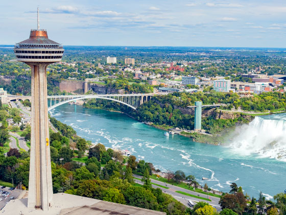
Regional photo of Golden Horseshoe

Using The Interactive Regional Map

The Golden Horseshoe metro area map shows exits and toll points for region-wide toll roads or other toll roads that cross the region.

View Map ▾Road List ▾

The following (4) toll roads are in this area, cross through this area or connect with this region:

The Golden Horseshoe area includes the following cities: Toronto, Niagara Falls, Hamilton, and Mississauga.

Markers on the interactive map can be selected to get close-up views of exit points, toll gantries and other locations and points-of-interest. Each POI map shows all nearby dining, gas, EV charging, hotels and other services.

View Map ▾Road List ▾

A complete list of exits and other points-of-interest in the Golden Horseshoe area follows the map. Exit lists are sorted by toll road.

Advertising
Advertising

Regional Map For Golden Horseshoe

Pan and zoom the map as desired, and select or tap the interactive markers to get information about that specific location. Each marker also includes options for viewing a close-up map of the destination point.

A complete list of exits and other points-of-interest is below this map, and other regions are shown further down the page.

Advertising
Advertising

Regional Exits, Listed By Toll Road

A list of all exits and other points-of-interest in this region, sorted by toll road.

I-190 / Niagara Street / Porter Avenue

Exit 9I-190 / Niagara Street / Porter Avenue — Buffalo

View Map & Info

▸ GPS 42.898999000 X -78.897349000
NOTES: NB exit to Niagara / SB exit to Porter for bridge

The Authority Buffalo and Fort Erie Public Bridge Authority manages this segment.

East Side / US

East Side / US — Buffalo

View Map & Info

▸ GPS 42.905405000 X -78.899782000
NOTES: United States

The Authority Buffalo and Fort Erie Public Bridge Authority manages this segment.
West Side / Canada

West Side / Canada — Fort Erie ON

View Map & Info

▸ GPS 42.907838000 X -78.912485000
NOTES: Canada

The Authority Buffalo and Fort Erie Public Bridge Authority manages this segment.

Peace Bridge Tolls

Peace Bridge Tolls — Fort Erie ON

View Map & Info

▸ GPS 42.908476000 X -78.916652000
NOTES: US to Canada charged only

The Authority Buffalo and Fort Erie Public Bridge Authority manages this segment.

Central Avenue / Niagara Regional Road 124

Central Avenue / Niagara Regional Road 124 — Fort Erie ON

View Map & Info

▸ GPS 42.908357000 X -78.917170000
NOTES:

The Authority Buffalo and Fort Erie Public Bridge Authority manages this segment.

Concession Road / QEW

Concession Road / QEW — Fort Erie ON

View Map & Info

▸ GPS 42.909929000 X -78.928081000
NOTES: Queen Elizabeth Way

The Authority Buffalo and Fort Erie Public Bridge Authority manages this segment.

Niagara Street / Rainbow Boulevard

Niagara Street / Rainbow Boulevard — Niagara Falls

View Map & Info

▸ GPS 43.088134000 X -79.063166000
NOTES:

NFBC Niagara Falls Bridge Commission manages this segment.

Rainbow Bridge Tolls

Rainbow Bridge Tolls — Niagara Falls

View Map & Info

▸ GPS 43.088874000 X -79.064865000
NOTES: US to Canada charged only

NFBC Niagara Falls Bridge Commission manages this segment.

East Side / US

East Side / US — Niagara Falls

View Map & Info

▸ GPS 43.088985000 X -79.066084000
NOTES: United States

NFBC Niagara Falls Bridge Commission manages this segment.

West Side / Canada

West Side / Canada — Niagara Falls ON

View Map & Info

▸ GPS 43.091539000 X -79.069470000
NOTES: Canada

NFBC Niagara Falls Bridge Commission manages this segment.

Ontario Hwy 420 / Bender Street

Ontario Hwy 420 / Bender Street — Niagara Falls ON

View Map & Info

▸ GPS 43.091796000 X -79.071142000
NOTES:

NFBC Niagara Falls Bridge Commission manages this segment.

I-190 / Upper Mountain Road

I-190 / Upper Mountain Road — Niagara Falls

View Map & Info

▸ GPS 43.151726000 X -79.033887000
NOTES: Roadway is called Lewiston-queenston Bridge here.

NFBC Niagara Falls Bridge Commission manages this segment.

East Side / US

East Side / US — Niagara Falls

View Map & Info

▸ GPS 43.152724000 X -79.041881000
NOTES: Roadway is called Lewiston-queenston Bridge here. United States

NFBC Niagara Falls Bridge Commission manages this segment.

West Side / Canada

West Side / Canada — Niagara Falls ON

View Map & Info

▸ GPS 43.153320000 X -79.047268000
NOTES: Roadway is called Lewiston-queenston Bridge here. Canada

NFBC Niagara Falls Bridge Commission manages this segment.

Lewiston-Queenston Tolls

Lewiston-Queenston Tolls — Niagara Falls ON

View Map & Info

▸ GPS 43.156676000 X -79.052457000
NOTES: Roadway is called Lewiston-queenston Bridge here. US to Canada charged only

NFBC Niagara Falls Bridge Commission manages this segment.

Ontario Hwy 405 / Stanley Avenue

Ontario Hwy 405 / Stanley Avenue — Niagara Falls ON

View Map & Info

▸ GPS 43.146788000 X -79.087367000
NOTES: Roadway is called Lewiston-queenston Bridge here. Niagara Regional Road 102

NFBC Niagara Falls Bridge Commission manages this segment.

Whirlpool Street

Whirlpool Street — Niagara Falls

View Map & Info

▸ GPS 43.109774000 X -79.055857000
NOTES: United States

NFBC Niagara Falls Bridge Commission manages this segment.

Whirlpool Rapids Tolls

Whirlpool Rapids Tolls — Niagara Falls

View Map & Info

▸ GPS 43.109594000 X -79.056655000
NOTES: US to Canada charged only

NFBC Niagara Falls Bridge Commission manages this segment.

Niagara River Parkway

Niagara River Parkway — Niagara Falls ON

View Map & Info

▸ GPS 43.108841000 X -79.060094000
NOTES: Canada

NFBC Niagara Falls Bridge Commission manages this segment.

Advertising
Advertising

EXPLORE ONTARIO

Journey to key destinations around and adjacent to Ontario!

Map Of This Region ▹

Communities in this metro area include Toronto, Niagara Falls, Hamilton, and Mississauga.

Individual toll maps for this region are listed below.

Map Of This Region ▹

Communities in this metro area include Sault Ste Marie, Thunder Bay, Fort Frances, and Greater Sudbury.

Individual toll maps for this region are listed below.

Map Of This Region ▹

Communities in this metro area include Windsor.

Individual toll maps for this region are listed below.

Map Of This Region ▹

Communities in this metro area include Buffalo, Batavia, Rochester, Amherst, Niagara Falls, and Niagara Falls, Ontario.

Individual toll maps for this region are listed below.

Map Of This Region ▹

Communities in this metro area include Detroit, Grosse Ile, Ann Arbor, Pontiac, and Lansing.

Individual toll maps for this region are listed below.

Map Of This Region ▹

Communities in this metro area include St Ignace and Sault Ste Marie.

Individual toll maps for this region are listed below.

Map Of This Region ▹

Communities in this metro area include Port Huron, Flint, Saginaw, and Bay City.

Individual toll maps for this region are listed below.

Map Of This Region ▹

Communities in this metro area include Duluth and International Falls.

Individual toll maps for this region are listed below.

Turnpikes.com is proud to partner with the following: