This Location At A Glance
This toll point is located in . NOTE: Start/End of Segment 6: 61 Ripley to 55 Lackawanna.
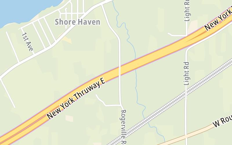
Map image © TomTom Intl BV
This location's approximate GPS Coordinates are 42.30828 x -79.63594.
On to Site of Old Ripley Barrier, about 6.0 miles away ►
◄ Back to NY Route 394 / Westfield / Mayville, about 3.5 miles away.
Nearby gas and food are shown on the interactive map below.
Weather & Visibility

A Shower
45°F / 7.5°C
Feels Like
39°F / 3.6°C

Visibility
11 Mi / 17.7 Km
3 Hr Precip
0.01 In / 0.0 Cm

-
W Wind
9.2 Mi / 14.9 Km
Gusts
14.5 Mi / 23.4 Km
Conditions and forecasts provided in partnership with AccuWeather.

Weather provided in partnership with AccuWeather.
Available Cameras
No camera feed …
There is no currently-available traffic camera feed for this location.
Advertising


 Bayonne Bridge ▹
 Goethals Bridge ▹
 Holland Tunnel ▹
 Garden State Parkway ▹
 George Washington Bridge ▹
 Lincoln Tunnel ▹
 New Jersey Turnpike ▹
 Outerbridge Crossing ▹
 Bronx Whitestone Bridge ▹
 Hugh L Carey Tunnel ▹
 Cross Westchester Expressway ▹
 Robert F Kennedy Bridge ▹
 Queens Midtown Tunnel ▹
 New England Thruway ▹
 New York State Thruway ▹
 Throgs Neck Bridge ▹
 Henry Hudson Bridge ▹
 Atlantic Beach Bridge ▹
 Marine Parkway Bridge ▹
 Connecticut Turnpike ▹
 Bear Mountain Bridge ▹
 Massachusetts Turnpike ▹
 Thousand Islands Bridge ▹
 Niagara Thruway ▹
 Peace Bridge ▹
 Rainbow Bridge ▹

 Pennsylvania Turnpike ▹
 Milford Montague Toll Bridge ▹
 Delaware Water Gap Toll Bridge ▹
 Portland Columbia Toll Bridge ▹
 Easton Phillipsburg Toll Bridge ▹
 I78 Toll Bridge ▹


