This Location At A Glance
This toll point is located in Rochester. NOTE: Fixed Toll Segment between Exits 45 and 46.
This location is in the Buffalo - Rochester - Niagara Falls area.
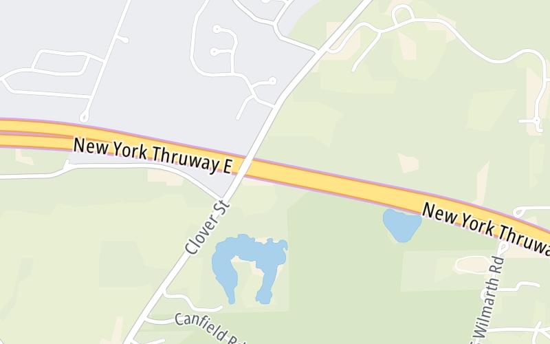
This location's approximate GPS Coordinates are 43.04607 x -77.56711.
On to I-390 / Airport/ROC / Rochester / Corning, about 4.3 miles away ►
◄ Back to I-490 / Rochester / Victor, about 7.1 miles away.
Nearby gas and food are shown on the interactive map below.
Weather & Visibility

Cloudy
49°F / 9.5°C
Feels Like
50°F / 9.8°C

Visibility
15 Mi / 24.1 Km
3 Hr Precip
0.01 In / 0.0 Cm

-
WNW Wind
4.5 Mi / 7.2 Km
Gusts
9.1 Mi / 14.6 Km
See the full forecast for the Buffalo - Rochester - Niagara Falls area
Conditions and forecasts provided in partnership with AccuWeather.

Weather provided in partnership with AccuWeather.
Available Cameras

3.78 Mi


 Bayonne Bridge ▹
 Goethals Bridge ▹
 Holland Tunnel ▹
 Garden State Parkway ▹
 George Washington Bridge ▹
 Lincoln Tunnel ▹
 New Jersey Turnpike ▹
 Outerbridge Crossing ▹
 Bronx Whitestone Bridge ▹
 Hugh L Carey Tunnel ▹
 Cross Westchester Expressway ▹
 Robert F Kennedy Bridge ▹
 Queens Midtown Tunnel ▹
 New England Thruway ▹
 New York State Thruway ▹
 Throgs Neck Bridge ▹
 Henry Hudson Bridge ▹
 Atlantic Beach Bridge ▹
 Marine Parkway Bridge ▹
 Connecticut Turnpike ▹
 Bear Mountain Bridge ▹
 Massachusetts Turnpike ▹
 Thousand Islands Bridge ▹
 Niagara Thruway ▹
 Peace Bridge ▹
 Rainbow Bridge ▹

 Pennsylvania Turnpike ▹
 Milford Montague Toll Bridge ▹
 Delaware Water Gap Toll Bridge ▹
 Portland Columbia Toll Bridge ▹
 Easton Phillipsburg Toll Bridge ▹
 I78 Toll Bridge ▹


