This Location At A Glance
This toll point is located in Syracuse. NOTE: Start/End of Segment 2: 39 Syracuse to 44 Canandaigua.
This location is in the Syracuse - Utica - Rome area.
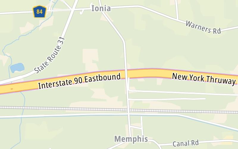
This location's approximate GPS Coordinates are 43.08960 x -76.37885.
On to NY Route 34 / Weedsport / Auburn, about 9.6 miles away ►
◄ Back to Warners Travel Plaza, about 2.6 miles away.
Nearby gas and food are shown on the interactive map below.
Weather & Visibility

Cloudy
48°F / 8.7°C
Feels Like
46°F / 7.6°C

Visibility
11 Mi / 17.7 Km
3 Hr Precip
0 In / 0.0 Cm

-
NW Wind
5.5 Mi / 8.8 Km
Gusts
11.2 Mi / 18.1 Km
See the full forecast for the Syracuse - Utica - Rome area
Conditions and forecasts provided in partnership with AccuWeather.

Weather provided in partnership with AccuWeather.
Available Cameras
No camera feed …
There is no currently-available traffic camera feed for this location.


 Bayonne Bridge ▹
 Goethals Bridge ▹
 Holland Tunnel ▹
 Garden State Parkway ▹
 George Washington Bridge ▹
 Lincoln Tunnel ▹
 New Jersey Turnpike ▹
 Outerbridge Crossing ▹
 Bronx Whitestone Bridge ▹
 Hugh L Carey Tunnel ▹
 Cross Westchester Expressway ▹
 Robert F Kennedy Bridge ▹
 Queens Midtown Tunnel ▹
 New England Thruway ▹
 New York State Thruway ▹
 Throgs Neck Bridge ▹
 Henry Hudson Bridge ▹
 Atlantic Beach Bridge ▹
 Marine Parkway Bridge ▹
 Connecticut Turnpike ▹
 Bear Mountain Bridge ▹
 Massachusetts Turnpike ▹
 Thousand Islands Bridge ▹
 Niagara Thruway ▹
 Peace Bridge ▹
 Rainbow Bridge ▹

 Pennsylvania Turnpike ▹
 Milford Montague Toll Bridge ▹
 Delaware Water Gap Toll Bridge ▹
 Portland Columbia Toll Bridge ▹
 Easton Phillipsburg Toll Bridge ▹
 I78 Toll Bridge ▹


