This Location At A Glance
This toll point is located in Syracuse. NOTE: Start/End of Segment 3: 36 Syracuse I-81 to 39 Syracuse I-690.
This location is in the Syracuse - Utica - Rome area.
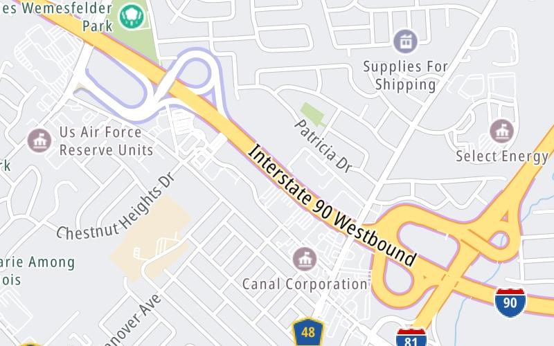
This location's approximate GPS Coordinates are 43.09792 x -76.17456.
On to Electronics Parkway / Syracuse / Liverpool, about 0.4 miles away ►
◄ Back to I-81 / Airport/SYR / Watertown, about 0.5 miles away.
Nearby gas and food are shown on the interactive map below.
Weather & Visibility

Cloudy
62°F / 16.9°C
Feels Like
63°F / 17.1°C

Visibility
10 Mi / 16.1 Km
3 Hr Precip
0.01 In / 0.0 Cm

-
S Wind
2.8 Mi / 4.5 Km
Gusts
7 Mi / 11.2 Km
See the full forecast for the Syracuse - Utica - Rome area
Conditions and forecasts provided in partnership with AccuWeather.

Weather provided in partnership with AccuWeather.
Available Cameras

0.44 Mi
0.46 Mi
1.32 Mi
2.34 Mi
2.35 Mi


 Bayonne Bridge ▹
 Goethals Bridge ▹
 Holland Tunnel ▹
 Garden State Parkway ▹
 George Washington Bridge ▹
 Lincoln Tunnel ▹
 New Jersey Turnpike ▹
 Outerbridge Crossing ▹
 Bronx Whitestone Bridge ▹
 Hugh L Carey Tunnel ▹
 Cross Westchester Expressway ▹
 Robert F Kennedy Bridge ▹
 Queens Midtown Tunnel ▹
 New England Thruway ▹
 New York State Thruway ▹
 Throgs Neck Bridge ▹
 Henry Hudson Bridge ▹
 Atlantic Beach Bridge ▹
 Marine Parkway Bridge ▹
 Connecticut Turnpike ▹
 Bear Mountain Bridge ▹
 Massachusetts Turnpike ▹
 Thousand Islands Bridge ▹
 Niagara Thruway ▹
 Peace Bridge ▹
 Rainbow Bridge ▹

 Pennsylvania Turnpike ▹
 Milford Montague Toll Bridge ▹
 Delaware Water Gap Toll Bridge ▹
 Portland Columbia Toll Bridge ▹
 Easton Phillipsburg Toll Bridge ▹
 I78 Toll Bridge ▹


