This Location At A Glance
NOTICE! Data for this plaza/rest stop is being updated.
This travel plaza is located in Ramapo. Sloatsburg is nearby.
This location is in the Catskills - Hudson Valley area.
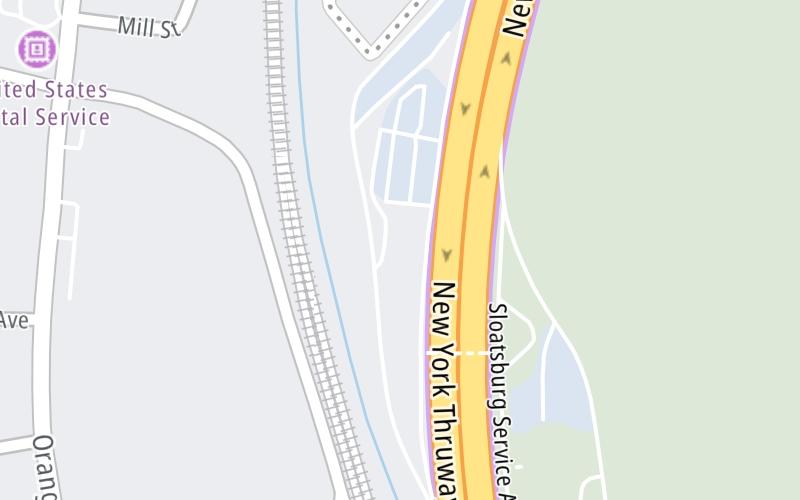
Map image © TomTom Intl BV
This location's approximate GPS Coordinates are 41.15308 x -74.18975.
On to US Hwy 6 / NY Route 17, about 12.0 miles away ►
◄ Back to Sloatsburg Travel Plaza, about 0.0 miles away.
Nearby gas and food are shown on the interactive map below.
Weather & Visibility

Cloudy
60°F / 15.5°C
Feels Like
60°F / 15.5°C

Visibility
12 Mi / 19.3 Km
3 Hr Precip
0 In / 0.0 Cm

-
SW Wind
2.2 Mi / 3.5 Km
Gusts
5.6 Mi / 9 Km
See the full forecast for This Location or the Catskills - Hudson Valley area
Conditions and forecasts provided in partnership with AccuWeather.

Weather provided in partnership with AccuWeather.
Available Cameras

2.17 Mi
2.86 Mi
2.92 Mi
Advertising


 Bayonne Bridge ▹
 Goethals Bridge ▹
 Holland Tunnel ▹
 Garden State Parkway ▹
 George Washington Bridge ▹
 Lincoln Tunnel ▹
 New Jersey Turnpike ▹
 Outerbridge Crossing ▹
 Bronx Whitestone Bridge ▹
 Hugh L Carey Tunnel ▹
 Cross Westchester Expressway ▹
 Robert F Kennedy Bridge ▹
 Queens Midtown Tunnel ▹
 New England Thruway ▹
 New York State Thruway ▹
 Throgs Neck Bridge ▹
 Henry Hudson Bridge ▹
 Atlantic Beach Bridge ▹
 Marine Parkway Bridge ▹
 Connecticut Turnpike ▹
 Bear Mountain Bridge ▹
 Massachusetts Turnpike ▹
 Thousand Islands Bridge ▹
 Niagara Thruway ▹
 Peace Bridge ▹
 Rainbow Bridge ▹

 Pennsylvania Turnpike ▹
 Milford Montague Toll Bridge ▹
 Delaware Water Gap Toll Bridge ▹
 Portland Columbia Toll Bridge ▹
 Easton Phillipsburg Toll Bridge ▹
 I78 Toll Bridge ▹


