Philadelphia - Wilmington - South Jersey Toll Maps

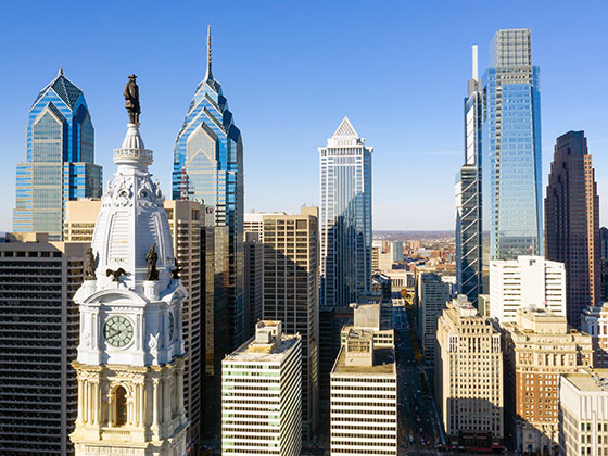
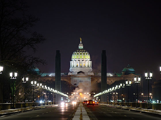
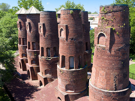
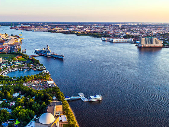
Regional photo of Philadelphia - Wilmington - South Jersey

Using The Interactive Regional Map

The Philadelphia - Wilmington - South Jersey metro area map shows exits and toll points for region-wide toll roads or other toll roads that cross the region.

View Map ▾Road List ▾

The following (13) toll roads are in this area, cross through this area or connect with this region:

The Philadelphia - Wilmington - South Jersey area includes the following cities: Philadelphia, King Of Prussia, Valley Forge, West Chester, Bristol, Burlington, New Jersey, Morrisville, Trenton, New Jersey, Palmyra, New Jersey, Wilmington, Delaware, and Camden, New Jersey.

Markers on the interactive map can be selected to get close-up views of exit points, toll gantries and other locations and points-of-interest. Each POI map shows all nearby dining, gas, EV charging, hotels and other services.

View Map ▾Road List ▾

A complete list of exits and other points-of-interest in the Philadelphia - Wilmington - South Jersey area follows the map. Exit lists are sorted by toll road.

Advertising
Advertising

Regional Map For Philadelphia - Wilmington - South Jersey

Pan and zoom as desired. Tap map markers for information and to view that specific location.

A complete list of exits and other points-of-interest is below this map, and other regions are shown further down the page.

Regional photo of Philadelphia - Wilmington - South Jersey

Visiting In The Philadelphia - Wilmington - South Jersey Area?

We have partnered with Hotels.com to help you get the best deal on hotels.

Find Hotels

Things to do around Philadelphia - Wilmington - South Jersey

Things To Do While You're Here

We have partnered with Tiqets to bring you deals on dining and attractions.

Travel Suggestions

Advertising
Advertising

Regional Exits, Listed By Toll Road

A list of all exits and other points-of-interest in this region, sorted by toll road.

NJ Turnpike @ Delaware Memorial Bridge

NJ Turnpike @ Delaware Memorial Bridge — Carneys Point

View Map & Info

▸ GPS 39.681068000 X -75.470803610
NOTES:

NJTA New Jersey Turnpike Authority manages this segment.
Delaware Memorial Bridge toll Plaza

Delaware Memorial Bridge toll Plaza — Penn's Grove

View Map & Info

▸ GPS 39.685232000 X -75.447561000
NOTES:

NJTA New Jersey Turnpike Authority manages this segment.

John Fenwick Service Area

John Fenwick Service Area — Oldmans Township

View Map & Info

▾ AVAILABLE GAS AND EV ▾

  • gas

    gas

  • diesel

    diesel

  • ev

    ev

  • tesla

    tesla

  • truck parking

    truck
    parking

Clara Barton Service Area

Clara Barton Service Area — Oldmans Township

View Map & Info

▾ AVAILABLE GAS AND EV ▾

  • gas

    gas

  • diesel

    diesel

  • ev

    ev

  • tesla

    tesla

  • truck parking

    truck
    parking

Swedesboro

Exit 2Swedesboro — Swedesboro

View Map & Info

▸ GPS 39.753710270 X -75.276005000
NOTES: Chester

NJTA New Jersey Turnpike Authority manages this segment.
Woodbury

Exit 3Woodbury — Woodbury

View Map & Info

▸ GPS 39.859980000 X -75.072659400
NOTES: South Camden

NJTA New Jersey Turnpike Authority manages this segment.

Walt Whitman Service Area

Walt Whitman Service Area — Cherry Hill

View Map & Info

▾ AVAILABLE GAS AND EV ▾

    Mt. Laurel / Camden

    Exit 4Mt. Laurel / Camden — Mount Laurel

    View Map & Info

    ▸ GPS 39.931375000 X -74.952662000
    NOTES: Philadelphia

    NJTA New Jersey Turnpike Authority manages this segment.

    James Fenimore Cooper Service Area

    James Fenimore Cooper Service Area — Mount Laurel

    View Map & Info

    ▾ AVAILABLE GAS AND EV ▾

      Burlington

      Exit 5Burlington — Burlington

      View Map & Info

      ▸ GPS 40.024910500 X -74.823079720
      NOTES: Mount Holly

      NJTA New Jersey Turnpike Authority manages this segment.

      Delaware River Bridge

      Delaware River Bridge — Burlington

      View Map & Info

      ▸ GPS 40.115500000 X -74.825200000
      NOTES: to Pennsylvania Turnpike

      NJTA New Jersey Turnpike Authority manages this segment.

      US 130

      US 130 — Burlington

      View Map & Info

      ▸ GPS 40.101363800 X -74.789516380
      NOTES: Florence

      NJTA New Jersey Turnpike Authority manages this segment.

      NJTP Extension to Pennsylvania Turnpike

      Exit 6NJTP Extension to Pennsylvania Turnpike — Bordentown

      View Map & Info

      ▸ GPS 40.096121000 X -74.730725000
      NOTES:

      NJTA New Jersey Turnpike Authority manages this segment.

      Bordentown

      Exit 7Bordentown — Bordentown

      View Map & Info

      ▸ GPS 40.124737500 X -74.699775000
      NOTES: Trenton

      NJTA New Jersey Turnpike Authority manages this segment.

      Richard Stockton Service Area

      Richard Stockton Service Area — Hamilton Township

      View Map & Info

      ▾ AVAILABLE GAS AND EV ▾

      • gas

        gas

      • diesel

        diesel

      • ev

        ev

      • tesla

        tesla

      • truck parking

        truck
        parking

      Woodrow Wilson Service Area

      Woodrow Wilson Service Area — Hamilton Township

      View Map & Info

      ▾ AVAILABLE GAS AND EV ▾

      • gas

        gas

      • diesel

        diesel

      • ev

        ev

      • tesla

        tesla

      • truck parking

        truck
        parking

      I–195

      Exit 7AI–195 — Allentown

      View Map & Info

      ▸ GPS 40.192487000 X -74.602505270
      NOTES: Begin/End I–95 NJ

      NJTA New Jersey Turnpike Authority manages this segment.

      I–176 / Morgantown Expy

      Exit 298I–176 / Morgantown Expy — Morgantown

      View Map & Info

      ▸ GPS 40.159500000 X -75.881000000
      NOTES:

      PTC Pennsylvania Turnpike Commission manages this segment.

      Peter J. Camiel Service Plaza

      Peter J. Camiel Service Plaza — Elverson

      View Map & Info

      ▾ AVAILABLE GAS AND EV ▾

      • gas

        gas

      • diesel

        diesel

      • ev

        ev

      • tesla

        tesla

      • truck parking

        truck
        parking

      PA 100 / Pottstown Pike / US 322

      Exit 312PA 100 / Pottstown Pike / US 322 — Downingtown

      View Map & Info

      ▸ GPS 40.067800000 X -75.666400000
      NOTES:

      PTC Pennsylvania Turnpike Commission manages this segment.

      PA 29 / US 202

      Exit 320PA 29 / US 202 — West Chester

      View Map & Info

      ▸ GPS 40.074800000 X -75.530600000
      NOTES:

      PTC Pennsylvania Turnpike Commission manages this segment.

      Valley Forge Service Plaza

      Valley Forge Service Plaza — Wayne

      View Map & Info

      ▾ AVAILABLE GAS AND EV ▾

      • gas

        gas

      • diesel

        diesel

      • truck parking

        truck
        parking

      I–76 / US 422 / US 202

      Exit 326I–76 / US 422 / US 202 — King Of Prussia

      View Map & Info

      ▸ GPS 40.091500000 X -75.410200000
      NOTES:

      PTC Pennsylvania Turnpike Commission manages this segment.

      King Of Prussia Service Plaza

      King Of Prussia Service Plaza — King Of Prussia

      View Map & Info

      ▾ AVAILABLE GAS AND EV ▾

      • gas

        gas

      • diesel

        diesel

      • ev

        ev

      • truck parking

        truck
        parking

      I–476 / Germantown Pike

      Exit 333I–476 / Germantown Pike — Norristown

      View Map & Info

      ▸ GPS 40.110500000 X -75.290200000
      NOTES:

      PTC Pennsylvania Turnpike Commission manages this segment.

      Mid–County Toll Plaza

      Mid–County Toll Plaza — Plymouth Township

      View Map & Info

      ▸ GPS 40.107705000 X -75.285768000
      NOTES:

      PTC Pennsylvania Turnpike Commission manages this segment.

      PA Turnpike Mainline

      Exit 20PA Turnpike Mainline — Plymouth Township

      View Map & Info

      ▸ GPS 40.109472000 X -75.281030000
      NOTES: Mid–County

      PTC Pennsylvania Turnpike Commission manages this segment.

      NORTHEAST EXTENSION / I–476

      NORTHEAST EXTENSION / I–476 — Norristown

      View Map & Info

      ▸ GPS 40.112648000 X -75.278053000
      NOTES:

      PTC Pennsylvania Turnpike Commission manages this segment.

      PA 309

      Exit 339PA 309 — Ft Washington

      View Map & Info

      ▸ GPS 40.132900000 X -75.192500000
      NOTES: Ft Washington Expy

      PTC Pennsylvania Turnpike Commission manages this segment.

      Virginia Drive

      Exit 340Virginia Drive — Ft Washington

      View Map & Info

      ▸ GPS 40.138600000 X -75.170600000
      NOTES: WB On/WB Off

      PTC Pennsylvania Turnpike Commission manages this segment.

      PA 611

      Exit 343PA 611 — Willow Grove

      View Map & Info

      ▸ GPS 40.161900000 X -75.120500000
      NOTES:

      PTC Pennsylvania Turnpike Commission manages this segment.

      PA 63

      Exit 31PA 63 — Harleysville

      View Map & Info

      ▸ GPS 40.251324000 X -75.347300000
      NOTES: Lansdale - This exit on the Northeast Extension

      PTC Pennsylvania Turnpike Commission manages this segment.

      US 1 / Lincoln Highway

      Exit 351US 1 / Lincoln Highway — Feasterville

      View Map & Info

      ▸ GPS 40.132200000 X -74.972100000
      NOTES:

      PTC Pennsylvania Turnpike Commission manages this segment.

      Street Road / US 1

      Exit 352Street Road / US 1 — Feasterville

      View Map & Info

      ▸ GPS 40.130200000 X -74.963300000
      NOTES: EB On/EB Off

      PTC Pennsylvania Turnpike Commission manages this segment.

      Neshaminy Falls Toll Plaza

      Neshaminy Falls Toll Plaza — Bensalem

      View Map & Info

      ▸ GPS 40.127942000 X -74.949479000
      NOTES:

      PTC Pennsylvania Turnpike Commission manages this segment.

      (Old 358) Delaware Valley / Bristol Pike / US 13

      Exit 42(Old 358) Delaware Valley / Bristol Pike / US 13 — Levittown

      View Map & Info

      ▸ GPS 40.123500000 X -74.853100000
      NOTES:

      PTC Pennsylvania Turnpike Commission manages this segment.

      Delaware River Bridge Toll Gantry

      Delaware River Bridge Toll Gantry — Levittown

      View Map & Info

      ▸ GPS 40.121011000 X -74.844428000
      NOTES:

      PTC Pennsylvania Turnpike Commission manages this segment.

      (Old 359) Delaware River Bridge / to NJTP

      Exit 43(Old 359) Delaware River Bridge / to NJTP — Levittown

      View Map & Info

      ▸ GPS 40.117500000 X -74.832200000
      NOTES:

      PTC Pennsylvania Turnpike Commission manages this segment.

      Center City / Philadelphia

      Center City / Philadelphia — Philadelphia

      View Map & Info

      ▸ GPS 39.955248000 X -75.147679000
      NOTES: Pennsylvania

      DRPA Delaware River Port Authority manages this segment.

      Ben Franklin Bridge Toll Plaza

      Ben Franklin Bridge Toll Plaza — Camden

      View Map & Info

      ▸ GPS 39.948474000 X -75.118549000
      NOTES: Westbound traffic charged

      DRPA Delaware River Port Authority manages this segment.

      Camden

      Camden — Camden

      View Map & Info

      ▸ GPS 39.947818000 X -75.117729000
      NOTES: New Jersey

      DRPA Delaware River Port Authority manages this segment.

      I–95 / Front St / Philadelphia

      Exit 351I–95 / Front St / Philadelphia — Philadelphia

      View Map & Info

      ▸ GPS 39.910436000 X -75.157739000
      NOTES: Pennsylvania / Schuylkill Expy

      DRPA Delaware River Port Authority manages this segment.

      Walt Whitman Bridge Toll Plaza

      Walt Whitman Bridge Toll Plaza — Philadelphia

      View Map & Info

      ▸ GPS 39.909727000 X -75.154390000
      NOTES: Westbound traffic charged

      DRPA Delaware River Port Authority manages this segment.

      North-South Fwy / I–676

      Exit 354North-South Fwy / I–676 — Gloucester City

      View Map & Info

      ▸ GPS 39.902810000 X -75.115680000
      NOTES: New Jersey / to Black Horse Pike

      DRPA Delaware River Port Authority manages this segment.

      I–95

      I–95 — Chester

      View Map & Info

      ▸ GPS 39.845155000 X -75.387213000
      NOTES: Delaware Expressway

      DRPA Delaware River Port Authority manages this segment.

      US 13 / W 9th St

      US 13 / W 9th St — Chester

      View Map & Info

      ▸ GPS 39.840631000 X -75.383513000
      NOTES: Pennsylvania

      DRPA Delaware River Port Authority manages this segment.

      Commodore Barry Bridge Toll Plaza

      Commodore Barry Bridge Toll Plaza — Bridgeport

      View Map & Info

      ▸ GPS 39.809959000 X -75.352271000
      NOTES: Westbound traffic charged

      DRPA Delaware River Port Authority manages this segment.

      US 130

      US 130 — Bridgeport

      View Map & Info

      ▸ GPS 39.802924000 X -75.348460000
      NOTES: US 322 to I–295

      DRPA Delaware River Port Authority manages this segment.

      Bridesburg / Philadelphia

      Bridesburg / Philadelphia — Philadelphia

      View Map & Info

      ▸ GPS 39.989124000 X -75.074682000
      NOTES: Pennsylvania

      DRPA Delaware River Port Authority manages this segment.

      Betsy Ross Bridge Toll Plaza

      Betsy Ross Bridge Toll Plaza — Pennsauken Township

      View Map & Info

      ▸ GPS 39.977084000 X -75.048803000
      NOTES: Westbound traffic charged

      DRPA Delaware River Port Authority manages this segment.

      Pennsauken

      Pennsauken — Pennsauken Township

      View Map & Info

      ▸ GPS 39.973699000 X -75.041934000
      NOTES: New Jersey

      DRPA Delaware River Port Authority manages this segment.

      Taylorsville Road

      Exit 10Taylorsville Road — Lower Makefield Township

      View Map & Info

      ▸ GPS 40.255088000 X -74.854227000
      NOTES: Pennsylvania / to Yardley Park & Ride

      DRJTBC Delaware River Joint Toll Bridge Commission manages this segment.

      Bridge Toll Plaza

      Bridge Toll Plaza — Lower Makefield Township

      View Map & Info

      ▸ GPS 40.256562000 X -74.851409000
      NOTES:

      DRJTBC Delaware River Joint Toll Bridge Commission manages this segment.

      NJ 29 / River Road

      Exit 76NJ 29 / River Road — Ewing Township

      View Map & Info

      ▸ GPS 40.260060000 X -74.845388000
      NOTES: New Jersey

      DRJTBC Delaware River Joint Toll Bridge Commission manages this segment.

      Pennsylvania Ave / Philadelphia via US 1

      Exit 10Pennsylvania Ave / Philadelphia via US 1 — Morrisville

      View Map & Info

      ▸ GPS 40.205936000 X -74.774517000
      NOTES: Pennsylvania / to Yardley Park & Ride

      DRJTBC Delaware River Joint Toll Bridge Commission manages this segment.

      Bridge Toll Plaza

      Bridge Toll Plaza — Trenton

      View Map & Info

      ▸ GPS 40.207317000 X -74.771618000
      NOTES:

      DRJTBC Delaware River Joint Toll Bridge Commission manages this segment.

      NJ 29 / Broad St via US 1

      Exit 76NJ 29 / Broad St via US 1 — Trenton

      View Map & Info

      ▸ GPS 40.209687000 X -74.766640000
      NOTES: New Jersey

      DRJTBC Delaware River Joint Toll Bridge Commission manages this segment.

      Tacony / Philadelphia

      Tacony / Philadelphia — Philadelphia

      View Map & Info

      ▸ GPS 40.017182000 X -75.047699000
      NOTES: Pennsylvania

      Burlington County Bridge Commission Burlington County Bridge Commission manages this segment.

      Bridge Toll Plaza

      Bridge Toll Plaza — Pennsauken Township

      View Map & Info

      ▸ GPS 40.006880000 X -75.038574000
      NOTES: Westbound traffic charged

      Burlington County Bridge Commission Burlington County Bridge Commission manages this segment.

      Palmyra

      Palmyra — Palmyra

      View Map & Info

      ▸ GPS 40.006282000 X -75.037953000
      NOTES: New Jersey

      Burlington County Bridge Commission Burlington County Bridge Commission manages this segment.

      State Road / Geo. Patterson Blvd.

      State Road / Geo. Patterson Blvd. — Bristol Township

      View Map & Info

      ▸ GPS 40.096351000 X -74.873458000
      NOTES: to US 13 / Bristol Pike

      Burlington County Bridge Commission Burlington County Bridge Commission manages this segment.

      Bridge Toll Plaza

      Bridge Toll Plaza — Burlilngton

      View Map & Info

      ▸ GPS 40.076387000 X -74.867520000
      NOTES: Northbound only charged

      Burlington County Bridge Commission Burlington County Bridge Commission manages this segment.

      Reed Street / Broad Street

      Reed Street / Broad Street — Burlington

      View Map & Info

      ▸ GPS 40.075632000 X -74.867125000
      NOTES: to US 130 / Burlington Pike via Keim Blvd

      Burlington County Bridge Commission Burlington County Bridge Commission manages this segment.

      Advertising
      Advertising

      EXPLORE PENNSYLVANIA

      Journey to key destinations around and adjacent to Pennsylvania!

      Map Of This Region ▹

      Communities in this metro area include Pittsburgh, Cranberry Township, Beaver Valley, New Castle, Washington, Uniontown, Cheat Lake, West Virginia, Boardman, Ohio, and Youngstown, Ohio.

      Individual toll maps for this region are listed below.

      Map Of This Region ▹

      Communities in this metro area include Harrisburg, Mechanicsburg, Carlisle, Hershey, and York.

      Individual toll maps for this region are listed below.

      Map Of This Region ▹

      Communities in this metro area include Philadelphia, King Of Prussia, Valley Forge, West Chester, Bristol, Burlington, New Jersey, Morrisville, Trenton, New Jersey, Palmyra, New Jersey, Wilmington, Delaware, and Camden, New Jersey.

      Individual toll maps for this region are listed below.

      Map Of This Region ▹

      Communities in this metro area include Scranton, Wilkes Barre, Stroudsburg, Clarks Summit, and Knowlton Township, New Jersey.

      Individual toll maps for this region are listed below.

      Map Of This Region ▹

      Communities in this metro area include Camden, Burlington, Palmyra, Pennsauken, Cherry Hill, Gloucester City, Trenton, Wilmington, Delaware, Philadelphia, Pennsylvania, Tacony, Pennsylvania, and Bristol, Pennsylvania.

      Individual toll maps for this region are listed below.

      Map Of This Region ▹

      Communities in this metro area include Knowlton Township, Trenton, Phillipsburg, Easton, Pennsylvania, Lambertville, Ewing, Morrisville, Pennsylvania, and Stroudsburg, Pennsylvania.

      Individual toll maps for this region are listed below.

      Map Of This Region ▹

      Communities in this metro area include Cleveland, Akron, Boardman, Lorain, Aurora, Youngstown, New Castle, Pennsylvania, and Beaver Falls, Pennsylvania.

      Individual toll maps for this region are listed below.

      Turnpikes.com is proud to partner with the following: