This map of the Ohio Turnpike displays markers for exits and tolling points, which you can select to get a close-up map of that point of interest or location.
The points-of-interest shown on this map are also listed below, ordered from west to east.
See below for more comprehensive information about the Ohio Turnpike
This state toll road serves several key cities, including Cleveland, Youngstown, Akron, Sandusky, Maumee, Toledo, Elyria, and Warren.
The static map seen here shows a segment of The Ohio Turnpike at Amherst/Oberlin / SR 58. The entirety of The Ohio Turnpike can be seen in the fully-interactive map above, which includes linked markers. You may resize and reposition the interactive map to orient the road in relation to other landmarks.
There is also a complete list of exits below.
CLOSURE - Ohio Turnpike
Friday August 1, 2025 — Wednesday October 1, 2025
At and around mile marker 215: Pavement replacement on eastbound exit ramp to Lordstown West, at Toll Plaza 215. Exit closed. Full details below
Impacted area(s):
Tolls For Cars, SUVs, Pickups, etc.
▹ Toll as of January 1, 2025.
The total toll for using the Ohio Turnpike is $18.50, if you are using a compatible transponder, RFID sticker or other pass.
NOTE: The rates shown are the maximum toll incurred. Your trip may have a lower rate.
For drivers paying with a transponder, the following passes will work on the Ohio Turnpike
Learn about transponders and accounts in Ohio.
Without a compatible pass or transponder, the toll will be $27.00.
View MapAll Tolls / Calculator ▸
Our new toll and trip calculator is being constructed. For most roads, you can still use the legacy calculator for current, accurate tolls.
Turnpikes.com has partnered with Tiqets.com to bring you these excusive deals on attractions!
Selecting an exit or other location opens a separate map with locations of available gas, EV charging, fast-food and other dining options. Current weather and driving conditions will also be shown.
Westgate Toll Barrier — Edon
Note(s): Pictures here. to Indiana Toll Road
GPS 41.629200000 X -84.754300000
Ohio Turnpike and Infrastructure Commission manages this segment.
Exit 13Bryan/Montpelier / SR 15 — Bryan
Note(s): None.
GPS 41.614000000 X -84.549100000
Ohio Turnpike and Infrastructure Commission manages this segment.
Tiffin River Service Plaza — West Unity
Note(s): Pictures here.
GPS 41.603600000 X -84.408000000
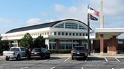
Indian Meadow Service Plaza — West Unity
Note(s): Pictures here.
GPS 41.605200000 X -84.407200000
Exit 25Archbold/Fayette / SR 66 — Archbold
Note(s): Pictures here.
GPS 41.591600000 X -84.320100000
Ohio Turnpike and Infrastructure Commission manages this segment.
Exit 34Wauseon/Napoleon / SR 108 — Wauseon
Note(s): Pictures here.
GPS 41.593700000 X -84.142600000
Ohio Turnpike and Infrastructure Commission manages this segment.
Exit 39Delta/Lyons / SR 109 — Delta
Note(s): Pictures here.
GPS 41.591600000 X -84.048100000
Ohio Turnpike and Infrastructure Commission manages this segment.
Exit 52Toledo Airport/Swanton / SR 2 — Toledo
Note(s): Pictures here.
GPS 41.600700000 X -83.803700000
Ohio Turnpike and Infrastructure Commission manages this segment.
Exit 59Maumee/Toledo / US 20 — Toledo
Note(s): Pictures here.
GPS 41.592000000 X -83.670800000
Ohio Turnpike and Infrastructure Commission manages this segment.
Exit 64Perrysburg/Toledo / I-75 — Toledo
Note(s): Pictures here.
GPS 41.566600000 X -83.575000000
Ohio Turnpike and Infrastructure Commission manages this segment.
Exit 71Stony Ridge/Toledo / I–280 / SR 420 — Stony Ridge
Note(s): Pictures here.
GPS 41.522700000 X -83.454700000
Ohio Turnpike and Infrastructure Commission manages this segment.
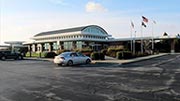
Blue Heron Service Plaza — Genoa
Note(s): Pictures here.
GPS 41.490700000 X -83.367700000
Wynadot Service Plaza — Genoa
Note(s): Pictures here.
GPS 41.489800000 X -83.369400000
Exit 81Elmore/Woodville/Gibsonburg / SR 51 — Elmore
Note(s): Pictures here.
GPS 41.458700000 X -83.285000000
Ohio Turnpike and Infrastructure Commission manages this segment.
Exit 91Fremont/Port Clinton / SR 53 — Fremont
Note(s): Pictures here.
GPS 41.399400000 X -83.105800000
Ohio Turnpike and Infrastructure Commission manages this segment.
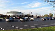
Erie Islands Service Plaza — Clyde
Note(s): Pictures here.
GPS 41.368800000 X -82.956300000
Commodore Perry Service Plaza — Clyde
Note(s): Pictures here.
GPS 41.368100000 X -82.958900000
Exit 110Sandusky/Bellevue / SR 4 — Sandusky
Note(s): Pictures here.
GPS 41.340100000 X -82.759400000
Ohio Turnpike and Infrastructure Commission manages this segment.
Exit 118Sandusky/Norwalk / US 250 — Sandusky
Note(s): Pictures here.
GPS 41.323200000 X -82.608200000
Ohio Turnpike and Infrastructure Commission manages this segment.
Exit 135Vermilion / Baumhart Rd. — Vermilion
Note(s): Pictures here.
GPS 41.360300000 X -82.284200000
Ohio Turnpike and Infrastructure Commission manages this segment.
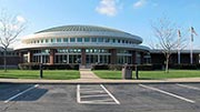
Middle Ridge Service Plaza — Amherst
Note(s): Pictures here.
GPS 41.379500000 X -82.222600000
Vermilion Valley Service Plaza — Amherst
Note(s): Pictures here.
GPS 41.377700000 X -82.225000000
Exit 140Amherst/Oberlin / SR 58 — Amherst
Note(s): Pictures here.
GPS 41.382200000 X -82.201800000
Ohio Turnpike and Infrastructure Commission manages this segment.
Exit 142Lorain County West / I–90 / SR 2 — Lorain Cty
Note(s): None.
GPS 41.387000000 X -82.177800000
Ohio Turnpike and Infrastructure Commission manages this segment.
Exit 145Lorain / Elyria / SR 57 — Elyria
Note(s): Pictures here.
GPS 41.387300000 X -82.110900000
Ohio Turnpike and Infrastructure Commission manages this segment.
Exit 151N Ridgeville/Cleveland / I–480 — Cleveland
Note(s): None.
GPS 41.379200000 X -81.996700000
Ohio Turnpike and Infrastructure Commission manages this segment.
Exit 152N Olmsted/Cleveland / Lorain Rd — Cleveland
Note(s): Pictures here.
GPS 41.378300000 X -81.987800000
Ohio Turnpike and Infrastructure Commission manages this segment.
Exit 161Strongsville/Cleveland / US 42 / I–71 — Cleveland
Note(s): Pictures here.
GPS 41.332800000 X -81.816800000
Ohio Turnpike and Infrastructure Commission manages this segment.
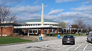
Great Lakes Service Plaza — Broadview Heights
Note(s): Pictures here.
GPS 41.292000000 X -81.671300000
Towpath Service Plaza — Broadview Heights
Note(s): Pictures here.
GPS 41.292000000 X -81.675700000
Exit 173Cleveland / SR 21 / I–77 — Cleveland
Note(s): Pictures here. to Rock and Roll Hall of Fame
GPS 41.275600000 X -81.636300000
Ohio Turnpike and Infrastructure Commission manages this segment.
Exit 180Akron / SR 8 — Akron
Note(s): Pictures here.
GPS 41.258600000 X -81.501200000
Ohio Turnpike and Infrastructure Commission manages this segment.
Exit 187Streetsboro / SR 14 / I–480 — Streetsboro
Note(s): Pictures here.
GPS 41.256200000 X -81.364200000
Ohio Turnpike and Infrastructure Commission manages this segment.
Exit 193Ravenna / SR 44 — Ravenna
Note(s): Pictures here.
GPS 41.245100000 X -81.237000000
Ohio Turnpike and Infrastructure Commission manages this segment.
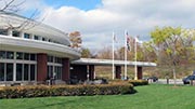
Portage Service Plaza — Mantua
Note(s): Pictures here.
GPS 41.244200000 X -81.175700000
Brady's Leap Service Plaza — Mantua
Note(s): Pictures here.
GPS 41.242800000 X -81.177900000
Exit 209Warren / SR 5 — Warren
Note(s): Pictures here.
GPS 41.213600000 X -80.950500000
Ohio Turnpike and Infrastructure Commission manages this segment.
Exit 215Lordstown West / Ellsworth Bailey Rd — Lordstown
Note(s): Pictures here. WB On/EB Off
GPS 41.153700000 X -80.895900000
Ohio Turnpike and Infrastructure Commission manages this segment.
Exit 216Lordstown East Hallock Young Rd — Lordstown
Note(s): Pictures here. WB Off/EB On
GPS 41.135600000 X -80.867300000
Ohio Turnpike and Infrastructure Commission manages this segment.
Exit 218Akron/Youngstown / I–76 W/I–80 E — Youngstown
Note(s): Pictures here.
GPS 41.109900000 X -80.837800000
Ohio Turnpike and Infrastructure Commission manages this segment.
Exit 232Youngstown / SR 7 — Youngstown
Note(s): Pictures here.
GPS 40.967500000 X -80.656100000
Ohio Turnpike and Infrastructure Commission manages this segment.
Exit 234Youngstown/Poland / I–680 — Youngstown
Note(s): Pictures here. WB Off/EB On
GPS 40.954100000 X -80.637300000
Ohio Turnpike and Infrastructure Commission manages this segment.
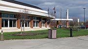
Mahoning Valley Service Plaza — New Springfield
Note(s): Pictures here.
GPS 40.940400000 X -80.586400000
Glacier Hills Service Plaza — New Springfield
Note(s): Pictures here.
GPS 40.938800000 X -80.587200000
Eastgate Toll Barrier — North Lima
Note(s): Pictures here. to Pennsylvania Turnpike
GPS 40.924300000 X -80.556800000
Ohio Turnpike and Infrastructure Commission manages this segment.
Journey to key destinations around and adjacent to Ohio!
Communities in this metro area include Cleveland, Akron, Boardman, Lorain, Aurora, Youngstown, New Castle, Pennsylvania, and Beaver Falls, Pennsylvania.
Individual toll maps for this region are listed below.
Communities in this metro area include Toledo, Perrysburg, Maumee, Montpelier, and Wauseon.
Individual toll maps for this region are listed below.
Communities in this metro area include Castalia, Sandusky, Norwalk, Bellevue, Huron, Milan, and Monroeville.
Individual toll maps for this region are listed below.
Communities in this metro area include Columbus, Upper Arlington, Westerville, New Albany, Worthington, Dublin, Pickerington, and Reynoldsburg.
Individual toll maps for this region are listed below.
Roads Within Region
Communities in this metro area include Cincinnati, Norwood, Cheviot, Northbrook, Reading, Covington, Kentucky, and Newport, Kentucky.
Individual toll maps for this region are listed below.
Roads Within Region
Communities in this metro area include Gary, South Bend, Elkhart, Portage, and Fremont.
Individual toll maps for this region are listed below.
Communities in this metro area include Pittsburgh, Cranberry Township, Beaver Valley, New Castle, Washington, Uniontown, Cheat Lake, West Virginia, Boardman, Ohio, and Youngstown, Ohio.
Individual toll maps for this region are listed below.
Communities in this metro area include Parkersburg, North Hills, Vienna, and Belpre, Ohio.
Individual toll maps for this region are listed below.
Communities in this metro area include Detroit, Grosse Ile, Ann Arbor, Pontiac, and Lansing.
Individual toll maps for this region are listed below.