Pennsylvania Turnpike At Sideling Hill Service Plaza

Advertising
Advertising

Map & services within two (2) miles

Interactive map shows available cameras, plus nearby fuel, food and lodging

See below for more about this area

Advertising
Advertising

About This Location

Sideling Hill Service Plaza

At A Glance

NOTICE! Data for this plaza/rest stop is being updated.

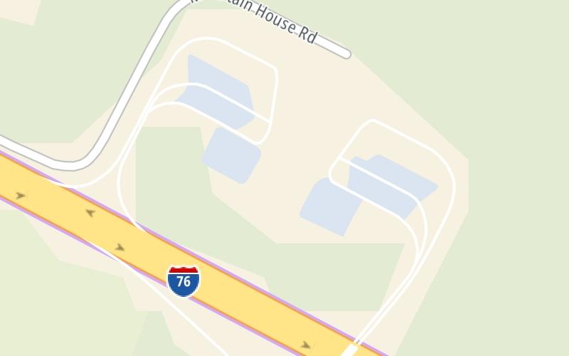
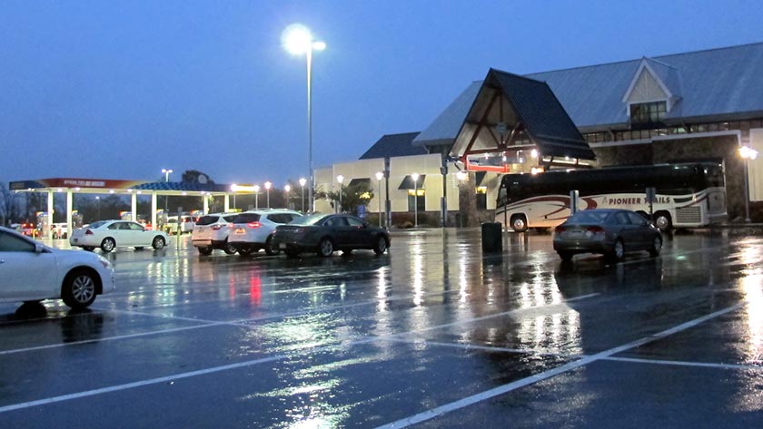
This travel plaza is located in Bedford.

This location is in the Pittsburgh - Western Pennsylvania area.

Interactive Map Above

This location's approximate GPS Coordinates are 40.05860 x -78.08190.

On to US 522, about 7.1 miles away ►

◄ Back to Toll Gantry T 168, about 4.0 miles away.

View Map Travel Conditions

Above: Photo by Turnpikes.com

Using The POI Map

The interactive map and lists on this page include key traveler services within two miles of this destination point.

You will find common services, including gas stations, truck stops, EV charging facilities, fast-food or family restaurants, and hotels. These are displayed on the interactive map as markers, which you can select for more information.

Current driving conditions and weather, along with a more complete list of key services, may be found below the map.

View Map Weather

Static map of Pennsylvania Turnpike at Sideling Hill Service Plaza
Static map. Interactive map is above.
Advertising
Advertising

Travel Conditions At Sideling Hill Service Plaza

Current Weather And Visibility

  • 04 6 05
  • Rain

    54°F / 12.4°C

    Feels Like:

    51°F / 10.8°C

  • Visibility

    9 Mi / 14.5 Km

    3-Hour Precip:

    0.12 In / 0.3 Cm

  • North Northeast
    Winds (NNE)

    3.9 MPH / 6.3 KPH

    Gusts:

    10.4 MPH / 16.7 KPH

▸ Get the full forecast for This Location | The Pittsburgh - Western Pennsylvania area

Available Cameras

No camera feed …

There is no currently-available traffic camera feed for this location.

Advertising
Advertising

Travel Pictures

Pictures Around Sideling Hill Service Plaza

About this photo:
Evening is well settled upon the Sideling Hill Service Plaza on the Pennyslvania Turnpike. Photo taken October 31, 2019.

Photo taken 10-31-2019

More Pictures Near Sideling Hill Service Plaza

Photo taken 10-31-2019
Photo taken 05-16-2012
Advertising
Advertising

Closest Food, Gas, EV And Other Services Near Sideling Hill Service Plaza

The map above shows all services within about a two (2) mile radius.

Hotels and destinations header

Hotels & Airports

Destination Travel

Fuel, EV and convenience store header

Gas & EV Charging

Closest Gas Stations

Sunoco

SUNOCO

3748 North Hess Road • 0.46 miles

Store/Fuel Brand: Sunoco

7-Eleven

PENNSYLVANIA TURNPIKE - SIDELING HILL SERVICE PLAZA - 7-ELEVEN

3744 N Hess Rd • 24 feet

Store/Fuel Brand: 7-Eleven

View Map

Closest EV Chargers

View Map

No EV charging stations nearby.

Coffee, snacks and dining header

Fast Food & Beverage

Closest Fast Food

Fast food refers ONLY to quick-service and take-out diners. All restaurant types are shown on the map above.

Auntie Anne's

AUNTIE ANNE'S

3744 North Hess Road • 24 feet

POPEYES LOUISIANA KITCHEN

• 37 feet

Dunkin'

DUNKIN'

3744 North Hess Road • 90 feet

View Map

Discover Pennsylvania Attractions

Advertising
Advertising

EXPLORE PENNSYLVANIA

Journey to key destinations around and adjacent to Pennsylvania!

Map Of This Region ▹

Communities in this metro area include Pittsburgh, Cranberry Township, Beaver Valley, New Castle, Washington, Uniontown, Cheat Lake, West Virginia, Boardman, Ohio, and Youngstown, Ohio.

Individual toll maps for this region are listed below.

Map Of This Region ▹

Communities in this metro area include Harrisburg, Mechanicsburg, Carlisle, Hershey, and York.

Individual toll maps for this region are listed below.

Map Of This Region ▹

Communities in this metro area include Philadelphia, King Of Prussia, Valley Forge, West Chester, Bristol, Burlington, New Jersey, Morrisville, Trenton, New Jersey, Palmyra, New Jersey, Wilmington, Delaware, and Camden, New Jersey.

Individual toll maps for this region are listed below.

Map Of This Region ▹

Communities in this metro area include Scranton, Wilkes Barre, Stroudsburg, Clarks Summit, and Knowlton Township, New Jersey.

Individual toll maps for this region are listed below.

Map Of This Region ▹

Communities in this metro area include Camden, Burlington, Palmyra, Pennsauken, Cherry Hill, Gloucester City, Trenton, Wilmington, Delaware, Philadelphia, Pennsylvania, Tacony, Pennsylvania, and Bristol, Pennsylvania.

Individual toll maps for this region are listed below.

Map Of This Region ▹

Communities in this metro area include Knowlton Township, Trenton, Phillipsburg, Easton, Pennsylvania, Lambertville, Ewing, Morrisville, Pennsylvania, and Stroudsburg, Pennsylvania.

Individual toll maps for this region are listed below.

Map Of This Region ▹

Communities in this metro area include Cleveland, Akron, Boardman, Lorain, Aurora, Youngstown, New Castle, Pennsylvania, and Beaver Falls, Pennsylvania.

Individual toll maps for this region are listed below.

Advertising
Advertising
Turnpikes.com is proud to partner with the following: