This Location At A Glance
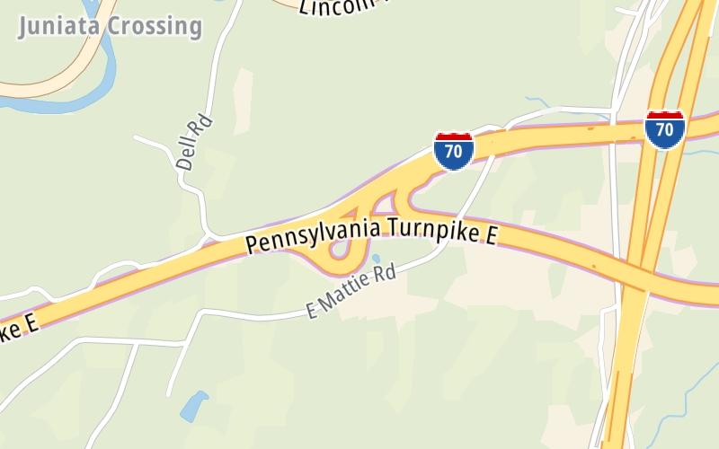
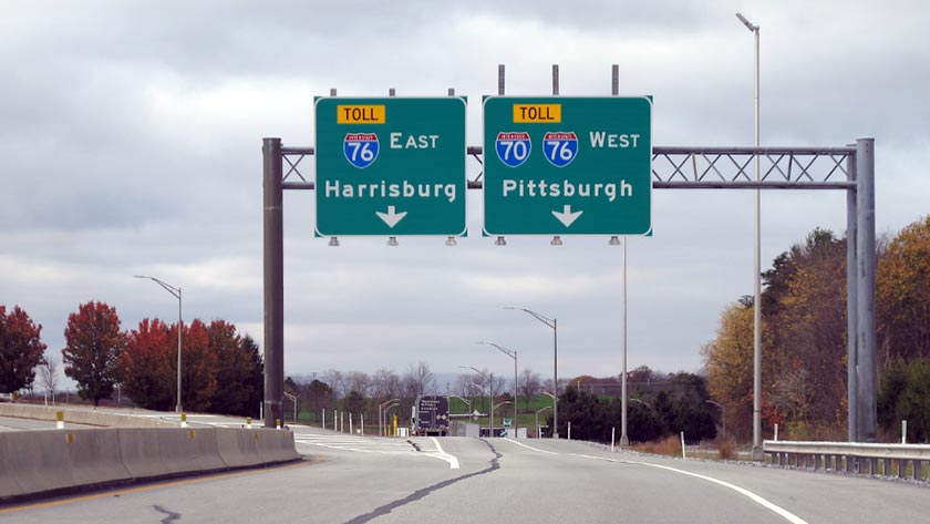
This is Exit 161 of the Pennsylvania Turnpike.
This junction is located in Breezewood. NOTE: Breezewood.
This location is in the Pittsburgh - Western Pennsylvania area.
This location's approximate GPS Coordinates are 39.98720 x -78.25670.
Which directions can I travel from here?
From this junction, traffic can enter traveling both westbound and eastbound. Traffic can also exit traveling both westbound and eastbound.
On to US 522, about 17.9 miles away ►
◄ Back to I-99 / US 220, about 16.0 miles away.
▹ The Pennsylvania Turnpike and the I 70 connect here.
Nearby gas and food are shown on the interactive map below.
Weather & Visibility

Sunny
50°F / 10.1°C
Feels Like
64°F / 17.7°C

Visibility
18 Mi / 29 Km
3 Hr Precip
0 In / 0.0 Cm

-
SSW Wind
2.8 Mi / 4.4 Km
Gusts
6.1 Mi / 9.8 Km
See the full forecast for This Location or the Pittsburgh - Western Pennsylvania area
Conditions and forecasts provided in partnership with AccuWeather.

Weather provided in partnership with AccuWeather.
Available Cameras

0.84 Mi
1.19 Mi
1.27 Mi
1.49 Mi


 PA Turnpike 66 ▹
 Beaver Valley Expressway ▹
 Mon Fayette Expressway ▹
 Pennsylvania Turnpike ▹
 Ohio Turnpike ▹
 PA Turnpike 576 ▹

 Delaware Memorial Bridge ▹
 Delaware Turnpike ▹
 Atlantic City Expressway ▹
 New Jersey Turnpike ▹
 Benjamin Franklin Bridge ▹
 Walt Whitman Bridge ▹
 Commodore Barry Bridge ▹
 Betsy Ross Bridge ▹
 Scudder Falls Toll Bridge ▹
 Trenton Morrisville Toll Bridge ▹
 Tacony Palmyra Bridge ▹
 Burlington Bristol Bridge ▹
 Milford Montague Toll Bridge ▹
 Delaware Water Gap Toll Bridge ▹
 Portland Columbia Toll Bridge ▹
 Easton Phillipsburg Toll Bridge ▹
 I78 Toll Bridge ▹
 Garden State Parkway ▹
 New Hope Lambertville Toll Bridge ▹