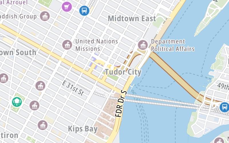
This Location At A Glance
This toll point is located in Manhattan. New York City is nearby.
This location is in the New York City - Northern New Jersey area.
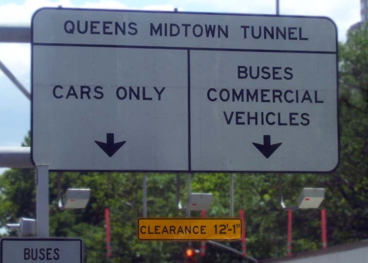
Photo by Turnpikes.com
This location's approximate GPS Coordinates are 40.74567 x -73.97338.
On to Queens / L.I.E., about 1.2 miles away ►
◄ Back to Manhattan / 2nd Avenue, about 0.1 miles away.
Nearby gas and food are shown on the interactive map below.
Weather & Visibility

Clear
32°F / 0°C
Feels Like
31°F / -0.6°C

Visibility
10 Mi / 16.1 Km
3 Hr Precip
0 In / 0.0 Cm

-
N Wind
4.5 Mi / 7.2 Km
Gusts
10.9 Mi / 17.6 Km
See the full forecast for the New York City - Northern New Jersey area
Conditions and forecasts provided in partnership with AccuWeather.

Weather provided in partnership with AccuWeather.
Available Cameras

436 Ft
464 Ft
486 Ft
741 Ft
741 Ft
Advertising


 Bayonne Bridge ▹
 Goethals Bridge ▹
 Holland Tunnel ▹
 Garden State Parkway ▹
 George Washington Bridge ▹
 Lincoln Tunnel ▹
 New Jersey Turnpike ▹
 Outerbridge Crossing ▹
 Bronx Whitestone Bridge ▹
 Hugh L Carey Tunnel ▹
 Cross Westchester Expressway ▹
 Robert F Kennedy Bridge ▹
 Queens Midtown Tunnel ▹
 New England Thruway ▹
 New York State Thruway ▹
 Throgs Neck Bridge ▹
 Henry Hudson Bridge ▹
 Atlantic Beach Bridge ▹
 Marine Parkway Bridge ▹
 Connecticut Turnpike ▹
 Bear Mountain Bridge ▹
 Massachusetts Turnpike ▹
 Thousand Islands Bridge ▹
 Niagara Thruway ▹
 Peace Bridge ▹
 Rainbow Bridge ▹

 Pennsylvania Turnpike ▹
 Milford Montague Toll Bridge ▹
 Delaware Water Gap Toll Bridge ▹
 Portland Columbia Toll Bridge ▹
 Easton Phillipsburg Toll Bridge ▹
 I78 Toll Bridge ▹