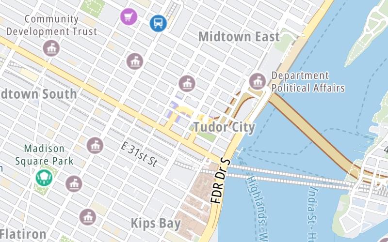
This Location At A Glance
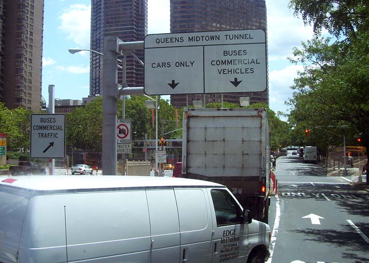
This junction is located in Manhattan. New York City is nearby. NOTE: Tunnel Approach St to United Nations.
This location is in the New York City - Northern New Jersey area.
This location's approximate GPS Coordinates are 40.74604 x -73.97475.
Which directions can I travel from here?
From this junction, traffic can only enter going eastbound. Traffic can only exit going westbound.
On to Queens / L.I.E., about 1.3 miles away ►
Nearby gas and food are shown on the interactive map below.
Weather & Visibility

Clear
32°F / 0°C
Feels Like
31°F / -0.6°C

Visibility
10 Mi / 16.1 Km
3 Hr Precip
0 In / 0.0 Cm

-
N Wind
4.5 Mi / 7.2 Km
Gusts
10.9 Mi / 17.6 Km
See the full forecast for This Location or the New York City - Northern New Jersey area
Conditions and forecasts provided in partnership with AccuWeather.

Weather provided in partnership with AccuWeather.
Available Cameras

60 Ft
85 Ft
259 Ft
589 Ft
596 Ft


 Bayonne Bridge ▹
 Goethals Bridge ▹
 Holland Tunnel ▹
 Garden State Parkway ▹
 George Washington Bridge ▹
 Lincoln Tunnel ▹
 New Jersey Turnpike ▹
 Outerbridge Crossing ▹
 Bronx Whitestone Bridge ▹
 Hugh L Carey Tunnel ▹
 Cross Westchester Expressway ▹
 Robert F Kennedy Bridge ▹
 Queens Midtown Tunnel ▹
 New England Thruway ▹
 New York State Thruway ▹
 Throgs Neck Bridge ▹
 Henry Hudson Bridge ▹
 Atlantic Beach Bridge ▹
 Marine Parkway Bridge ▹
 Connecticut Turnpike ▹
 Bear Mountain Bridge ▹
 Massachusetts Turnpike ▹
 Thousand Islands Bridge ▹
 Niagara Thruway ▹
 Peace Bridge ▹
 Rainbow Bridge ▹

 Pennsylvania Turnpike ▹
 Milford Montague Toll Bridge ▹
 Delaware Water Gap Toll Bridge ▹
 Portland Columbia Toll Bridge ▹
 Easton Phillipsburg Toll Bridge ▹
 I78 Toll Bridge ▹