This Location At A Glance
This junction is located in Highland.
This location is in the Catskills - Hudson Valley area.
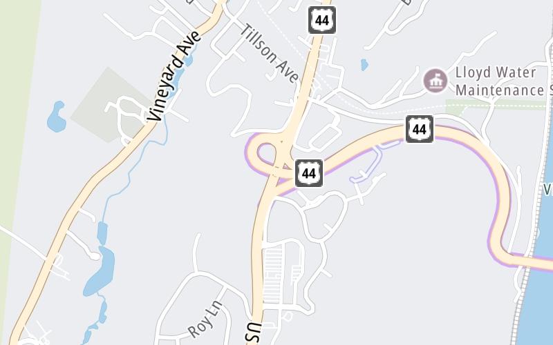
This location's approximate GPS Coordinates are 41.70755 x -73.96637.
Which directions can I travel from here?
From this junction, traffic can enter traveling both westbound and eastbound. Traffic can also exit traveling both westbound and eastbound.
On to US 9 / Church Street / East Side, about 1.7 miles away ►
Nearby gas and food are shown on the interactive map below.
Weather & Visibility

Cloudy
54°F / 12.2°C
Feels Like
57°F / 13.9°C

Visibility
10 Mi / 16.1 Km
3 Hr Precip
0 In / 0.0 Cm

-
N Wind
0 Mi / 0 Km
Gusts
0 Mi / 0 Km
See the full forecast for This Location or the Catskills - Hudson Valley area
Conditions and forecasts provided in partnership with AccuWeather.

Weather provided in partnership with AccuWeather.
Available Cameras
No camera feed …
There is no currently-available traffic camera feed for this location.


 Bayonne Bridge ▹
 Goethals Bridge ▹
 Holland Tunnel ▹
 Garden State Parkway ▹
 George Washington Bridge ▹
 Lincoln Tunnel ▹
 New Jersey Turnpike ▹
 Outerbridge Crossing ▹
 Bronx Whitestone Bridge ▹
 Hugh L Carey Tunnel ▹
 Cross Westchester Expressway ▹
 Robert F Kennedy Bridge ▹
 Queens Midtown Tunnel ▹
 New England Thruway ▹
 New York State Thruway ▹
 Throgs Neck Bridge ▹
 Henry Hudson Bridge ▹
 Atlantic Beach Bridge ▹
 Marine Parkway Bridge ▹
 Connecticut Turnpike ▹
 Bear Mountain Bridge ▹
 Massachusetts Turnpike ▹
 Thousand Islands Bridge ▹
 Niagara Thruway ▹
 Peace Bridge ▹
 Rainbow Bridge ▹

 Pennsylvania Turnpike ▹
 Milford Montague Toll Bridge ▹
 Delaware Water Gap Toll Bridge ▹
 Portland Columbia Toll Bridge ▹
 Easton Phillipsburg Toll Bridge ▹
 I78 Toll Bridge ▹


