Currently In The Richmond - State Capital Area
Conditions And Visibility
Local time is 1:35 am

Cloudy
68°F / 19.9°C
Feels Like
65°F / 18.2°C

Visibility
10 Mi / 16.1 Km
3 Hr Precip
0.03 In / 0.1 Cm

-
SW Wind
2.8 Mi / 4.4 Km
Gusts
5.8 Mi / 9.4 Km
Conditions and forecasts provided in partnership with AccuWeather.

Weather provided in partnership with AccuWeather.
12-Hour Travel Forecast
Local time is 1:35 am
Thursday - 2:00 am
Rain
68% Chance Rain
64° F/17.8° C
Feels Like:
60° F/15.6° C
Visibility
6 Mi/
9.7 Km
Dewpoint
60° F/
15.6° C
SSW Wind
6.9 Mi/
11.1 Km
Gusts
6.9 Mi/
11.1 Km
Thursday - 3:00 am
Rain
66% Chance Rain
62° F/16.7° C
Feels Like:
57° F/13.9° C
Visibility
6 Mi/
9.7 Km
Dewpoint
59° F/
15.0° C
NNW Wind
8.1 Mi/
13.0 Km
Gusts
9.2 Mi/
14.8 Km
Thursday - 4:00 am
Cloudy
49% Chance Rain
60° F/15.6° C
Feels Like:
56° F/13.3° C
Visibility
10 Mi/
16.1 Km
Dewpoint
58° F/
14.4° C
N Wind
9.2 Mi/
14.8 Km
Gusts
10.4 Mi/
16.7 Km
Thursday - 5:00 am
Rain
65% Chance Rain
58° F/14.4° C
Feels Like:
51° F/10.6° C
Visibility
6 Mi/
9.7 Km
Dewpoint
57° F/
13.9° C
N Wind
9.2 Mi/
14.8 Km
Gusts
10.4 Mi/
16.7 Km
Thursday - 6:00 am
Rain
65% Chance Rain
57° F/13.9° C
Feels Like:
50° F/10.0° C
Visibility
6 Mi/
9.7 Km
Dewpoint
55° F/
12.8° C
N Wind
8.1 Mi/
13.0 Km
Gusts
9.2 Mi/
14.8 Km
Thursday - 7:00 am
Cloudy
49% Chance Rain
55° F/12.8° C
Feels Like:
53° F/11.7° C
Visibility
10 Mi/
16.1 Km
Dewpoint
54° F/
12.2° C
N Wind
8.1 Mi/
13.0 Km
Gusts
8.1 Mi/
13.0 Km
Thursday - 8:00 am
Showers
61% Chance Rain
55° F/12.8° C
Feels Like:
44° F/6.7° C
Visibility
7.3 Mi/
11.7 Km
Dewpoint
53° F/
11.7° C
NNE Wind
16.1 Mi/
25.9 Km
Gusts
19.6 Mi/
31.5 Km
Thursday - 9:00 am
Cloudy
49% Chance Rain
55° F/12.8° C
Feels Like:
49° F/9.4° C
Visibility
10 Mi/
16.1 Km
Dewpoint
52° F/
11.1° C
NNE Wind
16.1 Mi/
25.9 Km
Gusts
18.4 Mi/
29.6 Km
Thursday - 10:00 am
Showers
61% Chance Rain
55° F/12.8° C
Feels Like:
46° F/7.8° C
Visibility
6 Mi/
9.7 Km
Dewpoint
51° F/
10.6° C
NNE Wind
16.1 Mi/
25.9 Km
Gusts
18.4 Mi/
29.6 Km
Thursday - 11:00 am
Cloudy
40% Chance Rain
56° F/13.3° C
Feels Like:
50° F/10.0° C
Visibility
10 Mi/
16.1 Km
Dewpoint
50° F/
10.0° C
NNE Wind
16.1 Mi/
25.9 Km
Gusts
19.6 Mi/
31.5 Km
Thursday - 12:00 pm
Cloudy
34% Chance Rain
56° F/13.3° C
Feels Like:
51° F/10.6° C
Visibility
10 Mi/
16.1 Km
Dewpoint
48° F/
8.9° C
NNE Wind
16.1 Mi/
25.9 Km
Gusts
20.7 Mi/
33.3 Km
Thursday - 1:00 pm
Cloudy
39% Chance Rain
56° F/13.3° C
Feels Like:
52° F/11.1° C
Visibility
10 Mi/
16.1 Km
Dewpoint
47° F/
8.3° C
NE Wind
15 Mi/
24.1 Km
Gusts
23 Mi/
37.0 Km
Conditions and forecasts provided in partnership with AccuWeather.
Weather provided in partnership with AccuWeather.
More Weather Options

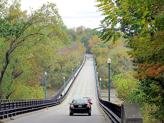
 Boulevard Bridge ▹
 Downtown Expressway ▹
 Pocahontas Parkway ▹
 Powhite Parkway ▹
 Chesapeake Bay Bridge Tunnel ▹
 Chesapeake Expressway ▹
 Downtown Tunnel ▹
 South Norfolk Jordan Bridge ▹
 Midtown Tunnel ▹
 Dominion Boulevard Veterans Bridge ▹
 Wm Preston Lane Jr Memorial Bridge ▹
 Intercounty Connector MD 200 ▹
 Dulles Greenway ▹
 PA Turnpike 66 ▹
 Beaver Valley Expressway ▹
 Mon Fayette Expressway ▹
 Pennsylvania Turnpike ▹
 Ohio Turnpike ▹
 PA Turnpike 576 ▹
 West Virginia Turnpike ▹


