Share

Pocahontas Parkway At Main Toll Plaza

Advertising
Advertising

This Location At A Glance

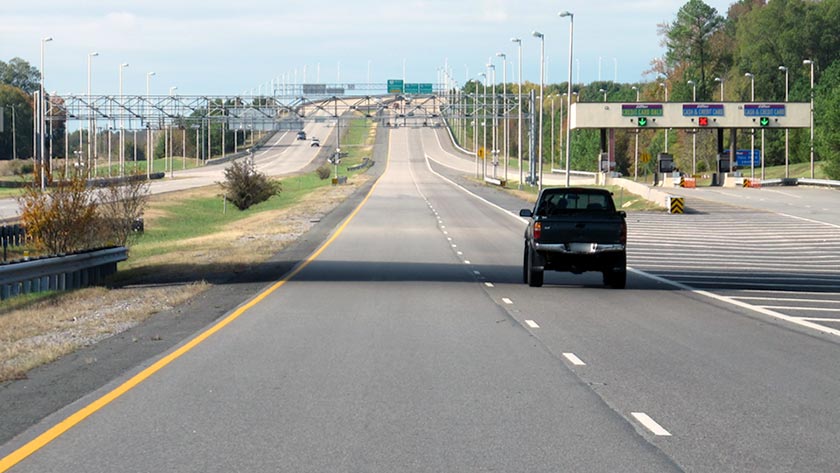
This toll point is located in Henrico. Richmond is nearby.

This location is in the Richmond - State Capital area.

Main Toll Plaza
Photo by Turnpikes.com

This location's approximate GPS Coordinates are 37.44572 x -77.40781.

Interactive Map Below


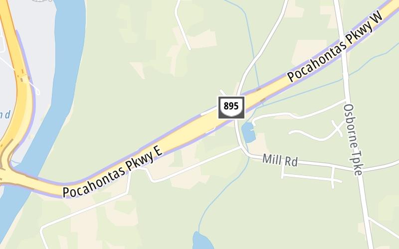
On to Laburnum Avenue / New Market Road, about 1.5 miles away ►

◄ Back to I-95 / VA 150, about 1.0 mile away.

Nearby gas and food are shown on the interactive map below.

View Map

Weather & Visibility

  • 21 6 06
  • Sunny

    90°F / 32.5°C

    Feels Like

    93°F / 33.9°C

  • Visibility

    17 Mi / 27.4 Km

    3 Hr Precip

    0 In / 0.0 Cm

  • NW Wind

    2.6 Mi / 4.3 Km

    Gusts

    4.4 Mi / 7.1 Km


Available Cameras

I-95 / MM 68.2 / NB

Camera direction: SOUTH. undetermined 23231.
Source: VDOT.

Camera direction: SOUTH. undetermined 23231.<br />Source: VDOT -

0.87 Mi

Camera direction: NORTH. Richmond 23234.<br />Source: VDOT -

0.99 Mi

Camera direction: SOUTH. Richmond 23234.<br />Source: VDOT -

1.23 Mi

Camera direction: SOUTH. Richmond 23234.<br />Source: VDOT -

1.55 Mi

Camera direction: SOUTH. undetermined 23237.<br />Source: VDOT -

1.63 Mi

Advertising

Main Toll Plaza on the Pocahontas Parkway

The map is interactive, and it also shows traffic cameras within about a two-mile radius. Not all locations have cameras.

Advertising

Discover Virginia Attractions

Hotels and destinations header

Hotels & Airports

Destination Travel

Advertising
Advertising

EXPLORE VIRGINIA

Journey to key destinations around and adjacent to Virginia!

Map Of This Region ▹

Communities in this metro area include Richmond, Meadowbrook, Manchester, and Brandermill.

Individual toll maps for this region are listed below.

Map Of This Region ▹

Communities in this metro area include Norfolk, Chesapeake, Virginia Beach, Newport News, Portsmouth, Suffolk, and Moyock, North Carolina.

Individual toll maps for this region are listed below.

Map Of This Region ▹

Communities in this metro area include Washington, Dc, Fairfax County, Virginia, Loundoun County, Virginia, Montgomery County, Maryland, and Prince George's County, Maryland.

Individual toll maps for this region are listed below.

Map Of This Region ▹

Communities in this metro area include Pittsburgh, Cranberry Township, Beaver Valley, New Castle, Washington, Uniontown, Cheat Lake, West Virginia, Boardman, Ohio, and Youngstown, Ohio.

Individual toll maps for this region are listed below.

Map Of This Region ▹

Communities in this metro area include Charleston, Malden, South Ruffner, and Snow Hill.

Individual toll maps for this region are listed below.

Map Of This Region ▹

Communities in this metro area include Beckley, Beaver, Mac Arthur, Daniels, and Shady Spring.

Individual toll maps for this region are listed below.

Static map of Pocahontas Parkway at Main Toll Plaza

Static map. Interactive map is above.

Advertising
Advertising
Turnpikes.com is proud to partner with the following:
Turnpikes.com vendor: AccuWeather

AccuWeather