Select markers to see a close-up map of that location The points-of-interest shown on this map are also listed below, ordered from south to north.

Wv Turnpike is another name used for this facility. This state toll road serves several key cities, including Charleston, Beckley, Camp Creek, Princeton, and Kanawha City.
This road traverses the Charleston - State Capital as well as the Beckley - Princeton areas.
A complete list of exits can be found below.
Accepted types of payment taken while on the road
Available when checked
The West Virginia Turnpike offers license-plate tolling for those without a compatible transponder.
For drivers with a transponder, the following passes can be used on the West Virginia Turnpike


Learn about transponders and accounts in West Virginia.
View MapToll CalculatorAll West Virginia Tolls
Our new toll and trip calculator is complete, but many roads' data are still being entered into our database. The legacy calculator remains active for current, accurate tolls.
Turnpikes.com has partnered with Tiqets.com to bring you these excusive deals on attractions!
The West Virginia Turnpike
Viewing an exit or other location opens a new map showing gas, EV charging, fast-food and other dining, plus weather and driving conditions.
Exit 9US 460 / to Welcome Center — Princeton
Note(s): Pictures here.
GPS 37.363157000 X -81.048024000
 West Virginia Parkways Authority manages this segment.
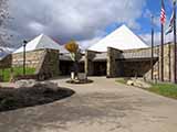
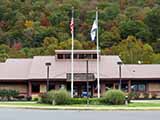
Princeton Welcome Center — Princeton
Note(s): Pictures here. West Virginia Tourist Information Center
GPS 37.362876000 X -81.045266000
Exit 14CR 7/Mercer Springs Road/Athens Rd — Princeton
Note(s): None.
GPS 37.425019000 X -81.066036000
West Virginia Parkways Authority manages this segment.
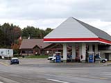
Bluestone Travel Plaza — Princeton
Note(s): Pictures here.
GPS 37.474604000 X -81.068110000
Exit 20US 19 — Spanishburg
Note(s): Pictures here. Camp Creek State Park
GPS 37.495796000 X -81.102710000
West Virginia Parkways Authority manages this segment.
Exit 28WV 48/Odd Road — Ghent
Note(s): None.
GPS 37.615265000 X -81.119435000
West Virginia Parkways Authority manages this segment.
Toll Plaza "A" — Ghent
Note(s): Pictures here. Ghent Tolls
GPS 37.631530000 X -81.111870000
West Virginia Parkways Authority manages this segment.
Exit 40I-64 East — Beaver
Note(s): Pictures here.
GPS 37.729429000 X -81.194361000
West Virginia Parkways Authority manages this segment.
Exit 42Robert C Byrd Drive/WV 16/WV 97 — Beckley
Note(s): Pictures here.
GPS 37.758641000 X -81.212749000
West Virginia Parkways Authority manages this segment.
Exit 44Harper Road/WV 3 — Beckley
Note(s): Pictures here.
GPS 37.792989000 X -81.216624000
West Virginia Parkways Authority manages this segment.
Exit 45Tamarack / Van Kirk Drive — Beckley
Note(s): Pictures here. Use this exit for Beckley Travel Plaza
GPS 37.810216000 X -81.212340000
West Virginia Parkways Authority manages this segment.
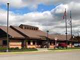
Beckley Travel Plaza — Beckley
Note(s): Pictures here. Use Exit 45 ramps
GPS 37.802185000 X -81.213231000
Exit 48US 19 — Mt Hope
Note(s): None.
GPS 37.835456000 X -81.215430000
West Virginia Parkways Authority manages this segment.
Exit 54CR 23/2 — Pax
Note(s): None.
GPS 37.916419000 X -81.269743000
West Virginia Parkways Authority manages this segment.
Toll Plaza "B" — Pax
Note(s): Pictures here. Pax Tolls
GPS 37.939819000 X -81.259579000
West Virginia Parkways Authority manages this segment.
Exit 60WV 612 — Mossy
Note(s): None.
GPS 37.973274000 X -81.284642000
West Virginia Parkways Authority manages this segment.
Exit 66CR 15 — Gallagher
Note(s): None.
GPS 38.029261000 X -81.357391000
West Virginia Parkways Authority manages this segment.
Morton Travel Plaza — Morton
Note(s): Pictures here.
GPS 38.102045000 X -81.383074000
Exit 74Paint Creek Road — Eskdale
Note(s): None.
GPS 38.129142000 X -81.388240000
West Virginia Parkways Authority manages this segment.
Exit 79CR 79/3 / Cabin Creek Road — Miami
Note(s): None.
GPS 38.158374000 X -81.445775000
West Virginia Parkways Authority manages this segment.
Toll Plaza "C" — Chelyan
Note(s): Pictures here. Chelyan Tolls
GPS 38.185992000 X -81.474728000
West Virginia Parkways Authority manages this segment.
Exit 85US 60 / WV 61 — Cabin Creek
Note(s): None.
GPS 38.193105000 X -81.500425000
West Virginia Parkways Authority manages this segment.
Exit 89WV 61 / WV 94 — Marmet
Note(s): None.
GPS 38.240633000 X -81.565282000
West Virginia Parkways Authority manages this segment.
Exit 95MacCorkle Avenue/WV 61 — Charleston
Note(s): None.
GPS 38.306954000 X -81.566345000
West Virginia Parkways Authority manages this segment.
Exit 96US 60/Kanawha Boulevard — Charleston
Note(s): None.
GPS 38.317514000 X -81.556790000
West Virginia Parkways Authority manages this segment.
Exit 9835th Street / Kaufman Mem Br — Charleston
Note(s): None.
GPS 38.335478000 X -81.598164000
West Virginia Parkways Authority manages this segment.
Exit 99Greenbrier Street/WV 114 / State Capitol — Charleston
Note(s): Pictures here.
GPS 38.341903000 X -81.612160000
West Virginia Parkways Authority manages this segment.
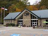
Exit 100Leon Sullivan Way / Brooks Street — Charleston
Note(s): Pictures here. Enter turnpike from Brooks Street
GPS 38.352622000 X -81.625232000
West Virginia Parkways Authority manages this segment.
Exit 101I77 North / I64 West / to I79 — Charleston
Note(s): None.
GPS 38.357596000 X -81.631851000
West Virginia Parkways Authority manages this segment.
Journey to key destinations around and adjacent to West Virginia!
Communities in this metro area include Charleston, Malden, South Ruffner, and Snow Hill.
Individual toll maps for this region are listed below.

Communities in this metro area include Beckley, Beaver, Mac Arthur, Daniels, and Shady Spring.
Individual toll maps for this region are listed below.

Communities in this metro area include Parkersburg, North Hills, Vienna, and Belpre, Ohio.
Individual toll maps for this region are listed below.

Communities in this metro area include Pittsburgh, Cranberry Township, Beaver Valley, New Castle, Washington, Uniontown, Cheat Lake, West Virginia, Boardman, Ohio, and Youngstown, Ohio.
Individual toll maps for this region are listed below.
 West Virginia Turnpike ▹
 Memorial Bridge ▹
 PA Turnpike 66 ▹
 Beaver Valley Expressway ▹
 Mon Fayette Expressway ▹
 Pennsylvania Turnpike ▹
 Ohio Turnpike ▹
 PA Turnpike 576 ▹


