Beckley - Princeton Toll Maps

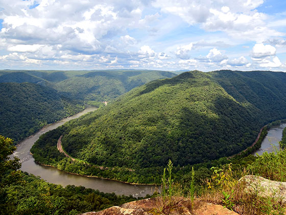
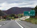
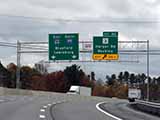
Regional photo of Beckley - Princeton

Using The Interactive Regional Map

The Beckley - Princeton metro area map shows exits and toll points for region-wide toll roads or other toll roads that cross the region.

View Map ▾Road List ▾

Only the following toll road is in this area:

The Beckley - Princeton area includes the following cities: Beckley, Beaver, Mac Arthur, Daniels, and Shady Spring.

Markers on the interactive map can be selected to get close-up views of exit points, toll gantries and other locations and points-of-interest. Each POI map shows all nearby dining, gas, EV charging, hotels and other services.

View Map ▾Road List ▾

A complete list of exits and other points-of-interest in the Beckley - Princeton area follows the map. Exit lists are sorted by toll road.

Advertising
Advertising

Regional Map For Beckley - Princeton

Pan and zoom as desired. Tap map markers for information and to view that specific location.

A complete list of exits and other points-of-interest is below this map, and other regions are shown further down the page.

Regional photo of Beckley - Princeton

Visiting In The Beckley - Princeton Area?

We have partnered with Hotels.com to help you get the best deal on hotels.

Find Hotels

Things to do around Beckley - Princeton

Things To Do While You're Here

We have partnered with Tiqets to bring you deals on dining and attractions.

Travel Suggestions

Advertising
Advertising

Regional Exits, Listed By Toll Road

A list of all exits and other points-of-interest in this region, sorted by toll road.

US 460 / to Welcome Center

Exit 9US 460 / to Welcome Center — Princeton

View Map & Info

▸ GPS 37.363157000 X -81.048024000

Princeton Welcome Center

Princeton Welcome Center — Princeton

View Map & Info

▸ GPS 37.362876000 X -81.045266000
NOTES: West Virginia Tourist Information Center

CR 7/Mercer Springs Road/Athens Rd

Exit 14CR 7/Mercer Springs Road/Athens Rd — Princeton

View Map & Info

▸ GPS 37.425019000 X -81.066036000
NOTES:

Bluestone Travel Plaza

Bluestone Travel Plaza — Princeton

View Map & Info

▸ GPS 37.474604000 X -81.068110000
NOTES:

US 19

Exit 20US 19 — Spanishburg

View Map & Info

▸ GPS 37.495796000 X -81.102710000
NOTES: Camp Creek State Park

WV 48/Odd Road

Exit 28WV 48/Odd Road — Ghent

View Map & Info

▸ GPS 37.615265000 X -81.119435000
NOTES:

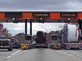
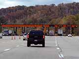
Toll Plaza

Toll Plaza "A" — Ghent

View Map & Info

▸ GPS 37.631530000 X -81.111870000
NOTES: Ghent Tolls

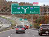
I-64 East

Exit 40I-64 East — Beaver

View Map & Info

▸ GPS 37.729429000 X -81.194361000
NOTES:

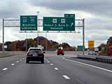
Robert C Byrd Drive/WV 16/WV 97

Exit 42Robert C Byrd Drive/WV 16/WV 97 — Beckley

View Map & Info

▸ GPS 37.758641000 X -81.212749000
NOTES:

Harper Road/WV 3

Exit 44Harper Road/WV 3 — Beckley

View Map & Info

▸ GPS 37.792989000 X -81.216624000
NOTES:

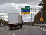
Tamarack / Van Kirk Drive

Exit 45Tamarack / Van Kirk Drive — Beckley

View Map & Info

▸ GPS 37.810216000 X -81.212340000
NOTES: Use this exit for Beckley Travel Plaza

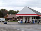
Beckley Travel Plaza

Beckley Travel Plaza — Beckley

View Map & Info

▸ GPS 37.802185000 X -81.213231000
NOTES: Use Exit 45 ramps

US 19

Exit 48US 19 — Mt Hope

View Map & Info

▸ GPS 37.835456000 X -81.215430000
NOTES:

CR 23/2

Exit 54CR 23/2 — Pax

View Map & Info

▸ GPS 37.916419000 X -81.269743000
NOTES:

Toll Plaza

Toll Plaza "B" — Pax

View Map & Info

▸ GPS 37.939819000 X -81.259579000
NOTES: Pax Tolls

WV 612

Exit 60WV 612 — Mossy

View Map & Info

▸ GPS 37.973274000 X -81.284642000
NOTES:

CR 15

Exit 66CR 15 — Gallagher

View Map & Info

▸ GPS 38.029261000 X -81.357391000
NOTES:

Advertising
Advertising

EXPLORE WEST VIRGINIA

Journey to key destinations around and adjacent to West Virginia!

Map Of This Region ▹

Communities in this metro area include Charleston, Malden, South Ruffner, and Snow Hill.

Individual toll maps for this region are listed below.

Map Of This Region ▹

Communities in this metro area include Beckley, Beaver, Mac Arthur, Daniels, and Shady Spring.

Individual toll maps for this region are listed below.

Map Of This Region ▹

Communities in this metro area include Parkersburg, North Hills, Vienna, and Belpre, Ohio.

Individual toll maps for this region are listed below.

Map Of This Region ▹

Communities in this metro area include Pittsburgh, Cranberry Township, Beaver Valley, New Castle, Washington, Uniontown, Cheat Lake, West Virginia, Boardman, Ohio, and Youngstown, Ohio.

Individual toll maps for this region are listed below.

Turnpikes.com is proud to partner with the following: