This Location At A Glance
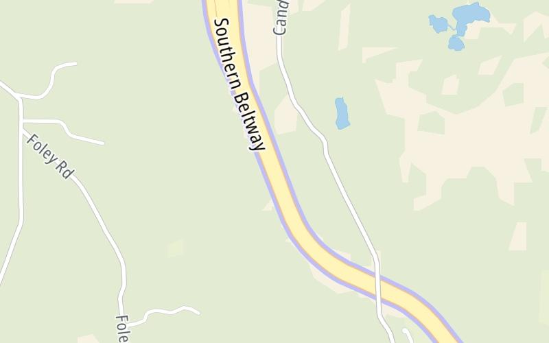
This toll point is located in Bulger. Robinson Township is nearby. NOTE: S7 Toll Point.
This location is in the Pittsburgh - Western Pennsylvania area.
This location's approximate GPS Coordinates are 40.41406 x -80.31483.
On to Beech Hollow Road, about 1.4 miles away ►
◄ Back to US 22 / William Penn Hwy, about 0.7 miles away.
Nearby gas and food are shown on the interactive map below.
Weather & Visibility

Clear
34°F / 1°C
Feels Like
36°F / 2.1°C

Visibility
10 Mi / 16.1 Km
3 Hr Precip
0 In / 0.0 Cm

-
WNW Wind
2.3 Mi / 3.6 Km
Gusts
4.8 Mi / 7.6 Km
See the full forecast for the Pittsburgh - Western Pennsylvania area
Conditions and forecasts provided in partnership with AccuWeather.

Weather provided in partnership with AccuWeather.
Available Cameras
No camera feed …
There is no currently-available traffic camera feed for this location.


 PA Turnpike 66 ▹
 Beaver Valley Expressway ▹
 Mon Fayette Expressway ▹
 Pennsylvania Turnpike ▹
 Ohio Turnpike ▹
 PA Turnpike 576 ▹

 Delaware Memorial Bridge ▹
 Delaware Turnpike ▹
 Atlantic City Expressway ▹
 New Jersey Turnpike ▹
 Benjamin Franklin Bridge ▹
 Walt Whitman Bridge ▹
 Commodore Barry Bridge ▹
 Betsy Ross Bridge ▹
 Scudder Falls Toll Bridge ▹
 Trenton Morrisville Toll Bridge ▹
 Tacony Palmyra Bridge ▹
 Burlington Bristol Bridge ▹
 Milford Montague Toll Bridge ▹
 Delaware Water Gap Toll Bridge ▹
 Portland Columbia Toll Bridge ▹
 Easton Phillipsburg Toll Bridge ▹
 I78 Toll Bridge ▹
 Garden State Parkway ▹
 New Hope Lambertville Toll Bridge ▹