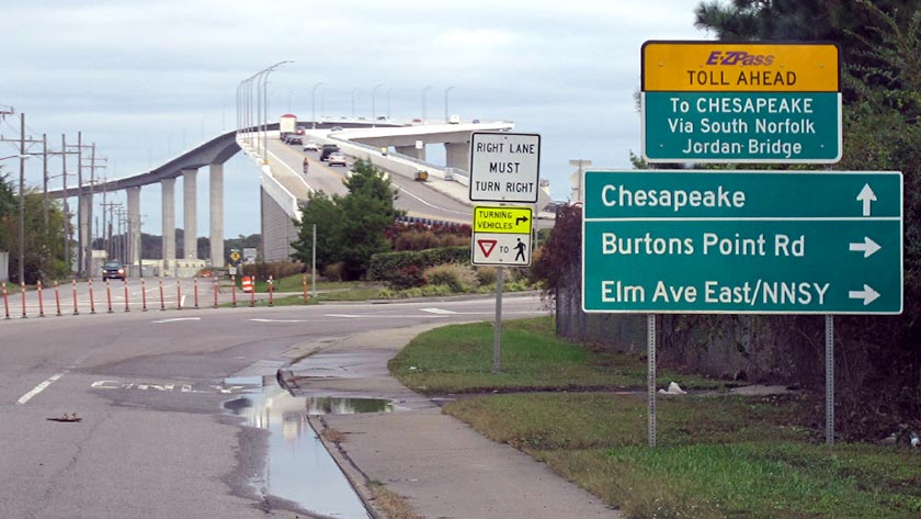
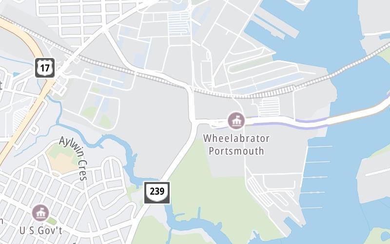
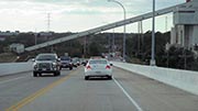
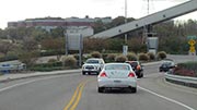
This junction is located in Portsmouth. Chesapeake is nearby.
This location is in the Norfolk - Chesapeake area.
This location's approximate GPS Coordinates are 36.80779 x -76.30393.
Which directions can I travel from here?
From this junction, traffic can only enter going eastbound. Traffic can only exit going westbound.
On to Poindexter Street / I–464, about 1.3 miles away ►
Which direction are tolls charged here?
Tolls are not charged or collected at this junction.
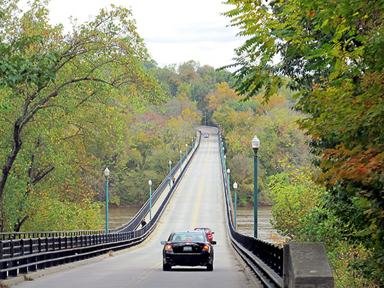
Above: Photo by Turnpikes.comThe interactive map and lists on this page include key traveler services within two miles of this destination point.
You will find common services, including gas stations, truck stops, EV charging facilities, fast-food or family restaurants, and hotels. These are displayed on the interactive map as markers, which you can select for more information.
Current driving conditions and weather, along with a more complete list of key services, may be found below the map.
The interactive map shows dining and services near your chosen location: Victory Boulevard / VA 337 and the South Norfolk Jordan Bridge. A detailed summary of food and services around here is shown after the map.
Pan and zoom the map as you desire, and select markers for information and other options, including online ordering, where available.
Rain
38°F / 3.5°C
Feels Like:
36°F / 2°C
Visibility
4 Mi / 6.4 Km
3-Hour Precip:
0.26 In / 0.7 Cm
North Northeast
Winds (NNE)
4.4 MPH / 7 KPH
Gusts:
8.9 MPH / 14.3 KPH
▸ Get the full forecast for This Location | The Norfolk - Chesapeake area
Closest Gas Stations
MIKES CORNER STORE
48 Afton Parkway • 0.89 miles
Store/Fuel Brand: Corner Store
CRADDOCK BP
4113 George Washington Highway • 0.97 miles
Store/Fuel Brand: BP
GW MARKET
4100 George Washington Highway • 0.99 miles
Store/Fuel Brand: Citgo
VICKIES CONVENIENCE AND DELI
1428 Effingham Street • 1.41 miles
Store/Fuel Brand: Citgo
Closest EV Chargers
No EV charging stations nearby.
Closest Fast Food
Fast food refers ONLY to quick-service and take-out diners. All restaurant types are shown on the map below.
POPEYES
3718 George Washington Highway • 0.80 miles
M RAES CHICKEN & SEAFOOD
4113 George Washington Highway • 0.97 miles
BURGER KING
4210 George Washington Highway • 1.04 miles
ARBY'S
4900 George Washington Highway • 1.50 miles
MCDONALD'S
2000 Victory Boulevard • 1.57 miles
WENDY'S
5001 George Washington Highway • 1.58 miles
LITTLE CAESARS
2032 Victory Boulevard • 1.62 miles
TACO BELL
5004 George Washington Highway • 1.63 miles
Select/Tap Vendors For Info
Vendors within about two miles of Victory Boulevard / VA 337 and the South Norfolk Jordan Bridge are listed, sorted by distance, with the closest displayed on top. Select/tap the vendor name to show address, phone numbers and available URLs for gas stations, EV charging stations and fast-food dining. Links will open in a new window. Turnpikes.com is not responsible for third-party website content.
MIKES CORNER STORE
• 0.89 miles
CRADDOCK BP
• 0.97 miles
GW MARKET
• 0.99 miles
VICKIES CONVENIENCE AND DELI
• 1.41 miles
KANGS BP
• 1.42 miles
CITGO PETROLEUM CORPORATION
• 1.44 miles
SAMS STOP N SHOP
• 1.49 miles
SHELL
• 1.67 miles
No EV charging stations nearby.
This list only includes quick-service and take-out restaurants. All nearby restaurants are shown on the map above.
POPEYES
• 0.80 miles
M RAES CHICKEN & SEAFOOD
• 0.97 miles
BURGER KING
• 1.04 miles
ARBY'S
• 1.50 miles
MCDONALD'S
• 1.57 miles
WENDY'S
• 1.58 miles
LITTLE CAESARS
• 1.62 miles
TACO BELL
• 1.63 miles
KFC
• 1.63 miles
Journey to key destinations around and adjacent to Virginia!
Communities in this metro area include Richmond, Meadowbrook, Manchester, and Brandermill.
Individual toll maps for this region are listed below.
Communities in this metro area include Norfolk, Chesapeake, Virginia Beach, Newport News, Portsmouth, Suffolk, and Moyock, North Carolina.
Individual toll maps for this region are listed below.
Communities in this metro area include Washington, Dc, Fairfax County, Virginia, Loundoun County, Virginia, Montgomery County, Maryland, and Prince George's County, Maryland.
Individual toll maps for this region are listed below.
Communities in this metro area include Pittsburgh, Cranberry Township, Beaver Valley, New Castle, Washington, Uniontown, Cheat Lake, West Virginia, Boardman, Ohio, and Youngstown, Ohio.
Individual toll maps for this region are listed below.
Communities in this metro area include Charleston, Malden, South Ruffner, and Snow Hill.
Individual toll maps for this region are listed below.
Communities in this metro area include Beckley, Beaver, Mac Arthur, Daniels, and Shady Spring.
Individual toll maps for this region are listed below.