Share

Chesapeake Expressway At Hanbury Road West/East

Advertising
Advertising

About This Location

Hanbury Road West/East
Photo by Turnpikes.com

At A Glance

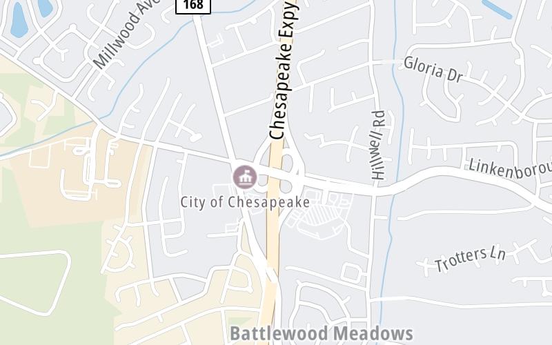
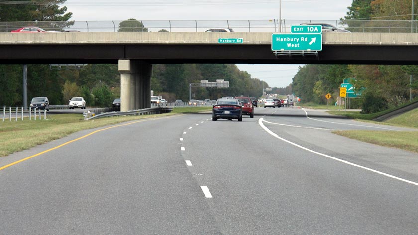
This is Exit 10A/10B of the Chesapeake Expressway.

This junction is located in Chesapeake. NOTE: SB On Use Battlefield Blvd.

This location is in the Norfolk - Chesapeake area.

Interactive Map Below

This location's approximate GPS Coordinates are 36.68853 x -76.22807.

Which directions can I travel from here?

From this junction, traffic can enter traveling both southbound and northbound. Traffic can also exit traveling both southbound and northbound.

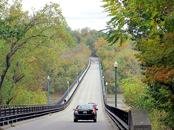
On to Mt Pleasant Road, about 1.3 miles away ►

◄ Back to Hillcrest Parkway, about 2.1 miles away.

Which direction are tolls charged here?

Tolls are not charged or collected at this junction.

View Map Travel Conditions

Closest Food, Gas, EV And Other Services Near Hanbury Road West/East

Use the map below for all services within about a two (2) mile radius.

Fuel, EV and convenience store header

Gas & EV Charging

Closest Gas Stations

7-Eleven

7-ELEVEN

225 Hanbury Road East • 1,357 feet

Store/Fuel Brand: 7-Eleven

Marathon

MARATHON

600 Battlefield Boulevard South • 1.14 miles

Store/Fuel Brand: Marathon

BP

BP

1040 Battlefield Boulevard South • 932 feet

Store/Fuel Brand: BP

View Map

Closest EV Chargers

View Map

No EV charging stations nearby.

Coffee, snacks and dining header

Fast Food & Beverage

Closest Fast Food

Fast food refers ONLY to quick-service and take-out diners. All restaurant types are shown on the map below.

POLLARD'S CHICKEN

717 Battlefield Boulevard South • 0.91 miles

Jimmy John's

JIMMY JOHN'S

601 Battlefield Boulevard South • 1.17 miles

Marco's Pizza

MARCO'S PIZZA

524 Battlefield Boulevard South • 1.27 miles

Domino's

DOMINO'S

450 Battlefield Boulevard South • 1.36 miles

McDonald's

MCDONALD'S

400 Battlefield Boulevard South • 1.58 miles

AMAZING GLAZED

321 Johnstown Road • 1.69 miles

View Map

Advertising
Advertising

Interactive POI Map

The interactive map and lists on this page include key traveler services in a two-mile radius, including gas stations, truck stops, EV charging facilities, fast-food or family restaurants, and hotels.

Current driving conditions and weather, may be found below.

Advertising
Advertising

Travel Conditions At Hanbury Road West/East

Current Weather And Visibility

  • 21 7 12
  • Mostly Sunny

    43°F / 6.3°C

    Feels Like:

    47°F / 8.1°C

  • Visibility

    10 Mi / 16.1 Km

    3-Hour Precip:

    0 In / 0.0 Cm

  • Northeast
    Winds (NE)

    2.2 MPH / 3.5 KPH

    Gusts:

    3.9 MPH / 6.3 KPH

▸ Get the full forecast for This Location | The Norfolk - Chesapeake area

Available Cameras

BATTLEFIELD BLVD @ KEMPSVILLE RD

Camera direction: SOUTH. Hampton Roads 23320.
Source: VDOT.

Camera direction: SOUTH. Hampton Roads 23320.<br />Source: VDOT -

3.21 Mi

Camera direction: SOUTH. Hampton Roads 23320.<br />Source: VDOT -

3.88 Mi

Advertising
Advertising

Pictures At Hanbury Road West/East

Sign and ramp marker for northbound drivers approaching Exit 10A, to Hanbury Road West. Photo taken October 28, 2019.  Photo taken 10-28-2019

Photo taken 10-28-2019
Advertising
Advertising

Discover Virginia Attractions

Hotels and destinations header

Hotels & Airports

Destination Travel

Advertising
Advertising

EXPLORE VIRGINIA

Journey to key destinations around and adjacent to Virginia!

Map Of This Region ▹

Communities in this metro area include Richmond, Meadowbrook, Manchester, and Brandermill.

Individual toll maps for this region are listed below.

Map Of This Region ▹

Communities in this metro area include Norfolk, Chesapeake, Virginia Beach, Newport News, Portsmouth, Suffolk, and Moyock, North Carolina.

Individual toll maps for this region are listed below.

Map Of This Region ▹

Communities in this metro area include Washington, Dc, Fairfax County, Virginia, Loundoun County, Virginia, Montgomery County, Maryland, and Prince George's County, Maryland.

Individual toll maps for this region are listed below.

Map Of This Region ▹

Communities in this metro area include Pittsburgh, Cranberry Township, Beaver Valley, New Castle, Washington, Uniontown, Cheat Lake, West Virginia, Boardman, Ohio, and Youngstown, Ohio.

Individual toll maps for this region are listed below.

Map Of This Region ▹

Communities in this metro area include Charleston, Malden, South Ruffner, and Snow Hill.

Individual toll maps for this region are listed below.

Map Of This Region ▹

Communities in this metro area include Beckley, Beaver, Mac Arthur, Daniels, and Shady Spring.

Individual toll maps for this region are listed below.

Static map of Chesapeake Expressway at Hanbury Road West/East

Static map. Interactive map is above.

Advertising
Advertising
Turnpikes.com is proud to partner with the following: