This Location At A Glance
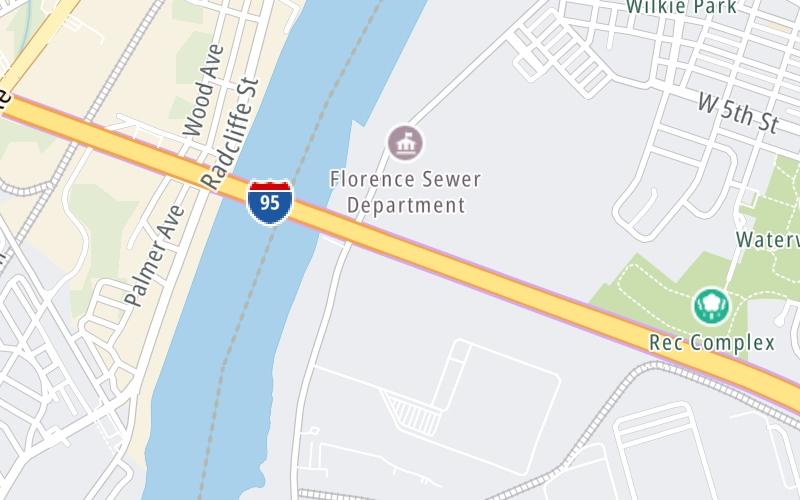
This junction is located in Burlington. Florence is nearby. NOTE: to Pennsylvania Turnpike.
This location is in the South Jersey - Philadelphia area; it also overlaps with the Philadelphia - Wilmington - South Jersey area.
This location's approximate GPS Coordinates are 40.11550 x -74.82520.
Which directions can I travel from here?
From this junction, traffic can enter traveling both southbound and northbound. Traffic can also exit traveling both southbound and northbound.
On to Bordentown, about 5.7 miles away ►
◄ Back to US 130, about 2.4 miles away.
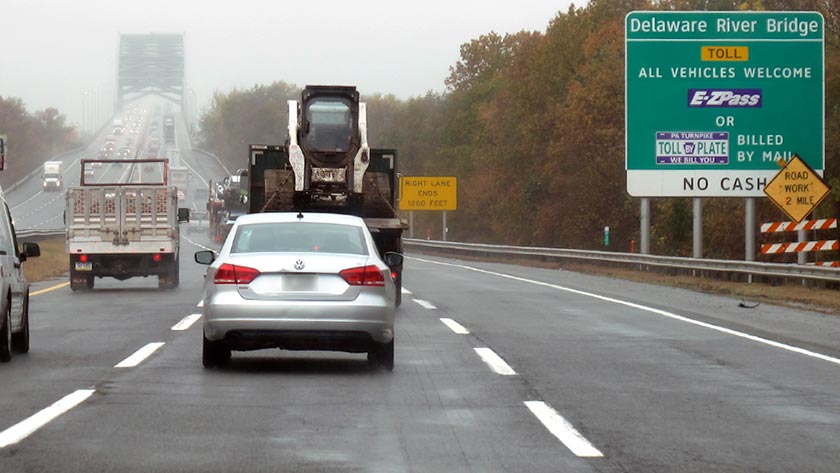
This location also connects with Pennsylvania.
▹ The New Jersey Turnpike and the Pennsylvania Turnpike connect here.
Nearby gas and food are shown on the interactive map below.
Weather & Visibility

Cloudy
66°F / 18.9°C
Feels Like
69°F / 20.6°C

Visibility
13 Mi / 20.9 Km
3 Hr Precip
0 In / 0.0 Cm

-
SW Wind
5.1 Mi / 8.3 Km
Gusts
11.4 Mi / 18.3 Km
See the full forecast for This Location or the South Jersey - Philadelphia area
Conditions and forecasts provided in partnership with AccuWeather.

Weather provided in partnership with AccuWeather.
Available Cameras

1.94 Mi
2.08 Mi
2.79 Mi
3.10 Mi


 Delaware Memorial Bridge ▹
 Atlantic City Expressway ▹
 Garden State Parkway ▹
 New Jersey Turnpike ▹
 Pennsylvania Turnpike ▹
 Benjamin Franklin Bridge ▹
 Walt Whitman Bridge ▹
 Commodore Barry Bridge ▹
 Betsy Ross Bridge ▹
 Scudder Falls Toll Bridge ▹
 Trenton Morrisville Toll Bridge ▹
 Tacony Palmyra Bridge ▹
 Burlington Bristol Bridge ▹
 Middle Thorofare Bridge ▹
 Grassy Sound Bridge ▹
 Ocean City Longport Bridge ▹
 Milford Montague Toll Bridge ▹
 Delaware Water Gap Toll Bridge ▹
 Portland Columbia Toll Bridge ▹
 Easton Phillipsburg Toll Bridge ▹
 I78 Toll Bridge ▹
 New Hope Lambertville Toll Bridge ▹
 Delaware Turnpike ▹
 State Route 1 ▹
 US 301 ▹
 John F Kennedy Memorial Highway ▹
 Bayonne Bridge ▹
 Goethals Bridge ▹
 Holland Tunnel ▹
 George Washington Bridge ▹
 Lincoln Tunnel ▹
 Outerbridge Crossing ▹
 Bronx Whitestone Bridge ▹
 Hugh L Carey Tunnel ▹
 Cross Westchester Expressway ▹
 Robert F Kennedy Bridge ▹
 Queens Midtown Tunnel ▹
 New England Thruway ▹
 New York State Thruway ▹
 Henry Hudson Bridge ▹
 Atlantic Beach Bridge ▹
 Marine Parkway Bridge ▹
 Connecticut Turnpike ▹