Tampa Traffic And Weather

Static map of Interstate 75 at SR 582 / Fowler Ave.

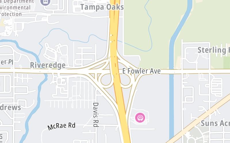
Right Now At SR 582 / Fowler Ave. and Interstate 75

Current Weather And Visibility

12:22 am Local Time

  • 00 6 05
  • Mostly Cloudy

    75°F / 23.6°C

    Feels Like:

    74°F / 23.5°C

  • Visibility

    10 Mi / 16.1 Km

    3-Hour Precip:

    0 In / 0.0 Cm

  • North Northeast
    Winds (NNE)

    1.7 MPH / 2.8 KPH

    Gusts:

    4.2 MPH / 6.7 KPH

Conditions and forecasts provided in partnership with AccuWeather.

AccuWeather logo

Weather provided in partnership with AccuWeather.

AccuWeather logo

Forecast weather and driving conditions follow the jump. These include an hour-by-hour forecast for the next 12-hours, a three-day forecast and an extended forecast, for extended travel planning.

An area traffic map, with available traffic cameras, shows driving conditions, from current traffic to mother nature's influence on the road. These follow the short-range forecasts below.

Driving Forecast Traffic Map

Advertising
Advertising

Driving Forecast For Tampa, At SR 582 / Fowler Ave.

Next 12 Hours

12:22 am Local Time

Conditions and forecasts provided in partnership with AccuWeather.

AccuWeather logo

Weather provided in partnership with AccuWeather.

AccuWeather logo

Available Cameras

No camera feed …

There is no currently-available traffic camera feed for this location.

Next Three (3) Days

Friday May 2

Friday forecast: Partly sunny and warm

Partly Sunny

4% Chance Rain

88° F/31.1° C

ENE Wind

5 to 14 Mi/

7 to 22 Km

Sunrise

6:49 AM

Friday night: Partly sunny and warm

Mostly Cloudy

4% Chance Rain

68° F/20.0° C

E Wind

7 to 15 Mi/

11 to 24 Km

Sunset

8:05 PM

Saturday May 3

Saturday forecast: Warm with periods of clouds and sunshine; a thunderstorm in spots in the afternoon

Partly Sunny W/ T-storms

40% Chance Rain

90° F/32.2° C

SSW Wind

8 to 22 Mi/

13 to 35 Km

Sunrise

6:48 AM

Saturday night: Warm with periods of clouds and sunshine; a thunderstorm in spots in the afternoon

Mostly Cloudy

10% Chance Rain

69° F/20.6° C

S Wind

6 to 17 Mi/

9 to 28 Km

Sunset

8:05 PM

Sunday May 4

Sunday forecast: Mostly cloudy with widely separated thunderstorms in the afternoon

Thunderstorms

42% Chance Rain

86° F/30.0° C

SW Wind

9 to 25 Mi/

15 to 41 Km

Sunrise

6:47 AM

Sunday night: Mostly cloudy with widely separated thunderstorms in the afternoon

Intermittent Clouds

25% Chance Rain

68° F/20.0° C

N Wind

4 to 18 Mi/

6 to 30 Km

Sunset

8:06 PM

Advertising
Advertising

Area Traffic Map

This junction is located in Tampa, at GPS 28.05422 x -82.35363. This location is in the Tampa Bay - West Central Florida area.

You can pan and zoom the interactive map. Select cameras to see the on-road traffic feeds, and pick exits or other markers for conditions at those locations.

Advertising
Advertising

Extended Forecast For Tampa, At SR 582 / Fowler Ave.

Ten (10) Day Travel Planner

Go Online Before You Go On The Road!®

Conditions and forecasts provided in partnership with AccuWeather.

AccuWeather logo

Weather provided in partnership with AccuWeather.

AccuWeather logo
Advertising
Advertising

EXPLORE FLORIDA

Journey to key destinations around and adjacent to Florida!

Map Of This Region ▹

Communities in this metro area include Destin, Pensacola Beach, Pensacola, Niceville, and Gulf Breeze.

Individual toll maps for this region are listed below.

Map Of This Region ▹

Communities in this metro area include Jacksonville and Middleburg.

Individual toll maps for this region are listed below.

Map Of This Region ▹

Communities in this metro area include Apopka, Cocoa, Kissimmee, Lake Buena Vista, Orlando, Saint Cloud, Sanford, Titusville, Melbourne, Poinciana, and Mount Dora.

Individual toll maps for this region are listed below.

Map Of This Region ▹

Communities in this metro area include Bradenton, Brandon, Saint Petersburg, Spring Hill, and Tampa.

Individual toll maps for this region are listed below.

Map Of This Region ▹

Communities in this metro area include Fort Pierce, Port Saint Lucie, Stuart, and Vero Beach.

Individual toll maps for this region are listed below.

Map Of This Region ▹

Communities in this metro area include Fort Lauderdale, Pompano Beach, Hialeah, Opa Locka, Homestead, Kendall, Key Largo, Miramar, Miami, Hollywood, Sunrise, Boca Raton, Delray Beach, West Palm Beach, Jupiter, Davie, Coral Springs, Lake Worth, and Boynton Beach.

Individual toll maps for this region are listed below.

Map Of This Region ▹

Communities in this metro area include Fort Myers, Naples, and Cape Coral.

Individual toll maps for this region are listed below.

Map Of This Region ▹

Communities in this metro area include Tallahassee, Quincy, Midway, and Fort Braden.

Individual toll maps for this region are listed below.

tallahassee-state capital

Roads Within Region

Map Of This Region ▹

Map Of This Region ▹

Communities in this metro area include Mobile, Daphne, Dauphin Island, Chickasaw, and Spanish Fort.

Individual toll maps for this region are listed below.

beaches-gulf coast

Roads Within Region

Map Of This Region ▹

Advertising
Advertising
Turnpikes.com is proud to partner with the following: