Suncoast Parkway/Veterans Expy Map

Advertising
Advertising

Exits Map For The Suncoast Parkway/Veterans Expy

This map of the Suncoast Parkway/Veterans Expy displays markers for exits and tolling points, which you can select to get a close-up map of that point of interest or location.

The points-of-interest shown on this map are also listed below, ordered from south to north.

See below for more comprehensive information about the Suncoast Parkway/Veterans Expy

Advertising
Advertising
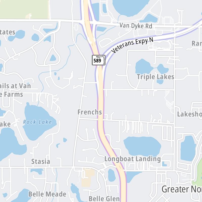
Static map a segment of the Suncoast Parkway/Veterans Expy

A Quick Look At The Suncoast Parkway/Veterans Expy

Veterans Expressway and SR 589 are other names for this roadway. This regional toll road serves several key cities, including Tampa,land O' and Lakes,spring Hill,crystal River,.

The static map seen here shows a segment of The Suncoast Parkway/Veterans Expy at Dale Mabry Highway (Spur). The entirety of The Suncoast Parkway/Veterans Expy can be seen in the fully-interactive map above, which includes linked markers. You may resize and reposition the interactive map to orient the road in relation to other landmarks.

There is also a complete list of exits below.

View Map Exit / POI List

Latest Travel Alert

CONSTRUCTION - Suncoast Parkway/Veterans Expy

Friday May 12, 2023 — Monday November 30, 2026

Between mile markers 68.0 and 71.5: The Suncoast Parkway (SR 589) is being extended from SR 44 north to County Road 486. Full details below

Impacted area(s):

See all travel alerts

Advertising
Advertising

What Does It Cost To Use The Suncoast Parkway/Veterans Expy?

Tolls For Cars, SUVs, Pickups, etc.

▹ Toll as of July 1, 2023.

This data is coming soon.

Transponders You Can Use

For drivers paying with a transponder, the following passes will work on the Suncoast Parkway/Veterans Expy

  • sunpass pro
  • sunpass
  • epass
  • epass xtra
  • e-zpass
  • i-pass
  • peach pass
  • quick pass
  • uni
  • k-tag
  • pikepass
  • tolltag
  • eztag

Learn about transponders and accounts in Florida.

View MapAll Tolls / Calculator ▸

Our new toll and trip calculator is being constructed. For most roads, you can still use the legacy calculator for current, accurate tolls.

Discover Florida Attractions

Turnpikes.com has partnered with Tiqets.com to bring you these excusive deals on attractions!

Advertising
Advertising

Suncoast Parkway/Veterans Expy Travel Alerts

CONSTRUCTION - Suncoast Parkway/Veterans Expy - More Project Detail

Friday May 12, 2023 — Monday November 30, 2026

Between mile markers 68.0 and 71.5: The Suncoast Parkway (SR 589) is being extended from SR 44 north to County Road 486.

Impacted area(s):


CONSTRUCTION - Suncoast Parkway/Veterans Expy

Friday May 12, 2023 — Monday November 30, 2026

At and around mile marker 68.3: Intermittent lane closures during off-peak daytime hours on SR 44 at SR 589 (Suncoast Parkway). The Suncoast Parkway (SR 589) is being extended from SR 44 north to County Road 486.

Impacted area(s):


CONSTRUCTION - Suncoast Parkway/Veterans Expy

Now — Thursday July 31, 2025

Between mile markers 2.5 and 12.5: New emergency stopping sites along the Veterans Expressway segment of SR 589 in Tampa. Road work includes widening or resurfacing existing pavement.

Impacted area(s):


Exit/POI List For The Suncoast Parkway/Veterans Expy

Selecting an exit or other location opens a separate map with locations of available gas, EV charging, fast-food and other dining options. Current weather and driving conditions will also be shown.

I–275 / SR 60 / Kennedy Blvd — Tampa

Note(s): Pictures here. Roadway is called Veterans Expressway here.

GPS 27.947756000 X -82.531298000

THEA Tampa Hillsborough Expressway Authority manages this segment.

View Map & Info

Exit 1Spruce Street / Tampa Int'l Airport/TPA — Tampa

Note(s): Pictures here. Roadway is called Veterans Expressway here.

GPS 27.953889000 X -82.535514000

THEA Tampa Hillsborough Expressway Authority manages this segment.

View Map & Info

Exit 1AGeorge Bean Pkwy / Tampa Int'l Airport/TPA — Tampa

Note(s): Roadway is called Veterans Expressway here.

GPS 27.959474000 X -82.544207000

THEA Tampa Hillsborough Expressway Authority manages this segment.

View Map & Info

Exit 1BSpruce Street / Raymond James Stadium — Tampa

Note(s): Roadway is called Veterans Expressway here.

GPS 27.961385000 X -82.546164000

THEA Tampa Hillsborough Expressway Authority manages this segment.

View Map & Info

Exit 2ASR 60 / Courtney Campbell Causeway — Tampa

Note(s): Pictures here. Roadway is called Veterans Expressway here.

GPS 27.962410000 X -82.546298000

THEA Tampa Hillsborough Expressway Authority manages this segment.

View Map & Info

Exit 2BIndependence Parkway — Tampa

Note(s): Roadway is called Veterans Expressway here.

GPS 27.971579000 X -82.546500000

THEA Tampa Hillsborough Expressway Authority manages this segment.

View Map & Info

Exit 3Memorial Highway / Eisenhower Boulevard — Tampa

Note(s): Pictures here. Roadway is called Veterans Expressway here. To TPA Air Cargo terminal

GPS 27.981740000 X -82.546288000

THEA Tampa Hillsborough Expressway Authority manages this segment.

View Map & Info

Exit 4Hillsborough Avenue — Tampa

Note(s): Pictures here. Roadway is called Veterans Expressway here.

GPS 27.996332000 X -82.545816000

THEA Tampa Hillsborough Expressway Authority manages this segment.

View Map & Info

Exit 6AWaters Avenue — Tampa

Note(s): Pictures here. Roadway is called Veterans Expressway here.

GPS 28.025664000 X -82.544240000

THEA Tampa Hillsborough Expressway Authority manages this segment.

View Map & Info

Exit 6BAnderson Road — Tampa

Note(s): Pictures here. Roadway is called Veterans Expressway here.

GPS 28.034321000 X -82.544784000

THEA Tampa Hillsborough Expressway Authority manages this segment.

View Map & Info

Anderson Toll Plaza — Tampa

Note(s): Pictures here. Roadway is called Veterans Expressway here. Now an overhead toll gantry just south of Linebaugh Avenue

GPS 28.037752000 X -82.553243000

THEA Tampa Hillsborough Expressway Authority manages this segment.

View Map & Info

Exit 7Linebaugh Avenue — Tampa

Note(s): Pictures here. Roadway is called Veterans Expressway here.

GPS 28.040399000 X -82.558714000

THEA Tampa Hillsborough Expressway Authority manages this segment.

View Map & Info

Exit 8Wilsky Blvd / to Linebaugh Avenue — Tampa

Note(s): Pictures here. Roadway is called Veterans Expressway here. Access to Linebaugh, via Wilsky, for SB drivers; Access to NB SR 589, via Wilsky, for drivers on Linebaugh.

GPS 28.046002000 X -82.565709000

THEA Tampa Hillsborough Expressway Authority manages this segment.

View Map & Info

Exit 9Gunn Highway — Tampa

Note(s): Pictures here. Roadway is called Veterans Expressway here.

GPS 28.065877000 X -82.567310000

THEA Tampa Hillsborough Expressway Authority manages this segment.

View Map & Info

Exit 10Ehrlich Road — Tampa

Note(s): Pictures here. Roadway is called Veterans Expressway here.

GPS 28.078648000 X -82.562175000

THEA Tampa Hillsborough Expressway Authority manages this segment.

View Map & Info

Sugarwood Toll Plaza — Tampa

Note(s): Pictures here. Roadway is called Veterans Expressway here. Plaza is automated toll gantry over highway.

GPS 28.086007000 X -82.552467000

THEA Tampa Hillsborough Expressway Authority manages this segment.

View Map & Info

Exit 12Hutchinson Road — Tampa

Note(s): Pictures here. Roadway is called Veterans Expressway here.

GPS 28.097551000 X -82.542661000

THEA Tampa Hillsborough Expressway Authority manages this segment.

View Map & Info

Exit 13Dale Mabry Highway (Spur) — Tampa

Note(s): Pictures here. SB On/NB Off

GPS 28.116704000 X -82.545926000

FTE Florida's Turnpike Enterprise manages this segment.

View Map & Info

Exit 14Van Dyke Road — Tampa

Note(s): Pictures here.

GPS 28.128555000 X -82.548296000

FTE Florida's Turnpike Enterprise manages this segment.

View Map & Info

Exit 16Lutz Lake Fern Road — Lutz

Note(s): Pictures here.

GPS 28.156018000 X -82.537663000

FTE Florida's Turnpike Enterprise manages this segment.

View Map & Info

Exit 19SR 54 — Lutz

Note(s): Pictures here.

GPS 28.189595000 X -82.543905000

FTE Florida's Turnpike Enterprise manages this segment.

View Map & Info

Anclote Toll Gantry — Land O Lakes

Note(s): Pictures here. Gantry has replaced plaza.

GPS 28.254217000 X -82.549905000

FTE Florida's Turnpike Enterprise manages this segment.

View Map & Info

Exit 25Ridge Road — River Ridge

Note(s): Pictures here.

GPS 28.282266000 X -82.550411000

FTE Florida's Turnpike Enterprise manages this segment.

View Map & Info

Exit 27SR 52 — Dade City

Note(s): Pictures here. To Werner-Boyce Salt Springs State Park

GPS 28.330706000 X -82.552124000

FTE Florida's Turnpike Enterprise manages this segment.

View Map & Info

Spring Hill Toll Gantry — Spring Hill

Note(s): Pictures here. Gantry has replaced plaza.

GPS 28.393920000 X -82.528278000

FTE Florida's Turnpike Enterprise manages this segment.

View Map & Info

Exit 37County Line Road — Spring Hill

Note(s): Pictures here.

GPS 28.433856000 X -82.484929000

FTE Florida's Turnpike Enterprise manages this segment.

View Map & Info

Exit 41Spring Hill Drive — Spring Hill

Note(s): Pictures here.

GPS 28.481494000 X -82.482167000

FTE Florida's Turnpike Enterprise manages this segment.

View Map & Info

Exit 46SR 50 / Cortez Boulevard — Spring Hill

Note(s): Pictures here.

GPS 28.533884000 X -82.479252000

FTE Florida's Turnpike Enterprise manages this segment.

View Map & Info

Oak Hammock Toll Gantry — Brooksville

Note(s): Pictures here. Gantry has replaced plaza.

GPS 28.599822000 X -82.489795000

FTE Florida's Turnpike Enterprise manages this segment.

View Map & Info

Oak Hammock Toll Plaza (Closed) — Spring Hill

Note(s): Pictures here. Once the northernmost plaza on the parkway, plaza is now closed.

GPS 28.658885000 X -82.493387000

FTE Florida's Turnpike Enterprise manages this segment.

View Map & Info

Exit 55Ponce de Leon Blvd / US 98 — Brooksville

Note(s): Pictures here.

GPS 28.687456000 X -82.498137000

FTE Florida's Turnpike Enterprise manages this segment.

View Map & Info

Sugarmill Toll Gantry — Brooksville

Note(s): Pictures here.

GPS 28.712559000 X -82.499687000

FTE Florida's Turnpike Enterprise manages this segment.

View Map & Info

Exit 60W Cardinal Street / CR 482 — Lecanto

Note(s): Pictures here.

GPS 28.763994000 X -82.498445000

FTE Florida's Turnpike Enterprise manages this segment.

View Map & Info

Lecanto Toll Gantry — Lecanto

Note(s): Pictures here.

GPS 28.816958000 X -82.516176000

FTE Florida's Turnpike Enterprise manages this segment.

View Map & Info

SR 44 / W Gulf to Lake Hwy — Lecanto

Note(s): Pictures here.

GPS 28.864721000 X -82.509224000

FTE Florida's Turnpike Enterprise manages this segment.

View Map & Info

Advertising
Advertising

EXPLORE FLORIDA

Journey to key destinations around and adjacent to Florida!

Map Of This Region ▹

Communities in this metro area include Destin, Pensacola Beach, Pensacola, Niceville, and Gulf Breeze.

Individual toll maps for this region are listed below.

Map Of This Region ▹

Communities in this metro area include Jacksonville and Middleburg.

Individual toll maps for this region are listed below.

Map Of This Region ▹

Communities in this metro area include Apopka, Cocoa, Kissimmee, Lake Buena Vista, Orlando, Saint Cloud, Sanford, Titusville, Melbourne, Poinciana, and Mount Dora.

Individual toll maps for this region are listed below.

Map Of This Region ▹

Communities in this metro area include Bradenton, Brandon, Saint Petersburg, Spring Hill, and Tampa.

Individual toll maps for this region are listed below.

Map Of This Region ▹

Communities in this metro area include Fort Pierce, Port Saint Lucie, Stuart, and Vero Beach.

Individual toll maps for this region are listed below.

Map Of This Region ▹

Communities in this metro area include Fort Lauderdale, Pompano Beach, Hialeah, Opa Locka, Homestead, Kendall, Key Largo, Miramar, Miami, Hollywood, Sunrise, Boca Raton, Delray Beach, West Palm Beach, Jupiter, Davie, Coral Springs, Lake Worth, and Boynton Beach.

Individual toll maps for this region are listed below.

Map Of This Region ▹

Communities in this metro area include Fort Myers, Naples, and Cape Coral.

Individual toll maps for this region are listed below.

Map Of This Region ▹

Communities in this metro area include Tallahassee, Quincy, Midway, and Fort Braden.

Individual toll maps for this region are listed below.

tallahassee-state capital

Roads Within Region

Map Of This Region ▹

Map Of This Region ▹

Communities in this metro area include Mobile, Daphne, Dauphin Island, Chickasaw, and Spanish Fort.

Individual toll maps for this region are listed below.

beaches-gulf coast

Roads Within Region

Map Of This Region ▹

Advertising
Advertising
Turnpikes.com is proud to partner with the following: