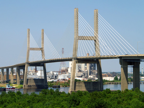
Western Beltway/Wekiva Pkwy Map

Advertising
Advertising

Exits Map For The Western Beltway/Wekiva Pkwy

This map of the Western Beltway/Wekiva Pkwy displays markers for exits and tolling points, which you can select to get a close-up map of that point of interest or location.

The points-of-interest shown on this map are also listed below, ordered from south to north.

See below for more comprehensive information about the Western Beltway/Wekiva Pkwy

Advertising
Advertising
Static map a segment of the Western Beltway/Wekiva Pkwy

A Quick Look At The Western Beltway/Wekiva Pkwy

SR 429 and Wekiva Parkway are other names for this roadway. This regional toll road serves several key cities, including Apopka, Ocoee, and Winter Garden.

The static map seen here shows a segment of The Western Beltway/Wekiva Pkwy at West Road / Clarcona Ocoee Road. The entirety of The Western Beltway/Wekiva Pkwy can be seen in the fully-interactive map above, which includes linked markers. You may resize and reposition the interactive map to orient the road in relation to other landmarks.

There is also a complete list of exits below.

View Map Exit / POI List

Latest Travel Alert

CONSTRUCTION - Western Beltway/Wekiva Pkwy

Now — Saturday November 1, 2025

Between mile markers 22 and 23: Repainting five bridges that intersect with the Western Beltway (SR 429) between Florida's Turnpike and West Colonial Dr… Full details below

Impacted area(s):

See all travel alerts

Advertising
Advertising

What Does It Cost To Use The Western Beltway/Wekiva Pkwy?

Tolls For Cars, SUVs, Pickups, etc.

▹ Toll as of July 1, 2023.

This data is coming soon.

Transponders You Can Use

For drivers paying with a transponder, the following passes will work on the Western Beltway/Wekiva Pkwy

  • epass
  • epass xtra
  • uni
  • sunpass pro
  • sunpass
  • e-zpass
  • i-pass
  • peach pass
  • quick pass

Learn about transponders and accounts in Florida.

View MapAll Tolls / Calculator ▸

Our new toll and trip calculator is being constructed. For most roads, you can still use the legacy calculator for current, accurate tolls.

Discover Florida Attractions

Turnpikes.com has partnered with Tiqets.com to bring you these excusive deals on attractions!

Advertising
Advertising

Western Beltway/Wekiva Pkwy Travel Alerts

CONSTRUCTION - Western Beltway/Wekiva Pkwy

Now — Saturday November 1, 2025

Between mile markers 22 and 23: Repainting five bridges that intersect with the Western Beltway (SR 429) between Florida's Turnpike and West Colonial Drive (SR 50). Expect overnight single lane closures.

Impacted area(s):


Exit/POI List For The Western Beltway/Wekiva Pkwy

Selecting an exit or other location opens a separate map with locations of available gas, EV charging, fast-food and other dining options. Current weather and driving conditions will also be shown.

Exit 1I–4 — Four Corners

Note(s): to Orlando / Tampa

GPS 28.287714000 X -81.596590000

FTE Florida's Turnpike Enterprise manages this segment.

View Map & Info

Exit 1ASinclair Road — Four Corners

Note(s): None.

GPS 28.295344000 X -81.602558000

FTE Florida's Turnpike Enterprise manages this segment.

View Map & Info

Exit 6US 192 / Irlo Bronson Mem Hwy — Four Corners

Note(s): None.

GPS 28.347007000 X -81.615895000

FTE Florida's Turnpike Enterprise manages this segment.

View Map & Info

Western Beltway Toll Plaza — Four Corners

Note(s): None.

GPS 28.359285000 X -81.611726000

FTE Florida's Turnpike Enterprise manages this segment.

View Map & Info

Exit 8Western Way / Disney World — Winter Garden

Note(s): None.

GPS 28.378172000 X -81.611395000

FTE Florida's Turnpike Enterprise manages this segment.

View Map & Info

Exit 11Seidel Road — Winter Garden

Note(s): None.

GPS 28.419726000 X -81.632146000

FTE Florida's Turnpike Enterprise manages this segment.

View Map & Info

Exit 13Schofield Road — Winter Garden

Note(s): None.

GPS 28.448883000 X -81.642426000

CFX Central Florida Expressway Authority manages this segment.

View Map & Info

Exit 15New Independence Parkway — Winter Garden

Note(s): None.

GPS 28.474400000 X -81.631427000

CFX Central Florida Expressway Authority manages this segment.

View Map & Info

Independence Mainline Toll Plaza — Winter Garden

Note(s): None.

GPS 28.498901000 X -81.616910000

CFX Central Florida Expressway Authority manages this segment.

View Map & Info

Exit 18Stoneybrook West Pkwy — Winter Garden

Note(s): SB Off/NB On

GPS 28.511968000 X -81.605248000

CFX Central Florida Expressway Authority manages this segment.

View Map & Info

Exit 19Winter Garden Vineland Road / CR 535 — Winter Garden

Note(s): None.

GPS 28.517553000 X -81.585921000

CFX Central Florida Expressway Authority manages this segment.

View Map & Info

Exit 22Florida's Turnpike — Winter Garden

Note(s): None.

GPS 28.546640000 X -81.557657000

CFX Central Florida Expressway Authority manages this segment.

View Map & Info

Exit 23West Colonial Drive / SR 50 — Winter Garden

Note(s): None.

GPS 28.551431000 X -81.558568000

CFX Central Florida Expressway Authority manages this segment.

View Map & Info

Exit 24Plant Street / SR 438 — Winter Garden

Note(s): None.

GPS 28.571976000 X -81.556696000

CFX Central Florida Expressway Authority manages this segment.

View Map & Info

Exit 26West Road / Clarcona Ocoee Road — Ocoee

Note(s): None.

GPS 28.601438000 X -81.543488000

CFX Central Florida Expressway Authority manages this segment.

View Map & Info

Forest Lake Mainline Toll Plaza — Ocoee

Note(s): None.

GPS 28.614791000 X -81.536591000

CFX Central Florida Expressway Authority manages this segment.

View Map & Info

Exit 29Ocoee Apopka Road — Ocoee

Note(s): None.

GPS 28.633821000 X -81.541574000

CFX Central Florida Expressway Authority manages this segment.

View Map & Info

Exit 30SR 414 / Apopka Expressway — Ocoee

Note(s): None.

GPS 28.646017000 X -81.542582000

CFX Central Florida Expressway Authority manages this segment.

View Map & Info

Exit 34US 441/Orange Blossom Trl / Plymouth Sorrento Rd — Apopka

Note(s): WEKIVA PKWY

GPS 28.698322000 X -81.559091000

CFX Central Florida Expressway Authority manages this segment.

View Map & Info

Ponkan Mainline Toll Gantry — Apopka

Note(s): WEKIVA PKWY - AET Toll Gantry

GPS 28.721125000 X -81.562703000

CFX Central Florida Expressway Authority manages this segment.

View Map & Info

Exit 38Kelly Park Road — Apopka

Note(s): WEKIVA PKWY

GPS 28.756636000 X -81.566882000

CFX Central Florida Expressway Authority manages this segment.

View Map & Info

Exit 39SR 453 — Apopka

Note(s): Roadway is called Wekiva Parkway here. WEKIVA PKWY / to SR 46 via Coronado Toll Gantry

GPS 28.771705000 X -81.563096000

CFX Central Florida Expressway Authority manages this segment.

View Map & Info

Mt Plymouth CFX Toll Gantry — Mt Plymouth

Note(s): Roadway is called Wekiva Parkway here. WEKIVA PARKWAY SEGMENT - AET Gantry operated by the Central Florida Expressway Authority (CFX)

GPS 28.775672000 X -81.541847000

CFX Central Florida Expressway Authority manages this segment.

View Map & Info

Mt Plymouth FDOT Toll Gantry — Mt Plymouth

Note(s): Roadway is called Wekiva Parkway here. WEKIVA PKWY - AET Gantry operated by the Florida Department of Transportation (FDOT)

GPS 28.799684000 X -81.515313000

CFX Central Florida Expressway Authority manages this segment.

View Map & Info

Exit 44SR 46/46 A — Mt. Plymouth

Note(s): Roadway is called Wekiva Parkway here. WEKIVA PKWY

GPS 28.810155000 X -81.508114000

CFX Central Florida Expressway Authority manages this segment.

View Map & Info

Wekiva River FDOT Toll Gantry — Sorento

Note(s): Roadway is called Wekiva Parkway here. WEKIVA PARKWAY SEGMENT/SR 429

GPS 28.814835000 X -81.478795000

CFX Central Florida Expressway Authority manages this segment.

View Map & Info

Exit 48Wekiva River Road — Lake County

Note(s): Roadway is called Wekiva Parkway here.

GPS 28.815469000 X -81.426205000

CFX Central Florida Expressway Authority manages this segment.

View Map & Info

Orange Plaza FDOT Toll Gantry — Sorento

Note(s): Roadway is called Wekiva Parkway here. WEKIVA PARKWAY SEGMENT/SR 429

GPS 28.805418000 X -81.360936000

CFX Central Florida Expressway Authority manages this segment.

View Map & Info

I–4/SR 417 — Lake County

Note(s): Roadway is called Wekiva Parkway here. Connects to Seminole Expressway/Central Florida Greeneway (SR 417)

GPS 28.796351000 X -81.345455000

CFX Central Florida Expressway Authority manages this segment.

View Map & Info

Advertising
Advertising

EXPLORE FLORIDA

Journey to key destinations around and adjacent to Florida!

Map Of This Region ▹

Communities in this metro area include Destin, Pensacola Beach, Pensacola, Niceville, and Gulf Breeze.

Individual toll maps for this region are listed below.

Map Of This Region ▹

Communities in this metro area include Jacksonville and Middleburg.

Individual toll maps for this region are listed below.

Map Of This Region ▹

Communities in this metro area include Apopka, Cocoa, Kissimmee, Lake Buena Vista, Orlando, Saint Cloud, Sanford, Titusville, Melbourne, Poinciana, and Mount Dora.

Individual toll maps for this region are listed below.

Map Of This Region ▹

Communities in this metro area include Bradenton, Brandon, Saint Petersburg, Spring Hill, and Tampa.

Individual toll maps for this region are listed below.

Map Of This Region ▹

Communities in this metro area include Fort Pierce, Port Saint Lucie, Stuart, and Vero Beach.

Individual toll maps for this region are listed below.

Map Of This Region ▹

Communities in this metro area include Fort Lauderdale, Pompano Beach, Hialeah, Opa Locka, Homestead, Kendall, Key Largo, Miramar, Miami, Hollywood, Sunrise, Boca Raton, Delray Beach, West Palm Beach, Jupiter, Davie, Coral Springs, Lake Worth, and Boynton Beach.

Individual toll maps for this region are listed below.

Map Of This Region ▹

Communities in this metro area include Fort Myers, Naples, and Cape Coral.

Individual toll maps for this region are listed below.

Map Of This Region ▹

Communities in this metro area include Tallahassee, Quincy, Midway, and Fort Braden.

Individual toll maps for this region are listed below.

tallahassee-state capital

Roads Within Region

Map Of This Region ▹

Map Of This Region ▹

Communities in this metro area include Mobile, Daphne, Dauphin Island, Chickasaw, and Spanish Fort.

Individual toll maps for this region are listed below.

beaches-gulf coast

Roads Within Region

Map Of This Region ▹

Advertising
Advertising
Turnpikes.com is proud to partner with the following: