Select markers to see a close-up map of that location The points-of-interest shown on this map are also listed below, ordered from west to east.

I 75 and Everglades Parkway are other names for this facility. This state toll road serves several key cities, including Fort Lauderdale, Naples, Weston, and Sunrise.
This road traverses the Miami - South Florida as well as the Fort Myers - Southwest Florida areas.
A complete list of exits can be found below.
Accepted types of payment taken while on the road
Available when checked
Alligator Alley does not have license-plate tolling! You must pay on road, or you may incur a violation.
For drivers with a transponder, the following passes can be used on Alligator Alley


Learn about transponders and accounts in Florida.
View MapToll CalculatorAll Florida Tolls
Our new toll and trip calculator is complete, but many roads' data are still being entered into our database. The legacy calculator remains active for current, accurate tolls.
Turnpikes.com has partnered with Tiqets.com to bring you these excusive deals on attractions!
Alligator Alley
Viewing an exit or other location opens a new map showing gas, EV charging, fast-food and other dining, plus weather and driving conditions.
Exit 101Collier Blvd / CR 951 — Naples
Note(s): Pictures here.
GPS 26.160181000 X -81.686583000
 Florida's Turnpike Enterprise manages this segment.
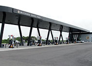
Edward J Beck Toll Plaza — Naples
Note(s): Pictures here.
GPS 26.155512000 X -81.668647000
Florida's Turnpike Enterprise manages this segment.
Exit 80SR 29 — Naples
Note(s): Pictures here.
GPS 26.154775000 X -81.345115000
Florida's Turnpike Enterprise manages this segment.
Big Cypress Nat'l Pres / Rest Stop — Ochopee
Note(s): None.
GPS 26.167215000 X -81.197504000
Collier County Rest Stop — Ochopee
Note(s): Pictures here.
GPS 26.168289000 X -81.075544000
Exit 49Miccosukee Service Plaza — Miccosukee Reservation
Available fuels and EV charging:
gas
diesel
tesla
truck
parking
Broward County Rest Stop — Weston
Note(s): Pictures here.
GPS 26.146204000 X -80.632838000
Westbound Toll Plaza — Weston
Note(s): Pictures here.
GPS 26.146175000 X -80.466927000
Florida's Turnpike Enterprise manages this segment.
Exit 23US 27 — Weston
Note(s): Pictures here.
GPS 26.144689000 X -80.441849000
Florida's Turnpike Enterprise manages this segment.
Exit 22Glades Parkway — Weston
Note(s): Pictures here. to Weston and Southwest Ranches
GPS 26.140113000 X -80.419399000
Florida's Turnpike Enterprise manages this segment.
Exit 21Indian Trace — Weston
Note(s): Pictures here.
GPS 26.135513000 X -80.400575000
Florida's Turnpike Enterprise manages this segment.
Exit 19Sawgrass Expressway / I–595 / I–75 — Weston
Note(s): Pictures here. to Fort Lauderdale via 595 / to Miami via 75
GPS 26.119599000 X -80.345919000
Florida's Turnpike Enterprise manages this segment.
Journey to key destinations around and adjacent to Florida!
Communities in this metro area include Destin, Pensacola Beach, Pensacola, Niceville, and Gulf Breeze.
Individual toll maps for this region are listed below.

Communities in this metro area include Jacksonville and Middleburg.
Individual toll maps for this region are listed below.

Communities in this metro area include Apopka, Cocoa, Kissimmee, Lake Buena Vista, Orlando, Saint Cloud, Sanford, Titusville, Melbourne, Poinciana, and Mount Dora.
Individual toll maps for this region are listed below.
Communities in this metro area include Bradenton, Brandon, Saint Petersburg, Spring Hill, and Tampa.
Individual toll maps for this region are listed below.
Communities in this metro area include Fort Pierce, Port Saint Lucie, Stuart, and Vero Beach.
Individual toll maps for this region are listed below.

Communities in this metro area include Fort Lauderdale, Pompano Beach, Hialeah, Opa Locka, Homestead, Kendall, Key Largo, Miramar, Miami, Hollywood, Sunrise, Boca Raton, Delray Beach, West Palm Beach, Jupiter, Davie, Coral Springs, Lake Worth, and Boynton Beach.
Individual toll maps for this region are listed below.
Communities in this metro area include Fort Myers, Naples, and Cape Coral.
Individual toll maps for this region are listed below.
Communities in this metro area include Tallahassee, Quincy, Midway, and Fort Braden.
Individual toll maps for this region are listed below.

Roads Within Region
Communities in this metro area include Mobile, Daphne, Dauphin Island, Chickasaw, and Spanish Fort.
Individual toll maps for this region are listed below.

Roads Within Region
 Garcon Point Bridge ▹
 Bob Sikes Bridge ▹
 SR 293 ▹
 First Coast Expressway ▹
 Central Florida Greeneway/Seminole Expy ▹
 Florida's Turnpike ▹
 East West Expressway ▹
 Beachline Expressway ▹
 Western Beltway/Wekiva Pkwy ▹
 Apopka Expressway ▹
 Poinciana Parkway ▹
 SR 453 ▹
 Goldenrod Road Extension ▹
 Osceola Parkway ▹
 SR 451 ▹
 Polk Parkway ▹
 Selmon Expressway ▹
 Suncoast Parkway/Veterans Expy ▹
 Sunshine Skyway ▹
 Pinellas Bayway ▹
 Gateway Expressway ▹
 Airport Expressway ▹
 Alligator Alley ▹
 Dolphin Expressway ▹
 Don Shula Expressway ▹
 Gratigny Parkway ▹
 Sawgrass Expressway ▹
 Snapper Creek Expressway ▹
 Rickenbacker Causeway ▹
 Venetian Causeway ▹
 Card Sound Road ▹
 Sanibel Causeway ▹
 Midpoint Memorial Bridge ▹
 Cape Coral Bridge ▹


