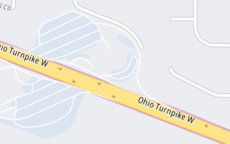
This travel plaza is located in Broadview Heights.
This location is in the Cleveland - Akron - Youngstown area.
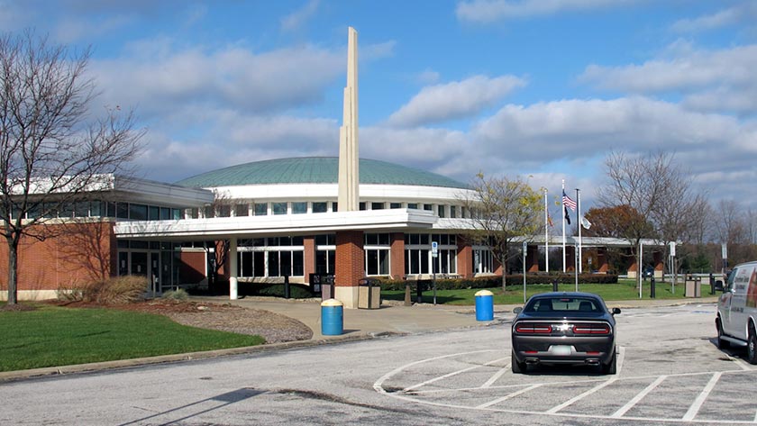
This location's approximate GPS Coordinates are 41.29200 x -81.67130.
On to Towpath Service Plaza, about 0.0 miles away ►
◄ Back to Strongsville/Cleveland / US 42 / I–71, about 8.3 miles away.
Use the map below for all services within about a two (2) mile radius.
Closest Gas Stations

SUNOCO
• 298 feet
Store/Fuel Brand: Sunoco

SUNOCO
• 931 feet
Store/Fuel Brand: Sunoco
Closest EV Chargers


Closest Fast Food
Fast food refers ONLY to quick-service and take-out diners. All restaurant types are shown on the map below.

KFC
10037 Broadview Road • 0.69 miles

BURGER KING
10037 Broadview Road • 0.69 miles

POPEYES
Towpath Road • 1,220 feet

PIZZA HUT DELIVERY
2000 East Edgerton Road • 1,654 feet
MICHAEL ANGELO'S WINERY
5515 Broadview Road • 1.23 miles

KFC
2000 West Edgerton Road • 1.27 miles
ROMEO'S PIZZA
500 East Royalton Road • 1.58 miles
COFFEE CLUB
500 East Royalton Road • 1.59 miles
The interactive map and lists on this page include key traveler services in a two-mile radius, including gas stations, truck stops, EV charging facilities, fast-food or family restaurants, and hotels.
Current driving conditions and weather, may be found below.

Sunny
27°F / -2.9°C
Feels Like:
32°F / 0.2°C
Visibility
1 Mi / 2 Km
3-Hour Precip:
0 In / 0.0 Cm
South
Winds (S)
3.4 MPH / 5.5 KPH
Gusts:
7.5 MPH / 12 KPH
▸ Get the full forecast for This Location | The Cleveland - Akron - Youngstown area
Destination Travel
Journey to key destinations around and adjacent to Ohio!
Communities in this metro area include Cleveland, Akron, Boardman, Lorain, Aurora, Youngstown, New Castle, Pennsylvania, and Beaver Falls, Pennsylvania.
Individual toll maps for this region are listed below.
Communities in this metro area include Toledo, Perrysburg, Maumee, Montpelier, and Wauseon.
Individual toll maps for this region are listed below.
Communities in this metro area include Castalia, Sandusky, Norwalk, Bellevue, Huron, Milan, and Monroeville.
Individual toll maps for this region are listed below.
Communities in this metro area include Columbus, Upper Arlington, Westerville, New Albany, Worthington, Dublin, Pickerington, and Reynoldsburg.
Individual toll maps for this region are listed below.
Roads Within Region
Communities in this metro area include Cincinnati, Norwood, Cheviot, Northbrook, Reading, Covington, Kentucky, and Newport, Kentucky.
Individual toll maps for this region are listed below.
Roads Within Region
Communities in this metro area include Gary, South Bend, Elkhart, Portage, and Fremont.
Individual toll maps for this region are listed below.
Communities in this metro area include Pittsburgh, Cranberry Township, Beaver Valley, New Castle, Washington, Uniontown, Cheat Lake, West Virginia, Boardman, Ohio, and Youngstown, Ohio.
Individual toll maps for this region are listed below.
Communities in this metro area include Parkersburg, North Hills, Vienna, and Belpre, Ohio.
Individual toll maps for this region are listed below.
Communities in this metro area include Detroit, Grosse Ile, Ann Arbor, Pontiac, and Lansing.
Individual toll maps for this region are listed below.