Share

Ohio Turnpike At Amherst/Oberlin / SR 58

Advertising
Advertising

This Location At A Glance

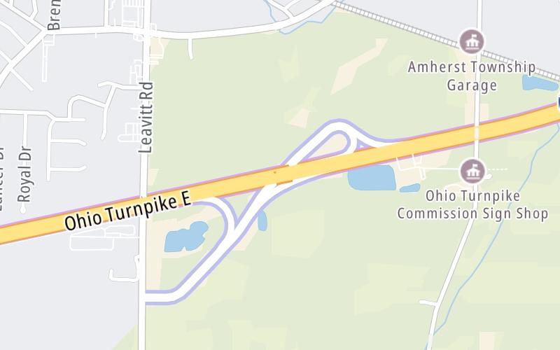
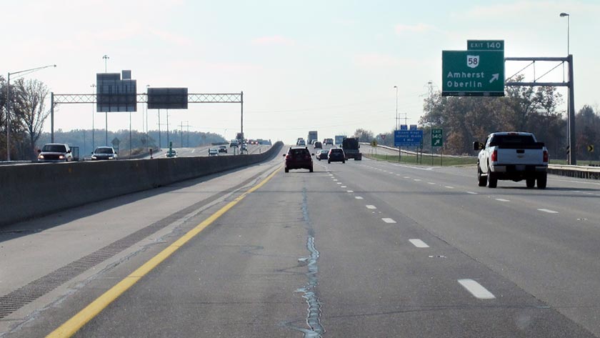
This is Exit 140 of the Ohio Turnpike.

This junction is located in Amherst.

This location is in the Cleveland - Akron - Youngstown area.

Amherst/Oberlin / SR 58
Photo by Turnpikes.com

This location's approximate GPS Coordinates are 41.38220 x -82.20180.

Interactive Map Below


Which directions can I travel from here?

From this junction, traffic can enter traveling both westbound and eastbound. Traffic can also exit traveling both westbound and eastbound.

On to Lorain County West / I-90 / SR 2, about 2.2 miles away ►

◄ Back to Vermilion Valley Service Plaza, about 1.1 miles away.

Nearby gas and food are shown on the interactive map below.

View Map

Weather & Visibility

  • 10 7 03
  • Partly Cloudy

    25°F / -4°C

    Feels Like

    19°F / -7.1°C

  • Visibility

    8 Mi / 12.9 Km

    3 Hr Precip

    0 In / 0.0 Cm

  • NNE Wind

    6.6 Mi / 10.7 Km

    Gusts

    15.2 Mi / 24.4 Km


Available Cameras

I-90 @ I-80

Camera direction: WEST. Cleveland 44035.
Source: ODOT.

Camera direction: WEST. Cleveland 44035.<br />Source: ODOT -

2.18 Mi

Camera direction: EAST. Cleveland 44035.<br />Source: ODOT -

3.07 Mi

Advertising

Closest Food, Gas, EV And Other Services Near Amherst/Oberlin / SR 58

The map shows traffic cameras and services in about a two-mile radius. Not all locations have cameras

Advertising

Discover Ohio Attractions

Hotels and destinations header

Hotels & Airports

Destination Travel

Advertising
Advertising

EXPLORE OHIO

Journey to key destinations around and adjacent to Ohio!

Map Of This Region ▹

Communities in this metro area include Cleveland, Akron, Boardman, Lorain, Aurora, Youngstown, New Castle, Pennsylvania, and Beaver Falls, Pennsylvania.

Individual toll maps for this region are listed below.

Map Of This Region ▹

Communities in this metro area include Toledo, Perrysburg, Maumee, Montpelier, and Wauseon.

Individual toll maps for this region are listed below.

Map Of This Region ▹

Communities in this metro area include Castalia, Sandusky, Norwalk, Bellevue, Huron, Milan, and Monroeville.

Individual toll maps for this region are listed below.

Map Of This Region ▹

Communities in this metro area include Columbus, Upper Arlington, Westerville, New Albany, Worthington, Dublin, Pickerington, and Reynoldsburg.

Individual toll maps for this region are listed below.

columbus-state capital

Roads Within Region

Map Of This Region ▹

Map Of This Region ▹

Communities in this metro area include Cincinnati, Norwood, Cheviot, Northbrook, Reading, Covington, Kentucky, and Newport, Kentucky.

Individual toll maps for this region are listed below.

cincinnati-covington

Roads Within Region

Map Of This Region ▹

Map Of This Region ▹

Communities in this metro area include Gary, South Bend, Elkhart, Portage, and Fremont.

Individual toll maps for this region are listed below.

Map Of This Region ▹

Communities in this metro area include Pittsburgh, Cranberry Township, Beaver Valley, New Castle, Washington, Uniontown, Cheat Lake, West Virginia, Boardman, Ohio, and Youngstown, Ohio.

Individual toll maps for this region are listed below.

Map Of This Region ▹

Communities in this metro area include Parkersburg, North Hills, Vienna, and Belpre, Ohio.

Individual toll maps for this region are listed below.

Map Of This Region ▹

Communities in this metro area include Detroit, Grosse Ile, Ann Arbor, Pontiac, and Lansing.

Individual toll maps for this region are listed below.

Static map of Ohio Turnpike at Amherst/Oberlin / SR 58

Static map. Interactive map is above.

Advertising
Advertising
Turnpikes.com is proud to partner with the following: