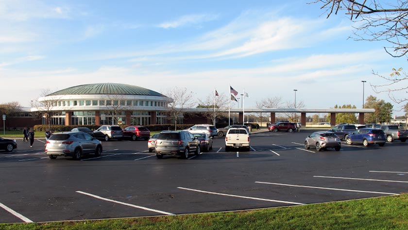
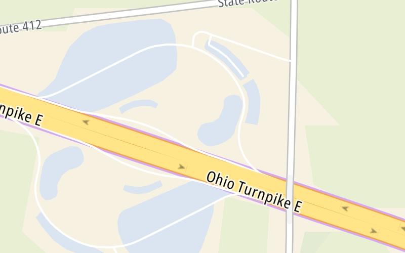
This travel plaza is located in Clyde.
This location is in the Sandusky - Sandusky Bay area.
This location's approximate GPS Coordinates are 41.36880 x -82.95630.
On to Commodore Perry Service Plaza, about 0.0 miles away ►
◄ Back to Fremont/Port Clinton / SR 53, about 8.4 miles away.
Use the map below for all services within about a two (2) mile radius.
Closest Fast Food
Fast food refers ONLY to quick-service and take-out diners. All restaurant types are shown on the map below.

DUNKIN'
I-80 West • 0.62 miles

DUNKIN'
1012 North County Road 260 • 149 feet

BURGER KING
• 202 feet

MARCO'S PIZZA
• 370 feet
EINSTEIN BROTHERS BAGELS
888 North County Road 260 • 755 feet

BURGER KING
• 781 feet

PANDA EXPRESS
I-80 East • 786 feet

AUNTIE ANNE'S
1012 North County Road 260 • 795 feet
The interactive map and lists on this page include key traveler services in a two-mile radius, including gas stations, truck stops, EV charging facilities, fast-food or family restaurants, and hotels.
Current driving conditions and weather, may be found below.

Mostly Cloudy
20°F / -6.5°C
Feels Like:
18°F / -7.7°C
Visibility
13 Mi / 20.9 Km
3-Hour Precip:
0 In / 0.0 Cm
East Northeast
Winds (ENE)
4.9 MPH / 7.8 KPH
Gusts:
7.6 MPH / 12.2 KPH
▸ Get the full forecast for This Location | The Sandusky - Sandusky Bay area
No camera feed …
There is no currently-available traffic camera feed for this location.
Destination Travel
Journey to key destinations around and adjacent to Ohio!
Communities in this metro area include Cleveland, Akron, Boardman, Lorain, Aurora, Youngstown, New Castle, Pennsylvania, and Beaver Falls, Pennsylvania.
Individual toll maps for this region are listed below.
Communities in this metro area include Toledo, Perrysburg, Maumee, Montpelier, and Wauseon.
Individual toll maps for this region are listed below.
Communities in this metro area include Castalia, Sandusky, Norwalk, Bellevue, Huron, Milan, and Monroeville.
Individual toll maps for this region are listed below.
Communities in this metro area include Columbus, Upper Arlington, Westerville, New Albany, Worthington, Dublin, Pickerington, and Reynoldsburg.
Individual toll maps for this region are listed below.
Roads Within Region
Communities in this metro area include Cincinnati, Norwood, Cheviot, Northbrook, Reading, Covington, Kentucky, and Newport, Kentucky.
Individual toll maps for this region are listed below.
Roads Within Region
Communities in this metro area include Gary, South Bend, Elkhart, Portage, and Fremont.
Individual toll maps for this region are listed below.
Communities in this metro area include Pittsburgh, Cranberry Township, Beaver Valley, New Castle, Washington, Uniontown, Cheat Lake, West Virginia, Boardman, Ohio, and Youngstown, Ohio.
Individual toll maps for this region are listed below.
Communities in this metro area include Parkersburg, North Hills, Vienna, and Belpre, Ohio.
Individual toll maps for this region are listed below.
Communities in this metro area include Detroit, Grosse Ile, Ann Arbor, Pontiac, and Lansing.
Individual toll maps for this region are listed below.