Share

Ohio Turnpike At Perrysburg/Toledo / I-75

Advertising
Advertising

About This Location

Perrysburg/Toledo / I-75
Photo by Turnpikes.com

At A Glance

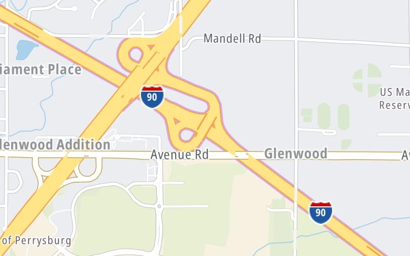
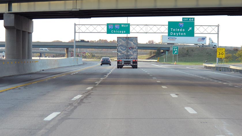
This is Exit 64 of the Ohio Turnpike.

This junction is located in Toledo.

This location is in the Toledo - Western Ohio area.

Interactive Map Below

This location's approximate GPS Coordinates are 41.56660 x -83.57500.

Which directions can I travel from here?

From this junction, traffic can enter traveling both westbound and eastbound. Traffic can also exit traveling both westbound and eastbound.

On to Stony Ridge/Toledo / I–280 / SR 420, about 6.8 miles away ►

◄ Back to Maumee/Toledo / US 20, about 5.4 miles away.

▹ The Ohio Turnpike and the I 75 connect here.

Which direction are tolls charged here?

  • ▸ Westbound on ramp
  • ▸ Westbound off ramp
  • ▸ Eastbound on ramp
  • ▸ Eastbound off ramp

View Map Travel Conditions

Closest Food, Gas, EV And Other Services Near Perrysburg/Toledo / I-75

Use the map below for all services within about a two (2) mile radius.

Fuel, EV and convenience store header

Gas & EV Charging

Closest Gas Stations

BP

BARNEYS CONVENIENCE MART

28311 Crossroads Parkway • 1,570 feet

Store/Fuel Brand: BP

AMOCO

1133 Buck Road • 1.46 miles

Store/Fuel Brand: Amoco

BP

BP

1130 Buck Road • 1.49 miles

Store/Fuel Brand: BP

Shell

SHELL

1000 Buck Road • 1.67 miles

Store/Fuel Brand: Shell

View Map

Closest EV Chargers

Tesla

ROSSFORD, OH SUPERCHARGER

10055 Fremont Pike • 1.59 miles

View Map

Coffee, snacks and dining header

Fast Food & Beverage

Closest Fast Food

Fast food refers ONLY to quick-service and take-out diners. All restaurant types are shown on the map below.

CAMEO PIZZA

27250 Crossroads Parkway • 1.47 miles

McDonald's

MCDONALD'S

835 Lime City Road • 1.49 miles

Wendy's

WENDY'S

27240 Crossroads Parkway • 1.49 miles

YALA KOL

27151 Crossroads Parkway • 1.52 miles

Pizza Hut

PIZZA HUT EXPRESS

9666 Fremont Pike • 1.63 miles

Wendy's

WENDY'S BUCK ROAD IN ROSSFORD OH

1003 Buck Road • 1.63 miles

KFC

KFC

10200 Fremont Pike • 1.66 miles

SONIC

10100 Fremont Pike • 1.66 miles

View Map

Advertising
Advertising

Interactive POI Map

The interactive map and lists on this page include key traveler services in a two-mile radius, including gas stations, truck stops, EV charging facilities, fast-food or family restaurants, and hotels.

Current driving conditions and weather, may be found below.

Advertising
Advertising

Travel Conditions At Perrysburg/Toledo / I-75

Current Weather And Visibility

  • 02 7 12
  • Cloudy

    28°F / -2°C

    Feels Like:

    21°F / -6.2°C

  • Visibility

    10 Mi / 16.1 Km

    3-Hour Precip:

    0 In / 0.0 Cm

  • Northwest
    Winds (NW)

    7.6 MPH / 12.2 KPH

    Gusts:

    14.9 MPH / 24 KPH

▸ Get the full forecast for This Location | The Toledo - Western Ohio area

Available Cameras

OH-795 @ OHIO TURNPIKE, LIME CITY RD

Camera direction: EAST. Toledo 43551.
Source: ODOT.

Camera direction: EAST. Toledo 43551.<br />Source: ODOT -

0.41 Mi

Camera direction: NORTH. Toledo 43551.<br />Source: ODOT -

0.42 Mi

Camera direction: NORTH. Toledo 43460.<br />Source: ODOT -

1.58 Mi

Camera direction: NORTH. Toledo 43551.<br />Source: ODOT -

2.91 Mi

Camera direction: NORTH. Toledo 43619.<br />Source: ODOT -

3.38 Mi

Advertising
Advertising

Pictures At Perrysburg/Toledo / I-75

The Ohio Turnpike WB at I–75, which takes travelers to Toledo and south to Dayton. Photo taken November 1, 2019. Photo taken 11-01-2019

Photo taken 11-01-2019
Advertising
Advertising

Discover Ohio Attractions

Hotels and destinations header

Hotels & Airports

Destination Travel

Advertising
Advertising

EXPLORE OHIO

Journey to key destinations around and adjacent to Ohio!

Map Of This Region ▹

Communities in this metro area include Cleveland, Akron, Boardman, Lorain, Aurora, Youngstown, New Castle, Pennsylvania, and Beaver Falls, Pennsylvania.

Individual toll maps for this region are listed below.

Map Of This Region ▹

Communities in this metro area include Toledo, Perrysburg, Maumee, Montpelier, and Wauseon.

Individual toll maps for this region are listed below.

Map Of This Region ▹

Communities in this metro area include Castalia, Sandusky, Norwalk, Bellevue, Huron, Milan, and Monroeville.

Individual toll maps for this region are listed below.

Map Of This Region ▹

Communities in this metro area include Columbus, Upper Arlington, Westerville, New Albany, Worthington, Dublin, Pickerington, and Reynoldsburg.

Individual toll maps for this region are listed below.

columbus-state capital

Roads Within Region

Map Of This Region ▹

Map Of This Region ▹

Communities in this metro area include Cincinnati, Norwood, Cheviot, Northbrook, Reading, Covington, Kentucky, and Newport, Kentucky.

Individual toll maps for this region are listed below.

cincinnati-covington

Roads Within Region

Map Of This Region ▹

Map Of This Region ▹

Communities in this metro area include Gary, South Bend, Elkhart, Portage, and Fremont.

Individual toll maps for this region are listed below.

Map Of This Region ▹

Communities in this metro area include Pittsburgh, Cranberry Township, Beaver Valley, New Castle, Washington, Uniontown, Cheat Lake, West Virginia, Boardman, Ohio, and Youngstown, Ohio.

Individual toll maps for this region are listed below.

Map Of This Region ▹

Communities in this metro area include Parkersburg, North Hills, Vienna, and Belpre, Ohio.

Individual toll maps for this region are listed below.

Map Of This Region ▹

Communities in this metro area include Detroit, Grosse Ile, Ann Arbor, Pontiac, and Lansing.

Individual toll maps for this region are listed below.

Static map of Ohio Turnpike at Perrysburg/Toledo / I-75

Static map. Interactive map is above.

Advertising
Advertising
Turnpikes.com is proud to partner with the following: