Polk Parkway At Waring Road

Static map of Polk Parkway at Waring Road

Using The POI Map

A summary of the closest services around the Polk Parkway and Waring Road is shown below. More complete detail follows the overview.

Area Overview ▾View Map ▾

The interactive map and lists on this page include key traveler services within two miles of this destination point, including gas stations, truck stops, EV charging facilities, fast-food or family restaurants, and hotels. These are displayed on the interactive map as markers, which you can select for more information.

Current driving conditions and weather, along with a more complete list of key services, may be found below the map.

View Map ▾Weather ▾

Advertising
Advertising

Interactive Exit Map With Nearby Gas, Food And Lodging

Waring Road

At A Glance

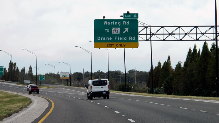
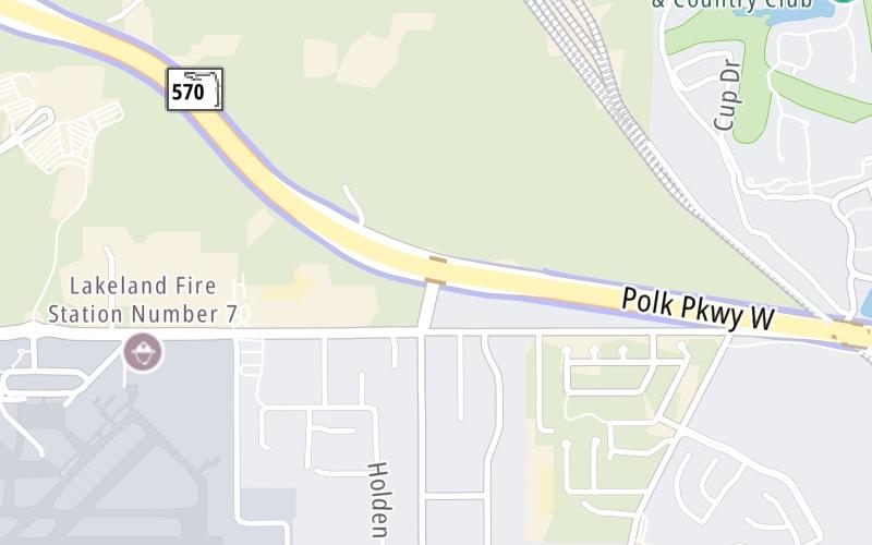
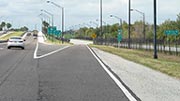
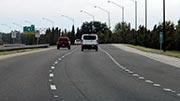
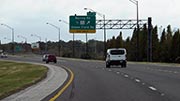
This is Exit 4 of the Polk Parkway.

This junction is located in Lakeland.

This location is in the Tampa Bay - West Central Florida area.

See the adjacent map for detail.▾ Interactive Map Below ▾

This location's approximate GPS Coordinates are 27.99875 x -81.99852.

Which directions can I travel from here?

From this junction, traffic can enter traveling both westbound and eastbound. Traffic can also exit traveling both westbound and eastbound.

The next exit is Harden Boulevard, approximately 1.4 miles away ►

◄ The previous exit is Airport Road, approximately 1.3 miles away.

Which direction are tolls charged here?

  • ▸ Westbound on ramp
  • ▸ Eastbound off ramp

▾ Travel Conditions ▾

Above: Photo by Turnpikes.com

Area Map & Services Up To Two (2) Miles

Pan and zoom the map as you desire, and select markers for information and other options, including online ordering, where available.

Advertising
Advertising

Food, Gas, EV And Other Services Near Waring Road

Fuel, EV and convenience store header

Gas & EV Charging

Closest Gas Stations

CITGO

CITGO

1950 Drane Field Road • 0.69 miles

Store/Fuel Brand: CITGO

Shell

SHELL

3730 Drane Field Road • 1.18 miles

Store/Fuel Brand: Shell

7-Eleven

7-ELEVEN

3611 Drane Field Road • 1.27 miles

Store/Fuel Brand: 7-Eleven

Racetrac

RACETRAC

3600 Harden Boulevard • 1.49 miles

Store/Fuel Brand: Racetrac

View Map ▴

Closest EV Chargers

CHARGEPOINT

1401 Town Center Drive • 1.22 miles

CONNECTOR: IEC62196Type1
POWER: 6 KW @ 240 V
CURRENT: 27 Amp AC1

LAKELAND AIRPORT SOUTH

3450 Flightline Drive • 1.61 miles

CONNECTOR: IEC62196Type1
POWER: 7 KW @ 240 V
CURRENT: 30 Amp AC1

View Map ▴

Coffee, snacks and dining header

Fast Food & Beverage

Closest Fast Food

Fast food refers ONLY to quick-service and take-out diners. All restaurant types are shown on the map below.

GREAT STEAK

1560 Town Center Drive • 1.09 miles

IT'S JUST WINGS

3750 Lakeside Village Court • 1.38 miles

BURGER KING

BURGER KING LAKELAND

3590 Harden Boulevard • 1.48 miles

SANDWICH FACTORY

5024 Lunn Road • 1.81 miles

View Map ▴Full List ▾

Coffee, snacks and dining header

Hotels & Airports

Destination Travel

Hotels closest to Waring Road.

Advertising
Advertising

Travel Conditions At Waring Road

Current Weather And Visibility

  • 10 6 07
  • Partly Cloudy

    76°F / 24.4°C

    Feels Like:

    88°F / 31.1°C

  • Visibility

    10 Mi / 16.1 Km

    3-Hour Precip:

    0 In / 0.0 Cm

  • North
    Winds (N)

    0 MPH / 0 KPH

    Gusts:

    3.3 MPH / 5.3 KPH

▸ Get the full forecast for This Location | The Tampa Bay - West Central Florida area

Available Cameras

FL-570 @ MM-3.9

FL-570 @ MM-3.9

Camera Direction: EAST. Source: FDOT - Tampa 33811

Cameras Closest To Waring Road

Camera Direction: EAST. Source: FDOT - Tampa 33811

772 Ft

Camera Direction: EAST. Source: FDOT - Tampa 33811

0.41 Mi

Camera Direction: WEST. Source: FDOT - Tampa 33811

1.24 Mi

Camera Direction: EAST. Source: FDOT - Tampa 33812

1.46 Mi

Camera Direction: EAST. Source: FDOT - Tampa 33811

2.21 Mi

Travel Pictures

Pictures Around Waring Road

About this photo:
The Polk Parkway eastbound at Exit 4, to Waring Road and SR 572. Photo taken December 12, 2019.

Photo taken 12-12-2019

More Pictures Near Waring Road

Photo taken 12-12-2019
Advertising
Advertising

Services Within Two Miles

Lists Include Fuel, EV Charging and Fast Food

Select/Tap Vendors For Info

Vendors within about two miles of Waring Road and the Polk Parkway are listed, sorted by distance, with the closest displayed on top. Select/tap the vendor name to show address, phone numbers and available URLs for gas stations, EV charging stations and fast-food dining. Links will open in a new window. Turnpikes.com is not responsible for third-party website content.

Gas/Diesel/Liquid Fuels

Fuels Within Two (2) Miles
CITGO

CITGO

• 0.69 miles

Shell

SHELL

• 1.18 miles

7-Eleven

7-ELEVEN

• 1.27 miles

Racetrac

RACETRAC

• 1.49 miles

EV Charging/Tesla Superchargers

EV & Tesla Stations Within Two (2) Miles

CHARGEPOINT

• 1.22 miles

LAKELAND AIRPORT SOUTH

• 1.61 miles

Fast-Food/Take-Out Dining

Fast-Food Restaurants Within Two (2) Miles

This list only includes quick-service and take-out restaurants. All nearby restaurants are shown on the map above.

GREAT STEAK

• 1.09 miles

IT'S JUST WINGS

• 1.38 miles

BURGER KING

BURGER KING LAKELAND

• 1.48 miles

SANDWICH FACTORY

• 1.81 miles

EXPLORE FLORIDA

Journey to key destinations around and adjacent to Florida!

Map Of This Region ▹

Communities in this metro area include Destin, Pensacola Beach, Pensacola, Niceville, and Gulf Breeze.

Individual toll maps for this region are listed below.

Map Of This Region ▹

Communities in this metro area include Jacksonville and Middleburg.

Individual toll maps for this region are listed below.

Map Of This Region ▹

Communities in this metro area include Apopka, Cocoa, Kissimmee, Lake Buena Vista, Orlando, Saint Cloud, Sanford, Titusville, Melbourne, Poinciana, and Mount Dora.

Individual toll maps for this region are listed below.

Map Of This Region ▹

Communities in this metro area include Bradenton, Brandon, Saint Petersburg, Spring Hill, and Tampa.

Individual toll maps for this region are listed below.

Map Of This Region ▹

Communities in this metro area include Fort Pierce, Port Saint Lucie, Stuart, and Vero Beach.

Individual toll maps for this region are listed below.

Map Of This Region ▹

Communities in this metro area include Fort Lauderdale, Pompano Beach, Hialeah, Opa Locka, Homestead, Kendall, Key Largo, Miramar, Miami, Hollywood, Sunrise, Boca Raton, Delray Beach, West Palm Beach, Jupiter, Davie, Coral Springs, Lake Worth, and Boynton Beach.

Individual toll maps for this region are listed below.

Map Of This Region ▹

Communities in this metro area include Fort Myers, Naples, and Cape Coral.

Individual toll maps for this region are listed below.

Advertising
Advertising