This Location At A Glance
This toll point is located in Spring Hill. NOTE: Gantry has replaced plaza..
This location is in the Tampa Bay - West Central Florida area.
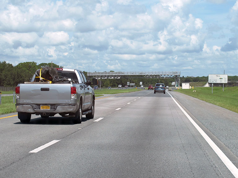
Photo by Turnpikes.com
This location's approximate GPS Coordinates are 28.39392 x -82.52828.
On to County Line Road, about 5.3 miles away ►
◄ Back to Ridge Road, about 6.8 miles away.
Nearby gas and food are shown on the interactive map below.
Weather & Visibility

Partly Sunny
89°F / 31.4°C
Feels Like
91°F / 32.7°C

Visibility
19 Mi / 30.6 Km
3 Hr Precip
0 In / 0.0 Cm

-
ESE Wind
5.1 Mi / 8.2 Km
Gusts
9.9 Mi / 16 Km
See the full forecast for the Tampa Bay - West Central Florida area
Conditions and forecasts provided in partnership with AccuWeather.

Weather provided in partnership with AccuWeather.
Available Cameras

0.57 Mi
0.59 Mi
1.28 Mi
1.56 Mi
2.27 Mi
Advertising


 Garcon Point Bridge ▹
 Bob Sikes Bridge ▹
 SR 293 ▹
 First Coast Expressway ▹
 Central Florida Greeneway/Seminole Expy ▹
 Florida's Turnpike ▹
 East West Expressway ▹
 Beachline Expressway ▹
 Western Beltway/Wekiva Pkwy ▹
 Apopka Expressway ▹
 Poinciana Parkway ▹
 SR 453 ▹
 Goldenrod Road Extension ▹
 Osceola Parkway ▹
 SR 451 ▹
 Polk Parkway ▹
 Selmon Expressway ▹
 Suncoast Parkway/Veterans Expy ▹
 Sunshine Skyway ▹
 Pinellas Bayway ▹
 Gateway Expressway ▹

 Airport Expressway ▹
 Alligator Alley ▹
 Dolphin Expressway ▹
 Don Shula Expressway ▹
 Gratigny Parkway ▹
 Sawgrass Expressway ▹
 Snapper Creek Expressway ▹
 Rickenbacker Causeway ▹
 Venetian Causeway ▹
 Card Sound Road ▹
 Sanibel Causeway ▹
 Midpoint Memorial Bridge ▹
 Cape Coral Bridge ▹