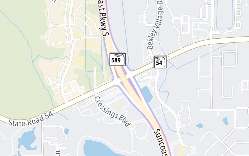
This Location At A Glance
This is Exit 19 of the Suncoast Parkway/Veterans Expy.
This junction is located in Lutz. Tampa is nearby.
This location is in the Tampa Bay - West Central Florida area.
This location's approximate GPS Coordinates are 28.18960 x -82.54391.
Which directions can I travel from here?
From this junction, traffic can enter traveling both southbound and northbound. Traffic can also exit traveling both southbound and northbound.
On to Ridge Road, about 6.5 miles away ►
◄ Back to Lutz Lake Fern Road, about 2.4 miles away.
Nearby gas and food are shown on the interactive map below.
Weather & Visibility

Partly Sunny
88°F / 31°C
Feels Like
91°F / 33°C

Visibility
24 Mi / 38.6 Km
3 Hr Precip
0 In / 0.0 Cm

-
ESE Wind
4.5 Mi / 7.2 Km
Gusts
9.2 Mi / 14.9 Km
See the full forecast for This Location or the Tampa Bay - West Central Florida area
Conditions and forecasts provided in partnership with AccuWeather.

Weather provided in partnership with AccuWeather.
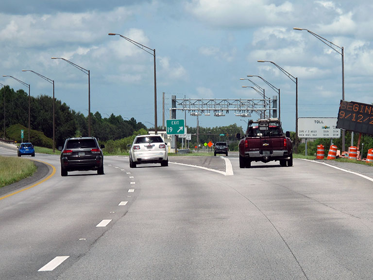
Available Cameras

393 Ft
440 Ft
0.57 Mi
0.61 Mi
1.46 Mi


 Garcon Point Bridge ▹
 Bob Sikes Bridge ▹
 SR 293 ▹
 First Coast Expressway ▹
 Central Florida Greeneway/Seminole Expy ▹
 Florida's Turnpike ▹
 East West Expressway ▹
 Beachline Expressway ▹
 Western Beltway/Wekiva Pkwy ▹
 Apopka Expressway ▹
 Poinciana Parkway ▹
 SR 453 ▹
 Goldenrod Road Extension ▹
 Osceola Parkway ▹
 SR 451 ▹
 Polk Parkway ▹
 Selmon Expressway ▹
 Suncoast Parkway/Veterans Expy ▹
 Sunshine Skyway ▹
 Pinellas Bayway ▹
 Gateway Expressway ▹

 Airport Expressway ▹
 Alligator Alley ▹
 Dolphin Expressway ▹
 Don Shula Expressway ▹
 Gratigny Parkway ▹
 Sawgrass Expressway ▹
 Snapper Creek Expressway ▹
 Rickenbacker Causeway ▹
 Venetian Causeway ▹
 Card Sound Road ▹
 Sanibel Causeway ▹
 Midpoint Memorial Bridge ▹
 Cape Coral Bridge ▹