Share

First Coast Expressway At Old Jennings Road / Discovery Drive

Advertising
Advertising

About This Location

Old Jennings Road / Discovery Drive
Photo by Turnpikes.com

At A Glance

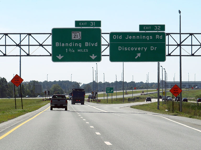
This is Exit 32 of the First Coast Expressway.

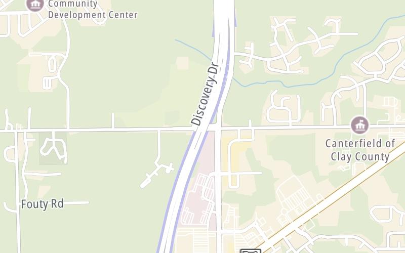
This junction is located in Clay County. Middleburg is nearby. NOTE: SB off / NB on.

This location is in the Jacksonville - Northeast Florida area.

Interactive Map Below

This location's approximate GPS Coordinates are 30.11455 x -81.83230.

Which directions can I travel from here?

From this junction, traffic can only enter going northbound. Traffic can only exit going southbound.

On to Trail Ridge Plaza, about 1.0 mile away ►

◄ Back to Blanding Boulevard / SR 21, about 1.4 miles away.

Which direction are tolls charged here?

Tolls are not charged or collected at this junction.

View Map Travel Conditions

Closest Food, Gas, EV And Other Services Near Old Jennings Road / Discovery Drive

Use the map below for all services within about a two (2) mile radius.

Fuel, EV and convenience store header

Gas & EV Charging

Closest Gas Stations

Murphy USA

MURPHY USA

1570 Branan Field Road • 0.55 miles

Store/Fuel Brand: Murphy USA

Wawa

WAWA

1563 Blanding Boulevard • 1.14 miles

Store/Fuel Brand: Wawa

Speedway

SPEEDWAY

1545 Blanding Boulevard • 1.19 miles

Store/Fuel Brand: Speedway

View Map

Closest EV Chargers

HAMPTON INN & SUITES - MIDDLEBURG

1735 Jeremiah Street • 1,678 feet

Blink

BRYCE LANDING APARTMENTS

1914 Bryce Landing Way • 1.43 miles

View Map

Coffee, snacks and dining header

Fast Food & Beverage

Closest Fast Food

Fast food refers ONLY to quick-service and take-out diners. All restaurant types are shown on the map below.

TROPICAL SMOOTHIE CAFE

1782 Blanding Boulevard • 0.60 miles

Chick-fil-A

CHICK-FIL-A

1710 Blanding Boulevard • 0.65 miles

WHATABURGER BLANDING BOULEVARD & BRANAN FIELD ROAD

1778 Blanding Boulevard • 0.66 miles

FARMHOUSE CHICKEN & DONUTS

1694 Blanding Boulevard • 0.69 miles

CULVER'S

1767 Blanding Boulevard • 0.77 miles

BURGER KING

BURGER KING

Blanding Boulevard • 1.46 miles

View Map

Advertising
Advertising

Interactive POI Map

The interactive map and lists on this page include key traveler services in a two-mile radius, including gas stations, truck stops, EV charging facilities, fast-food or family restaurants, and hotels.

Current driving conditions and weather, may be found below.

Advertising
Advertising

Travel Conditions At Old Jennings Road / Discovery Drive

Current Weather And Visibility

  • 15 7 12
  • Sunny

    65°F / 18.6°C

    Feels Like:

    68°F / 20.1°C

  • Visibility

    10 Mi / 16.1 Km

    3-Hour Precip:

    0 In / 0.0 Cm

  • West
    Winds (W)

    2.2 MPH / 3.6 KPH

    Gusts:

    5.9 MPH / 9.6 KPH

▸ Get the full forecast for This Location | The Jacksonville - Northeast Florida area

Available Cameras

FL-23 MM 32.6 NB

Camera direction: NORTH. Jacksonville 32068.
Source: FDOT.

Camera direction: NORTH. Jacksonville 32068.<br />Source: FDOT -

0.44 Mi

Camera direction: SOUTH. Jacksonville 32068.<br />Source: FDOT -

1.49 Mi

Camera direction: NORTH. undetermined 32068.<br />Source: FDOT -

2.93 Mi

Advertising
Advertising

Pictures At Old Jennings Road / Discovery Drive

Old Jennings, then Blanding: The guide signs at Exit 32 show southbound drivers the current exit and the distance to the next, and last, southbound exit on the First Coast Expressway. Photo taken 10-21-2022

Photo taken 10-21-2022
Advertising
Advertising

Discover Florida Attractions

Hotels and destinations header

Hotels & Airports

Destination Travel

Advertising
Advertising

EXPLORE FLORIDA

Journey to key destinations around and adjacent to Florida!

Map Of This Region ▹

Communities in this metro area include Destin, Pensacola Beach, Pensacola, Niceville, and Gulf Breeze.

Individual toll maps for this region are listed below.

Map Of This Region ▹

Communities in this metro area include Jacksonville and Middleburg.

Individual toll maps for this region are listed below.

Map Of This Region ▹

Communities in this metro area include Apopka, Cocoa, Kissimmee, Lake Buena Vista, Orlando, Saint Cloud, Sanford, Titusville, Melbourne, Poinciana, and Mount Dora.

Individual toll maps for this region are listed below.

Map Of This Region ▹

Communities in this metro area include Bradenton, Brandon, Saint Petersburg, Spring Hill, and Tampa.

Individual toll maps for this region are listed below.

Map Of This Region ▹

Communities in this metro area include Fort Pierce, Port Saint Lucie, Stuart, and Vero Beach.

Individual toll maps for this region are listed below.

Map Of This Region ▹

Communities in this metro area include Fort Lauderdale, Pompano Beach, Hialeah, Opa Locka, Homestead, Kendall, Key Largo, Miramar, Miami, Hollywood, Sunrise, Boca Raton, Delray Beach, West Palm Beach, Jupiter, Davie, Coral Springs, Lake Worth, and Boynton Beach.

Individual toll maps for this region are listed below.

Map Of This Region ▹

Communities in this metro area include Fort Myers, Naples, and Cape Coral.

Individual toll maps for this region are listed below.

Map Of This Region ▹

Communities in this metro area include Tallahassee, Quincy, Midway, and Fort Braden.

Individual toll maps for this region are listed below.

tallahassee-state capital

Roads Within Region

Map Of This Region ▹

Map Of This Region ▹

Communities in this metro area include Mobile, Daphne, Dauphin Island, Chickasaw, and Spanish Fort.

Individual toll maps for this region are listed below.

beaches-gulf coast

Roads Within Region

Map Of This Region ▹

Static map of First Coast Expressway at Old Jennings Road / Discovery Drive

Static map. Interactive map is above.

Advertising
Advertising
Turnpikes.com is proud to partner with the following: