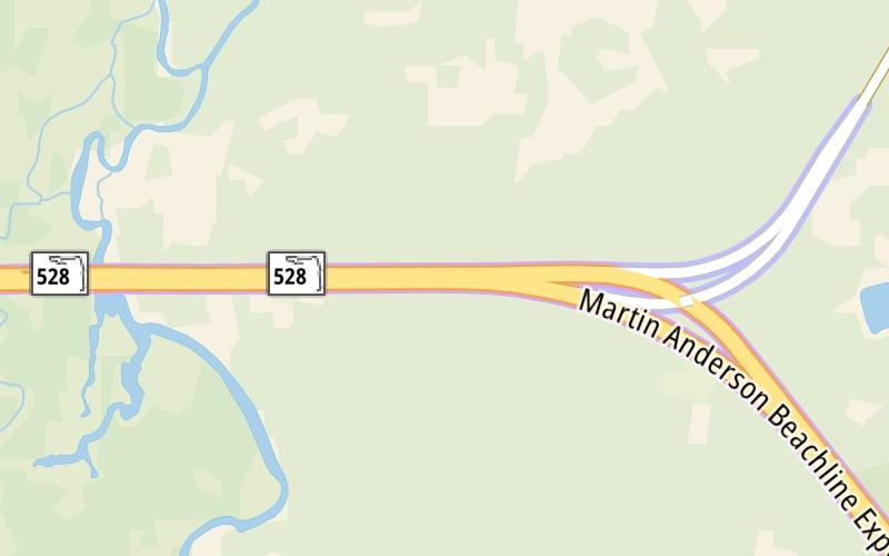
This Location At A Glance
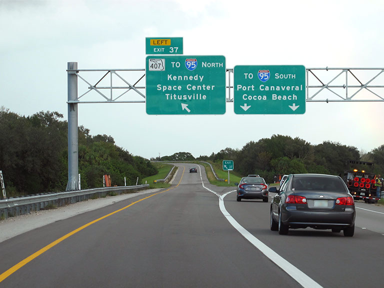
This is Exit 37 of the Beachline Expressway.
This junction is located in Cocoa. Port St. John is nearby. NOTE: WB On/EB Off.
This location is in the Orlando - Space Coast area.
This location's approximate GPS Coordinates are 28.45286 x -80.88394.
Which directions can I travel from here?
From this junction, traffic can only enter going westbound. Traffic can only exit going eastbound.
On to SR 407 at I-95 / Challenger Mem Pkwy, about 4.0 miles away ►
◄ Back to SR 520, about 6.0 miles away.
Nearby gas and food are shown on the interactive map below.
Weather & Visibility

Clear
75°F / 23.9°C
Feels Like
80°F / 26.9°C

Visibility
9 Mi / 14.5 Km
3 Hr Precip
0 In / 0.0 Cm

-
E Wind
4.3 Mi / 6.9 Km
Gusts
5.9 Mi / 9.6 Km
See the full forecast for This Location or the Orlando - Space Coast area
Conditions and forecasts provided in partnership with AccuWeather.

Weather provided in partnership with AccuWeather.
Available Cameras
No camera feed …
There is no currently-available traffic camera feed for this location.


 Garcon Point Bridge ▹
 Bob Sikes Bridge ▹
 SR 293 ▹
 First Coast Expressway ▹
 Central Florida Greeneway/Seminole Expy ▹
 Florida's Turnpike ▹
 East West Expressway ▹
 Beachline Expressway ▹
 Western Beltway/Wekiva Pkwy ▹
 Apopka Expressway ▹
 Poinciana Parkway ▹
 SR 453 ▹
 Goldenrod Road Extension ▹
 Osceola Parkway ▹
 SR 451 ▹
 Polk Parkway ▹
 Selmon Expressway ▹
 Suncoast Parkway/Veterans Expy ▹
 Sunshine Skyway ▹
 Pinellas Bayway ▹
 Gateway Expressway ▹

 Airport Expressway ▹
 Alligator Alley ▹
 Dolphin Expressway ▹
 Don Shula Expressway ▹
 Gratigny Parkway ▹
 Sawgrass Expressway ▹
 Snapper Creek Expressway ▹
 Rickenbacker Causeway ▹
 Venetian Causeway ▹
 Card Sound Road ▹
 Sanibel Causeway ▹
 Midpoint Memorial Bridge ▹
 Cape Coral Bridge ▹