This Location At A Glance
This is Exit 0X of Florida's Turnpike.
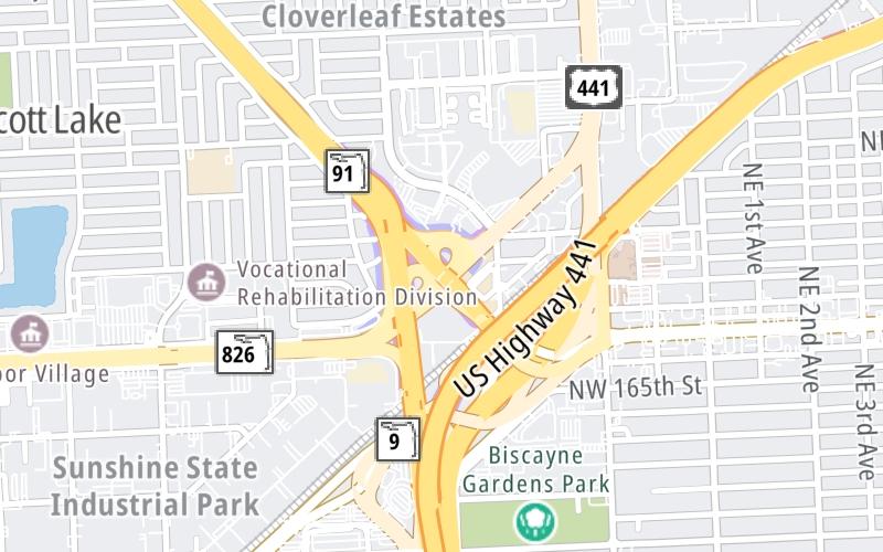
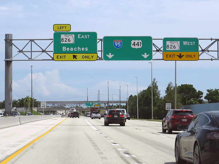
This junction is located in Miami Gardens. Aventura and Opa Locka are nearby. NOTE: to SR 826 W (Palmetto Expy), SR 826 E (167th St) / Golden Glades Train Station / Tri-Rail and Metrorail..
This location is in the Miami - South Florida area.
This location's approximate GPS Coordinates are 25.92999 x -80.21069.
Which directions can I travel from here?
From this junction, traffic can enter traveling both southbound and northbound. Traffic can also exit traveling both southbound and northbound.
On to Hard Rock Stadium/199th Street, about 2.1 miles away ►
▹ Florida's Turnpike and I 95 connect here.
Nearby gas and food are shown on the interactive map below.
Weather & Visibility

Thunderstorm
74°F / 23.5°C
Feels Like
72°F / 22.2°C

Visibility
12 Mi / 19.3 Km
3 Hr Precip
0.05 In / 0.1 Cm

-
E Wind
6 Mi / 9.6 Km
Gusts
14.5 Mi / 23.4 Km
See the full forecast for This Location or the Miami - South Florida area
Conditions and forecasts provided in partnership with AccuWeather.

Weather provided in partnership with AccuWeather.
Available Cameras

760 Ft
946 Ft
986 Ft
986 Ft
0.22 Mi


 Garcon Point Bridge ▹
 Bob Sikes Bridge ▹
 SR 293 ▹
 First Coast Expressway ▹
 Central Florida Greeneway/Seminole Expy ▹
 Florida's Turnpike ▹
 East West Expressway ▹
 Beachline Expressway ▹
 Western Beltway/Wekiva Pkwy ▹
 Apopka Expressway ▹
 Poinciana Parkway ▹
 SR 453 ▹
 Goldenrod Road Extension ▹
 Osceola Parkway ▹
 SR 451 ▹
 Polk Parkway ▹
 Selmon Expressway ▹
 Suncoast Parkway/Veterans Expy ▹
 Sunshine Skyway ▹
 Pinellas Bayway ▹
 Gateway Expressway ▹

 Airport Expressway ▹
 Alligator Alley ▹
 Dolphin Expressway ▹
 Don Shula Expressway ▹
 Gratigny Parkway ▹
 Sawgrass Expressway ▹
 Snapper Creek Expressway ▹
 Rickenbacker Causeway ▹
 Venetian Causeway ▹
 Card Sound Road ▹
 Sanibel Causeway ▹
 Midpoint Memorial Bridge ▹
 Cape Coral Bridge ▹