Cincinnati Traffic And Weather

Static map of Interstate 75 at SR 562 east

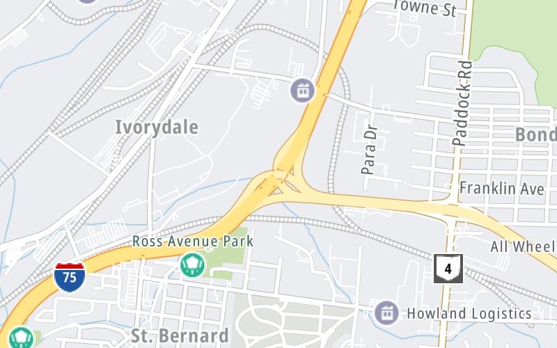
Right Now At SR 562 east and Interstate 75

Current Weather And Visibility

12:58 am Local Time

  • 00 6 05
  • Clear

    52°F / 10.9°C

    Feels Like:

    53°F / 11.6°C

  • Visibility

    5 Mi / 8 Km

    3-Hour Precip:

    0 In / 0.0 Cm

  • North Northeast
    Winds (NNE)

    2.3 MPH / 3.7 KPH

    Gusts:

    8.2 MPH / 13.2 KPH

Conditions and forecasts provided in partnership with AccuWeather.

AccuWeather logo

Weather provided in partnership with AccuWeather.

AccuWeather logo

Forecast weather and driving conditions follow the jump. These include an hour-by-hour forecast for the next 12-hours, a three-day forecast and an extended forecast, for extended travel planning.

An area traffic map, with available traffic cameras, shows driving conditions, from current traffic to mother nature's influence on the road. These follow the short-range forecasts below.

Driving Forecast Traffic Map

Advertising
Advertising

Driving Forecast For Cincinnati, At SR 562 east

Next 12 Hours

12:58 am Local Time

Conditions and forecasts provided in partnership with AccuWeather.

AccuWeather logo

Weather provided in partnership with AccuWeather.

AccuWeather logo

Available Cameras

I-75 AT SR-562 LOOKING SOUTH

I-75 AT SR-562 LOOKING SOUTH

Camera Direction: UNKNOWN. Source: ODOT - undetermined 45237

Cameras Closest To SR 562 east

Camera Direction: UNKNOWN. Source: ODOT - undetermined 45237

126 Ft

Camera Direction: UNKNOWN. Source: ODOT - undetermined 45237

540 Ft

Camera Direction: WEST. Source: ODOT - Cincinnati 45237

0.30 Mi

Camera Direction: EAST. Source: ODOT - Cincinnati 45217

0.41 Mi

Camera Direction: WEST. Source: ODOT - Cincinnati 45237

0.62 Mi

There are many more cameras to view. Please see the map below to see all cameras within a two-mile (2 mile) radius.

Next Three (3) Days

Thursday May 8

Thursday forecast: Overcast; a brief shower or two this morning followed by a couple of showers and a thunderstorm this afternoon

Thunderstorms

96% Chance Rain

71° F/21.7° C

NE Wind

6 to 21 Mi/

9 to 33 Km

Sunrise

6:32 AM

Thursday night: Overcast; a brief shower or two this morning followed by a couple of showers and a thunderstorm this afternoon

Intermittent Clouds

25% Chance Rain

44° F/6.7° C

NNE Wind

9 to 23 Mi/

15 to 37 Km

Sunset

8:38 PM

Friday May 9

Friday forecast: Partly sunny

Partly Sunny

0% Chance Rain

66° F/18.9° C

NNE Wind

9 to 22 Mi/

15 to 35 Km

Sunrise

6:31 AM

Friday night: Partly sunny

Clear

0% Chance Rain

41° F/5.0° C

NNE Wind

5 to 13 Mi/

7 to 20 Km

Sunset

8:38 PM

Saturday May 10

Saturday forecast: Plenty of sun; a beautiful start to the weekend

Sunny

0% Chance Rain

71° F/21.7° C

NNE Wind

5 to 10 Mi/

7 to 17 Km

Sunrise

6:30 AM

Saturday night: Plenty of sun; a beautiful start to the weekend

Clear

0% Chance Rain

47° F/8.3° C

SE Wind

2 to 8 Mi/

4 to 13 Km

Sunset

8:39 PM

Advertising
Advertising

Area Traffic Map

This junction is located in Cincinnati, at GPS 39.17527 x -84.48877. This location is in the Cincinnati - Covington area.

You can pan and zoom the interactive map. Select cameras to see the on-road traffic feeds, and pick exits or other markers for conditions at those locations.

Advertising
Advertising

Extended Forecast For Cincinnati, At SR 562 east

Ten (10) Day Travel Planner

Go Online Before You Go On The Road!®

Conditions and forecasts provided in partnership with AccuWeather.

AccuWeather logo

Weather provided in partnership with AccuWeather.

AccuWeather logo
Advertising
Advertising

EXPLORE OHIO

Journey to key destinations around and adjacent to Ohio!

Map Of This Region ▹

Communities in this metro area include Cleveland, Akron, Boardman, Lorain, Aurora, Youngstown, New Castle, Pennsylvania, and Beaver Falls, Pennsylvania.

Individual toll maps for this region are listed below.

Map Of This Region ▹

Communities in this metro area include Toledo, Perrysburg, Maumee, Montpelier, and Wauseon.

Individual toll maps for this region are listed below.

Map Of This Region ▹

Communities in this metro area include Castalia, Sandusky, Norwalk, Bellevue, Huron, Milan, and Monroeville.

Individual toll maps for this region are listed below.

Map Of This Region ▹

Communities in this metro area include Columbus, Upper Arlington, Westerville, New Albany, Worthington, Dublin, Pickerington, and Reynoldsburg.

Individual toll maps for this region are listed below.

columbus-state capital

Roads Within Region

Map Of This Region ▹

Map Of This Region ▹

Communities in this metro area include Cincinnati, Norwood, Cheviot, Northbrook, Reading, Covington, Kentucky, and Newport, Kentucky.

Individual toll maps for this region are listed below.

cincinnati-covington

Roads Within Region

Map Of This Region ▹

Map Of This Region ▹

Communities in this metro area include Gary, South Bend, Elkhart, Portage, and Fremont.

Individual toll maps for this region are listed below.

Map Of This Region ▹

Communities in this metro area include Pittsburgh, Cranberry Township, Beaver Valley, New Castle, Washington, Uniontown, Cheat Lake, West Virginia, Boardman, Ohio, and Youngstown, Ohio.

Individual toll maps for this region are listed below.

Map Of This Region ▹

Communities in this metro area include Parkersburg, North Hills, Vienna, and Belpre, Ohio.

Individual toll maps for this region are listed below.

Map Of This Region ▹

Communities in this metro area include Detroit, Grosse Ile, Ann Arbor, Pontiac, and Lansing.

Individual toll maps for this region are listed below.

Advertising
Advertising
Turnpikes.com is proud to partner with the following: