Share

Dover Traffic And Weather

Right Now At State Route 10 / Dover AFB North Gate and State Route 1

Current Weather And Visibility

6:33 am Local Time

  • 06 7 02
  • Cloudy

    34°F / 1.1°C

    Feels Like

    33°F / 0.4°C

  • Visibility

    10 Mi / 16.1 Km

    3 Hr Precip

    0 In / 0.0 Cm

  • S Wind

    4.6 Mi / 7.4 Km

    Gusts

    4.6 Mi / 7.4 Km

Conditions and forecasts provided in partnership with AccuWeather.

AccuWeather logo

Weather provided in partnership with AccuWeather.

AccuWeather logo

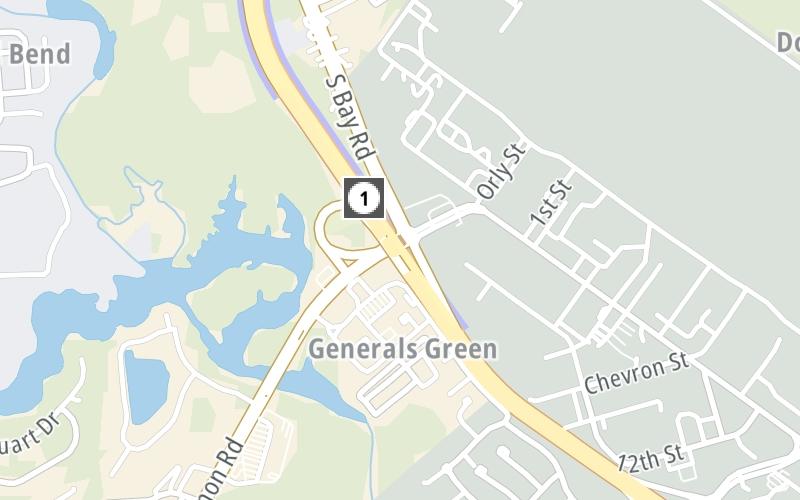
An area traffic map, with available traffic cameras, shows driving conditions, from current traffic to mother nature's influence on the road. These follow the short-range forecasts below.

Driving Forecast Traffic Map

Static map of State Route 1 at State Route 10 / Dover AFB North Gate
Advertising

Driving Forecast For Dover, At State Route 10 / Dover AFB North Gate

Next 12 Hours

6:33 am Local Time

Conditions and forecasts provided in partnership with AccuWeather.

AccuWeather logo

Weather provided in partnership with AccuWeather.

AccuWeather logo
Advertising

Today, Tomorrow & The Next Day

Sunday February 15

Sunday forecast: Considerable cloudiness with rain and drizzle this afternoon

Showers

72% Chance Rain

47° F/8.3° C

SE Wind

6 to 10 Mi/

9 to 17 Km

Sunrise

6:54 AM

Sunday night: Areas of fog will reduce visibility with rain

Rain

97% Chance Rain

35° F/1.7° C

NE Wind

9 to 20 Mi/

15 to 32 Km

Sunset

5:39 PM

Monday February 16

Monday forecast: Breezy in the morning; otherwise, clouds yielding to sun

Intermittent Clouds

2% Chance Rain

45° F/7.2° C

NNE Wind

10 to 21 Mi/

17 to 33 Km

Sunrise

6:53 AM

Monday night: Mainly clear

Mostly Clear

0% Chance Rain

34° F/1.1° C

SSE Wind

6 to 8 Mi/

9 to 13 Km

Sunset

5:40 PM

Tuesday February 17

Tuesday forecast: Times of clouds and sun

Intermittent Clouds

6% Chance Rain

55° F/12.8° C

WSW Wind

7 to 14 Mi/

11 to 22 Km

Sunrise

6:52 AM

Tuesday night: Increasing clouds

Mostly Cloudy

10% Chance Rain

38° F/3.3° C

S Wind

5 to 9 Mi/

7 to 15 Km

Sunset

5:41 PM

Advertising

Area Traffic Map

This junction is located in Dover, at GPS 39.13063 x -75.49218. Camden is nearby. This location is in the Dover - Dover AFB area.

You can pan and zoom the interactive map. Select cameras to see the on-road traffic feeds, and pick exits or other markers for conditions at those locations.

Advertising

EXPLORE DELAWARE

Journey to key destinations around and adjacent to Delaware!

Map Of This Region ▹

Communities in this metro area include Wilmington, Middletown, Newark, and Carneys Point, New Jersey.

Individual toll maps for this region are listed below.

Map Of This Region ▹

Communities in this metro area include Camden, Dover, Dover Afb, and Smyrna.

Individual toll maps for this region are listed below.

Map Of This Region ▹

Communities in this metro area include Camden, Burlington, Palmyra, Pennsauken, Cherry Hill, Gloucester City, Trenton, Wilmington, Delaware, Philadelphia, Pennsylvania, Tacony, Pennsylvania, and Bristol, Pennsylvania.

Individual toll maps for this region are listed below.

Map Of This Region ▹

Communities in this metro area include Philadelphia, King Of Prussia, Valley Forge, West Chester, Bristol, Burlington, New Jersey, Morrisville, Trenton, New Jersey, Palmyra, New Jersey, Wilmington, Delaware, and Camden, New Jersey.

Individual toll maps for this region are listed below.

Advertising
Advertising
Turnpikes.com is proud to partner with the following: