Lewisville Lake Toll Bridge At LLTB Toll Gantry

LLTB Toll Gantry

At A Glance

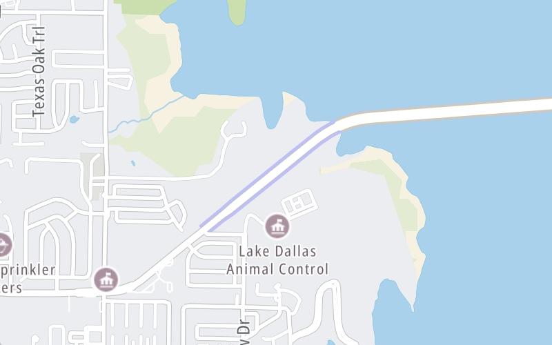
This toll point is located in Lake Dallas.

This location is in the Dallas - Fort Worth area.

▾ Interactive Map Below ▾

This location's approximate GPS Coordinates are 33.13608 x -97.01930.

On to W Eldorado Parkway, about 1.9 miles away ►

◄ Back to Swisher Road, about 0.2 miles away.

▾ Travel Conditions ▾

Above: Map image © TomTom Intl BV

Using The POI Map

The interactive map will help you orient this location in relationship to other junctions.

Current driving conditions and weather may also be found below the map.

View Map ▾Weather ▾

Static map of Lewisville Lake Toll Bridge at LLTB Toll Gantry
Static map. Interactive map is below.

Because of the nature of this location, no services are displayed. On most exit or junction pages, a summary of the closest services around the junction will be shown, along with detailed lists of services within two miles.

View Map ▾

Advertising
Advertising

Interactive Exit Map Of Lewisville Lake Toll Bridge

Your Selected Location Relative To Roadway

Advertising
Advertising

Travel Conditions At LLTB Toll Gantry

Current Weather And Visibility

  • 14 7 02
  • Drizzle

    48°F / C

    Feels Like:

    51°F / 10.7°C

  • Visibility

    3 Mi / 4.8 Km

    3-Hour Precip:

    0.01 In / 0.0 Cm

  • North Northwest
    Winds (NNW)

    1.1 MPH / 1.7 KPH

    Gusts:

    2.4 MPH / 3.8 KPH

▸ Get the full forecast for the Dallas - Fort Worth area

Available Cameras

IH35E @ HUNDLEY-TURBEVILLE

IH35E @ HUNDLEY-TURBEVILLE

Camera Direction: NORTH. Source: TXDOT - Dallas Fort Worth 75065

Cameras Closest To LLTB Toll Gantry

Camera Direction: NORTH. Source: TXDOT - Dallas Fort Worth 75065

1.24 Mi

Camera Direction: NORTH. Source: TXDOT - Dallas Fort Worth 76210

1.48 Mi

Camera Direction: NORTH. Source: TXDOT - Dallas Fort Worth 75065

1.70 Mi

Camera Direction: NORTH. Source: TXDOT - Dallas Fort Worth 76208

1.79 Mi

Camera Direction: NORTH. Source: TXDOT - Dallas Fort Worth 75057

2.19 Mi

Travel Pictures

No photos …

There are no currently-available photos for this location.

Advertising
Advertising

EXPLORE TEXAS

Journey to key destinations around and adjacent to Texas!

Map Of This Region ▹

Communities in this metro area include Dallas, Fort Worth, Plano, Addison, Frisco, Grand Prairie, Arlington, Carrrollton, and Lake Dallas.

Individual toll maps for this region are listed below.

Map Of This Region ▹

Communities in this metro area include Houston, Humble, Tomball, Sugar Land, Galveston, Pearland, and Katy.

Individual toll maps for this region are listed below.

Map Of This Region ▹

Communities in this metro area include Austin, Pflugerville, Round Rock, Georgetown, Cedar Park, Mustang Ridge, Manor, Serenada, Sunset Valley, and Hutto.

Individual toll maps for this region are listed below.

Map Of This Region ▹

Communities in this metro area include Tyler, Wood Springs, Noonday, and Whitehouse.

Individual toll maps for this region are listed below.

Map Of This Region ▹

Communities in this metro area include Brownsville, Heroica Matamoros, Tamaulipas, San Benito, Harlingen, and Rancho Viejo.

Individual toll maps for this region are listed below.

Map Of This Region ▹

Communities in this metro area include Lawton, Fort Sill, Geronimo, and Cache.

Individual toll maps for this region are listed below.

Advertising
Advertising
Turnpikes.com is proud to partner with the following: