This Location At A Glance
This junction is located in Houston. NOTE: North terminus / US 90 EB to I-610.
This location is in the Houston - Galveston area.
This location's approximate GPS Coordinates are 29.64148 x -95.47905.
Which directions can I travel from here?
From this junction, traffic can only enter going southbound. Traffic can only exit going northbound.
◄ Back to U.S. Hwy 90 Alt West / Chimney Rock Road, about 0.7 miles away.
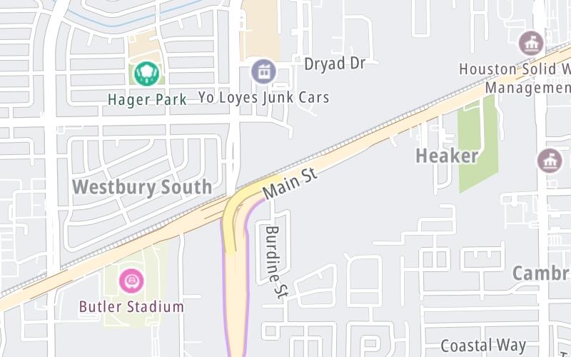
Nearby gas and food are shown on the interactive map below.
Weather & Visibility

Mostly Cloudy
76°F / 24.4°C
Feels Like
78°F / 25.4°C

Visibility
10 Mi / 16.1 Km
3 Hr Precip
0 In / 0.0 Cm

-
S Wind
2.7 Mi / 4.3 Km
Gusts
6.7 Mi / 10.8 Km
See the full forecast for This Location or the Houston - Galveston area
Conditions and forecasts provided in partnership with AccuWeather.

Weather provided in partnership with AccuWeather.
Available Cameras

3.49 Mi


 Addison Airport Toll Tunnel ▹
 Chisholm Trail Parkway ▹
 Dallas North Tollway ▹
 Lewisville Lake Toll Bridge ▹
 Mountain Creek Lake Toll Bridge ▹
 President George Bush Turnpike ▹
 Sam Rayburn Tollway ▹
 360 Tollway ▹
 Grand Parkway ▹
 Hardy Toll Road ▹
 Sam Houston Tollway ▹
 Tomball Tollway ▹
 Westpark Tollway ▹
 Loop 1 ▹
 SH 130 ▹
 SH 45 N ▹
 SH 45 SW ▹
 183A Toll Road ▹
 183 Toll Road ▹
 290 Toll Road ▹
 71 Toll Road ▹
 Toll 49 ▹
 SH 550 ▹
 H E Bailey Turnpike ▹


