Share

SH 550 At Paredes Line Rd / FM 1847

Advertising
Advertising

About This Location

Paredes Line Rd / FM 1847
Map image © TomTom Intl BV

At A Glance

This junction is located in Brownsville.

This location is in the Brownsville - Cameron County area.

Interactive Map Below

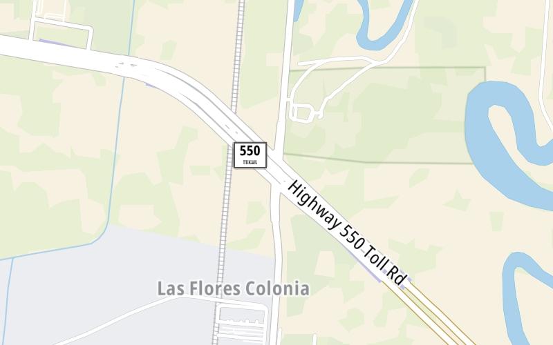
This location's approximate GPS Coordinates are 26.01373 x -97.48144.

Which directions can I travel from here?

From this junction,

On to SH 550 Frontage / FM 511, about 1.8 miles away ►

◄ Back to Paredes Line Rd Toll Gangries, about 0.1 miles away.

Which direction are tolls charged here?

  • ▸ Westbound on ramp
  • ▸ Eastbound off ramp

View Map Travel Conditions

Closest Food, Gas, EV And Other Services Near Paredes Line Rd / FM 1847

Use the map below for all services within about a two (2) mile radius.

Fuel, EV and convenience store header

Gas & EV Charging

Closest Gas Stations

View Map

No gas or other fuel stations nearby.

Closest EV Chargers

View Map

No EV charging stations nearby.

Coffee, snacks and dining header

Fast Food & Beverage

Closest Fast Food

Fast food refers ONLY to quick-service and take-out diners. All restaurant types are shown on the map below.

PIZZA MASTER

1807 Dennet Road • 1.51 miles

View Map

Advertising
Advertising

Interactive POI Map

The interactive map and lists on this page include key traveler services in a two-mile radius, including gas stations, truck stops, EV charging facilities, fast-food or family restaurants, and hotels.

Current driving conditions and weather, may be found below.

Advertising
Advertising

Travel Conditions At Paredes Line Rd / FM 1847

Current Weather And Visibility

  • 07 7 12
  • Mostly Cloudy

    63°F / 17°C

    Feels Like:

    64°F / 17.9°C

  • Visibility

    4 Mi / 6.4 Km

    3-Hour Precip:

    0 In / 0.0 Cm

  • West Southwest
    Winds (WSW)

    2.2 MPH / 3.5 KPH

    Gusts:

    3.8 MPH / 6.1 KPH

▸ Get the full forecast for This Location | The Brownsville - Cameron County area

Available Cameras

PHR IH 69E @ ALICE (STILLMAN RD)

Camera direction: NORTH. Corpus Christi 78526.
Source: TXDOT.

Camera direction: NORTH. Corpus Christi 78526.<br />Source: TXDOT -

2.96 Mi

Advertising
Advertising

Pictures At Paredes Line Rd / FM 1847

No photos …

There are no currently-available photos for this location.

Advertising
Advertising

Discover Texas Attractions

Hotels and destinations header

Hotels & Airports

Destination Travel

Advertising
Advertising

EXPLORE TEXAS

Journey to key destinations around and adjacent to Texas!

Map Of This Region ▹

Communities in this metro area include Dallas, Fort Worth, Plano, Addison, Frisco, Grand Prairie, Arlington, Carrrollton, and Lake Dallas.

Individual toll maps for this region are listed below.

Map Of This Region ▹

Communities in this metro area include Houston, Humble, Tomball, Sugar Land, Galveston, Pearland, and Katy.

Individual toll maps for this region are listed below.

Map Of This Region ▹

Communities in this metro area include Austin, Pflugerville, Round Rock, Georgetown, Cedar Park, Mustang Ridge, Manor, Serenada, Sunset Valley, and Hutto.

Individual toll maps for this region are listed below.

Map Of This Region ▹

Communities in this metro area include Tyler, Wood Springs, Noonday, and Whitehouse.

Individual toll maps for this region are listed below.

Map Of This Region ▹

Communities in this metro area include Brownsville, Heroica Matamoros, Tamaulipas, San Benito, Harlingen, and Rancho Viejo.

Individual toll maps for this region are listed below.

Map Of This Region ▹

Communities in this metro area include Lawton, Fort Sill, Geronimo, and Cache.

Individual toll maps for this region are listed below.

Static map of Sh 550 at Paredes Line Rd / FM 1847

Static map. Interactive map is above.

Advertising
Advertising
Turnpikes.com is proud to partner with the following: