Cherokee Turnpike At US 69

US 69

At A Glance

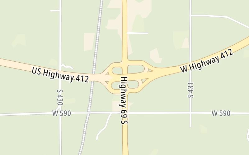
This junction is located in Chouteau. Pryor is nearby. to Chouteau / Pryor.

This location is in the Tulsa area.

▾ Interactive Map Below ▾

This location's approximate GPS Coordinates are 36.16648 x -95.34189.

Which directions can I travel from here?

From this junction, traffic can enter traveling both westbound and eastbound. Traffic can also exit traveling both westbound and eastbound.

On to US 412 Alt, about 4.6 miles away ►

Which direction are tolls charged here?

Tolls are not charged or collected at this junction.

▾ Travel Conditions ▾

Above: Map image © TomTom Intl BV

Using The POI Map

The interactive map and lists on this page include key traveler services within two miles of this destination point.

You will find common services, including gas stations, truck stops, EV charging facilities, fast-food or family restaurants, and hotels. These are displayed on the interactive map as markers, which you can select for more information.

Current driving conditions and weather, along with a more complete list of key services, may be found below the map.

View Map ▾Weather ▾

Static map of Cherokee Turnpike at US 69
Static map. Interactive map is below.

The interactive map shows dining and services near your chosen location: US 69 and the Cherokee Turnpike. A detailed summary of food and services around here is shown after the map.

View Map ▾

Advertising
Advertising

Interactive Exit Map With Nearby Gas, Food And Lodging

Area Map & Services Up To Two (2) Miles

Pan and zoom the map as you desire, and select markers for information and other options, including online ordering, where available.

Advertising
Advertising

Travel Conditions At US 69

Current Weather And Visibility

  • 14 7 02
  • Cloudy

    49°F / 9.5°C

    Feels Like:

    51°F / 10.7°C

  • Visibility

    13 Mi / 20.9 Km

    3-Hour Precip:

    0 In / 0.0 Cm

  • East Northeast
    Winds (ENE)

    2.2 MPH / 3.6 KPH

    Gusts:

    3.5 MPH / 5.6 KPH

▸ Get the full forecast for This Location | The Tulsa area

Available Cameras

No camera feed …

There is no currently-available traffic camera feed for this location.

Travel Pictures

No photos …

There are no currently-available photos for this location.

Advertising
Advertising

Food, Gas, EV And Other Services Near US 69

Fuel, EV and convenience store header

Gas & EV Charging

Closest Gas Stations

E-Z MART

102 South Chouteau Avenue • 1.35 miles

Store/Fuel Brand: E-Z Mart

View Map ▴

Closest EV Chargers

View Map ▴

No EV charging stations nearby.

Coffee, snacks and dining header

Fast Food & Beverage

Closest Fast Food

Fast food refers ONLY to quick-service and take-out diners. All restaurant types are shown on the map below.

DAYLIGHT DONUTS

1010 South Chouteau Avenue • 0.67 miles

McDonald's

MCDONALD'S

1404 South Chouteau Avenue • 1,131 feet

SONIC

1306 South Chouteau Avenue • 1,925 feet

AMISH CHEESE HOUSE

110 North Chouteau Avenue • 1.34 miles

DAYLIGHT DONUTS

68 East Main Street • 1.40 miles

View Map ▴Full List ▾

Hotels and destinations header

Hotels & Airports

Destination Travel

Discover Oklahoma Attractions

Advertising
Advertising

Services Within Two Miles

Lists Include Fuel, EV Charging and Fast Food

Select/Tap Vendors For Info

Vendors within about two miles of US 69 and the Cherokee Turnpike are listed, sorted by distance, with the closest displayed on top. Select/tap the vendor name to show address, phone numbers and available URLs for gas stations, EV charging stations and fast-food dining. Links will open in a new window. Turnpikes.com is not responsible for third-party website content.

Gas/Diesel/Liquid Fuels

Fuels Within Two (2) Miles

E-Z MART

• 1.35 miles

EV Charging/Tesla Superchargers

EV & Tesla Stations Within Two (2) Miles

No EV charging stations nearby.

Fast-Food/Take-Out Dining

Fast-Food Restaurants Within Two (2) Miles

This list only includes quick-service and take-out restaurants. All nearby restaurants are shown on the map above.

DAYLIGHT DONUTS

• 0.67 miles

McDonald's

MCDONALD'S

• 1,131 feet

SONIC

• 1,925 feet

AMISH CHEESE HOUSE

• 1.34 miles

DAYLIGHT DONUTS

• 1.40 miles

EXPLORE OKLAHOMA

Journey to key destinations around and adjacent to Oklahoma!

Map Of This Region ▹

Communities in this metro area include Tulsa, Broken Arrow, Muskogee, Stillwater, Sapulpa, Vinita, Joplin, Missouri, Siloam Springs, Arkansas, and San Springs.

Individual toll maps for this region are listed below.

Map Of This Region ▹

Communities in this metro area include Stillwater and Tulsa.

Individual toll maps for this region are listed below.

Map Of This Region ▹

Communities in this metro area include Oklahoma City, Choctaw, Norman, Shawnee, Henryetta, Edmond, and Chickasha.

Individual toll maps for this region are listed below.

Map Of This Region ▹

Communities in this metro area include Lawton, Fort Sill, Geronimo, and Cache.

Individual toll maps for this region are listed below.

Map Of This Region ▹

Communities in this metro area include Dallas, Fort Worth, Plano, Addison, Frisco, Grand Prairie, Arlington, Carrrollton, and Lake Dallas.

Individual toll maps for this region are listed below.

Map Of This Region ▹

Communities in this metro area include Wichita, Bel Aire, Andover, Valley Center, and Maize.

Individual toll maps for this region are listed below.

Advertising
Advertising
Turnpikes.com is proud to partner with the following: