Interactive map shows available cameras, plus nearby fuel, food and lodging
See below for more about this area
This is Exit 201B of I-75.
This street is located in the Toledo - Western Ohio area. You will find Toledo, Perrysburg, Maumee, Montpelier, and Wauseon in this region.
This location's approximate GPS Coordinates are 41.64087 x -83.54837.
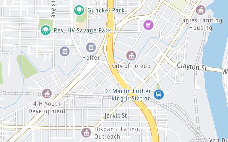
Above: Map image © TomTom Intl BVThe interactive map above and lists on this page below include key traveler services within two miles of this location.
You will find common services, including gas stations, truck stops, EV charging facilities, fast-food or family restaurants, and hotels. These are displayed on the interactive map as markers, which you can select for more information.
Current weather and driving conditions may be found below.
Cloudy
76°F / 24.5°C
Feels Like:
78°F / 25.4°C
Visibility
8 Mi / 12.9 Km
3-Hour Precip:
0.05 In / 0.1 Cm
South
Winds (S)
1.1 MPH / 1.7 KPH
Gusts:
3.6 MPH / 5.7 KPH
▸ Get the full forecast for This Location | The Toledo - Western Ohio area
There are no currently-available photos for this location.
The map above shows all services within about a two (2) mile radius.
Destination Travel
Closest Gas Stations
TRUE NORTH
822 Monroe Street • 0.80 miles
Store/Fuel Brand: True North
S&G
740 South Avenue • 0.83 miles
Store/Fuel Brand:
STOP N SHOP 9
905 South Avenue • 1.01 miles
Store/Fuel Brand:
MARATHON
1901 Jefferson Avenue • 1.07 miles
Store/Fuel Brand: Marathon
Closest EV Chargers
MAUMEE BAY BREW PUB
27 Broadway Street • 0.53 miles
CONNECTOR: IEC62196Type1
POWER: 7 KW @ 240 V
CURRENT: 30 Amp AC1
CHARGEPOINT
15 South Ontario Street • 0.62 miles
CONNECTOR: IEC62196Type1
POWER: 6 KW @ 240 V
CURRENT: 27 Amp AC1
CHARGEPOINT
401 Jefferson Avenue • 0.84 miles
CONNECTOR: IEC62196Type1
POWER: 6 KW @ 240 V
CURRENT: 27 Amp AC1
CHARGEPOINT
136 Water Street • 0.90 miles
CONNECTOR: IEC62196Type1
POWER: 6 KW @ 240 V
CURRENT: 27 Amp AC1
Closest Fast Food
Fast food refers ONLY to quick-service and take-out diners. All restaurant types are shown on the map below.
LITTLE CAESARS
1350 Broadway Street • 0.65 miles
TACO BELL
1422 Broadway Street • 0.71 miles
MCDONALD'S
1540 Broadway Street • 0.80 miles
KRISPY KRUNCHY CHICKEN
740 South Avenue • 0.84 miles
BURGER KING
910 Western Avenue • 0.86 miles
MCDONALD'S
1225 Collingwood Boulevard • 0.88 miles
MARCO'S PIZZA
401 Jefferson Avenue • 0.90 miles
MAGIC WOK
601 Adams Street • 1.08 miles
Turnpikes.com has partnered with Tiqets.com to bring you these vacation values!
Journey to key destinations around and adjacent to Ohio!
Communities in this metro area include Cleveland, Akron, Boardman, Lorain, Aurora, Youngstown, New Castle, Pennsylvania, and Beaver Falls, Pennsylvania.
Individual toll maps for this region are listed below.
Communities in this metro area include Toledo, Perrysburg, Maumee, Montpelier, and Wauseon.
Individual toll maps for this region are listed below.
Communities in this metro area include Castalia, Sandusky, Norwalk, Bellevue, Huron, Milan, and Monroeville.
Individual toll maps for this region are listed below.
Communities in this metro area include Columbus, Upper Arlington, Westerville, New Albany, Worthington, Dublin, Pickerington, and Reynoldsburg.
Individual toll maps for this region are listed below.
Roads Within Region
Communities in this metro area include Cincinnati, Norwood, Cheviot, Northbrook, Reading, Covington, Kentucky, and Newport, Kentucky.
Individual toll maps for this region are listed below.
Roads Within Region
Communities in this metro area include Gary, South Bend, Elkhart, Portage, and Fremont.
Individual toll maps for this region are listed below.
Communities in this metro area include Pittsburgh, Cranberry Township, Beaver Valley, New Castle, Washington, Uniontown, Cheat Lake, West Virginia, Boardman, Ohio, and Youngstown, Ohio.
Individual toll maps for this region are listed below.
Communities in this metro area include Parkersburg, North Hills, Vienna, and Belpre, Ohio.
Individual toll maps for this region are listed below.
Communities in this metro area include Detroit, Grosse Ile, Ann Arbor, Pontiac, and Lansing.
Individual toll maps for this region are listed below.