This Location At A Glance
This is Exit 165A/B/C of State Route 1.
This junction is located in New Castle. Christiana is nearby.
This location is in the Wilmington - Newark area.
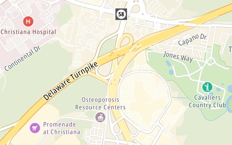
This location's approximate GPS Coordinates are 39.68187 x -75.65630.
Which directions can I travel from here?
From this junction, traffic can enter traveling both southbound and northbound. Traffic can also exit traveling both southbound and northbound.
On to SR 58 / Churchmans Road / SR 7, about 0.4 miles away ►
◄ Back to SR 7 / Mall Road, about 0.7 miles away.
▹ State Route 1 and Delaware Turnpike connect here.
Nearby gas and food are shown on the interactive map below.
Weather & Visibility

Sunny
82°F / 27.5°C
Feels Like
80°F / 26.9°C

Visibility
3 Mi / 4.8 Km
3 Hr Precip
0 In / 0.0 Cm

-
SSW Wind
10.5 Mi / 16.9 Km
Gusts
20.9 Mi / 33.6 Km
See the full forecast for This Location or the Wilmington - Newark area
Conditions and forecasts provided in partnership with AccuWeather.

Weather provided in partnership with AccuWeather.
Available Cameras
No camera feed …
There is no currently-available traffic camera feed for this location.


 Delaware Memorial Bridge ▹
 Delaware Turnpike ▹
 State Route 1 ▹
 US 301 ▹
 John F Kennedy Memorial Highway ▹

 Atlantic City Expressway ▹
 Garden State Parkway ▹
 New Jersey Turnpike ▹
 Pennsylvania Turnpike ▹
 Benjamin Franklin Bridge ▹
 Walt Whitman Bridge ▹
 Commodore Barry Bridge ▹
 Betsy Ross Bridge ▹
 Scudder Falls Toll Bridge ▹
 Trenton Morrisville Toll Bridge ▹
 Tacony Palmyra Bridge ▹
 Burlington Bristol Bridge ▹


