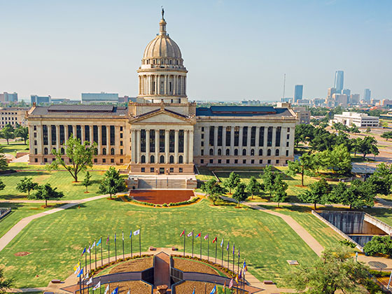
Currently In The Lawton - Fort Sill Area
Conditions And Visibility
Local time is 4:33 am

Cloudy
51°F / 10.6°C
Feels Like
49°F / 9.4°C

Visibility
10 Mi / 16.1 Km
3 Hr Precip
0 In / 0.0 Cm

-
NNE Wind
5.8 Mi / 9.3 Km
Gusts
5.8 Mi / 9.3 Km
Conditions and forecasts provided in partnership with AccuWeather.

Weather provided in partnership with AccuWeather.
12-Hour Travel Forecast
Local time is 4:33 am
Wednesday - 5:00 am
Intermittent Clouds
0% Chance Rain
49° F/9.4° C
Feels Like:
44° F/6.7° C
Visibility
10 Mi/
16.1 Km
Dewpoint
40° F/
4.4° C
NNE Wind
8.1 Mi/
13.0 Km
Gusts
16.1 Mi/
25.9 Km
Wednesday - 6:00 am
Partly Cloudy
0% Chance Rain
48° F/8.9° C
Feels Like:
43° F/6.1° C
Visibility
10 Mi/
16.1 Km
Dewpoint
42° F/
5.6° C
NNE Wind
8.1 Mi/
13.0 Km
Gusts
20.7 Mi/
33.3 Km
Wednesday - 7:00 am
Partly Sunny
0% Chance Rain
48° F/8.9° C
Feels Like:
44° F/6.7° C
Visibility
10 Mi/
16.1 Km
Dewpoint
44° F/
6.7° C
NNE Wind
9.2 Mi/
14.8 Km
Gusts
18.4 Mi/
29.6 Km
Wednesday - 8:00 am
Intermittent Clouds
0% Chance Rain
51° F/10.6° C
Feels Like:
46° F/7.8° C
Visibility
10 Mi/
16.1 Km
Dewpoint
40° F/
4.4° C
NE Wind
12.7 Mi/
20.4 Km
Gusts
20.7 Mi/
33.3 Km
Wednesday - 9:00 am
Intermittent Clouds
0% Chance Rain
52° F/11.1° C
Feels Like:
47° F/8.3° C
Visibility
10 Mi/
16.1 Km
Dewpoint
41° F/
5.0° C
NE Wind
13.8 Mi/
22.2 Km
Gusts
21.9 Mi/
35.2 Km
Wednesday - 10:00 am
Intermittent Clouds
0% Chance Rain
54° F/12.2° C
Feels Like:
49° F/9.4° C
Visibility
10 Mi/
16.1 Km
Dewpoint
41° F/
5.0° C
NE Wind
13.8 Mi/
22.2 Km
Gusts
21.9 Mi/
35.2 Km
Wednesday - 11:00 am
Intermittent Clouds
0% Chance Rain
56° F/13.3° C
Feels Like:
54° F/12.2° C
Visibility
10 Mi/
16.1 Km
Dewpoint
42° F/
5.6° C
NE Wind
12.7 Mi/
20.4 Km
Gusts
20.7 Mi/
33.3 Km
Wednesday - 12:00 pm
Intermittent Clouds
0% Chance Rain
58° F/14.4° C
Feels Like:
59° F/15.0° C
Visibility
10 Mi/
16.1 Km
Dewpoint
42° F/
5.6° C
ENE Wind
11.5 Mi/
18.5 Km
Gusts
19.6 Mi/
31.5 Km
Wednesday - 1:00 pm
Intermittent Clouds
0% Chance Rain
60° F/15.6° C
Feels Like:
63° F/17.2° C
Visibility
10 Mi/
16.1 Km
Dewpoint
43° F/
6.1° C
ENE Wind
10.4 Mi/
16.7 Km
Gusts
20.7 Mi/
33.3 Km
Wednesday - 2:00 pm
Intermittent Clouds
0% Chance Rain
63° F/17.2° C
Feels Like:
65° F/18.3° C
Visibility
10 Mi/
16.1 Km
Dewpoint
44° F/
6.7° C
NE Wind
10.4 Mi/
16.7 Km
Gusts
21.9 Mi/
35.2 Km
Wednesday - 3:00 pm
Intermittent Clouds
0% Chance Rain
65° F/18.3° C
Feels Like:
66° F/18.9° C
Visibility
10 Mi/
16.1 Km
Dewpoint
44° F/
6.7° C
NE Wind
11.5 Mi/
18.5 Km
Gusts
24.2 Mi/
38.9 Km
Wednesday - 4:00 pm
Intermittent Clouds
0% Chance Rain
66° F/18.9° C
Feels Like:
66° F/18.9° C
Visibility
10 Mi/
16.1 Km
Dewpoint
44° F/
6.7° C
NE Wind
11.5 Mi/
18.5 Km
Gusts
26.5 Mi/
42.6 Km
Conditions and forecasts provided in partnership with AccuWeather.
Weather provided in partnership with AccuWeather.
More Weather Options


 Cherokee Turnpike ▹
 Creek Turnpike ▹
 Muskogee Turnpike ▹
 Turner Turnpike ▹
 Will Rogers Turnpike ▹
 Gilcrease Expressway West ▹
 H E Bailey Turnpike ▹
 Indian Nation Turnpike ▹
 John Kilpatrick Turnpike ▹
 Kickapoo Turnpike ▹
 Chickasaw Turnpike ▹

 Addison Airport Toll Tunnel ▹
 Chisholm Trail Parkway ▹
 Dallas North Tollway ▹
 Lewisville Lake Toll Bridge ▹
 Mountain Creek Lake Toll Bridge ▹
 President George Bush Turnpike ▹
 Sam Rayburn Tollway ▹
 360 Tollway ▹
 Kansas Turnpike ▹


